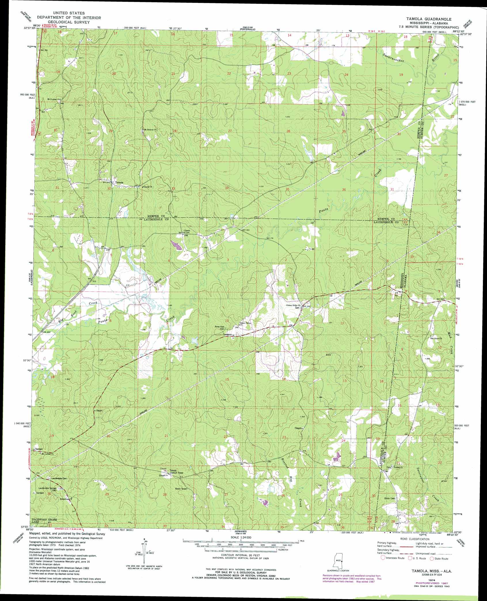
Tamola Topo Map Mississippi
To zoom in, hover over the map of Tamola
USGS Topo Quad 32088e4 - 1:24,000 scale
| Topo Map Name: | Tamola |
| USGS Topo Quad ID: | 32088e4 |
| Print Size: | ca. 21 1/4" wide x 27" high |
| Southeast Coordinates: | 32.5° N latitude / 88.375° W longitude |
| Map Center Coordinates: | 32.5625° N latitude / 88.4375° W longitude |
| U.S. States: | MS, AL |
| Filename: | o32088e4.jpg |
| Download Map JPG Image: | Tamola topo map 1:24,000 scale |
| Map Type: | Topographic |
| Topo Series: | 7.5´ |
| Map Scale: | 1:24,000 |
| Source of Map Images: | United States Geological Survey (USGS) |
| Alternate Map Versions: |
Tamola MS 1974, updated 1978 Download PDF Buy paper map Tamola MS 1974, updated 1987 Download PDF Buy paper map Tamola MS 2012 Download PDF Buy paper map Tamola MS 2015 Download PDF Buy paper map |
1:24,000 Topo Quads surrounding Tamola
De Kalb |
Townsend |
Scooba |
Geiger |
Gainesville |
Lauderdale Nw |
Oak Grove |
Porterville |
Emelle |
Epes West |
Daleville |
Lauderdale |
Tamola |
Boyd |
Livingston |
Meridian North |
Toomsuba |
Kewanee |
York |
Bellamy |
Meridian South |
Vimville |
Whynot |
Ward |
Gaston |
> Back to 32088e1 at 1:100,000 scale
> Back to 32088a1 at 1:250,000 scale
> Back to U.S. Topo Maps home
Tamola topo map: Gazetteer
Tamola: Dams
H S Wedgeworth Catfish Ponds Dam elevation 57m 187′W B Boutwell Pond Dam elevation 76m 249′
Tamola: Populated Places
Tamola elevation 70m 229′Tamola: Springs
Grigsbys Springs elevation 87m 285′Tamola: Streams
Big Reed Creek elevation 55m 180′Running Creek elevation 48m 157′
Simmons Creek elevation 55m 180′
Tamola digital topo map on disk
Buy this Tamola topo map showing relief, roads, GPS coordinates and other geographical features, as a high-resolution digital map file on DVD:
Gulf Coast (LA, MS, AL, FL) & Southwestern Georgia
Buy digital topo maps: Gulf Coast (LA, MS, AL, FL) & Southwestern Georgia
 & Southwestern Georgia map DVD")