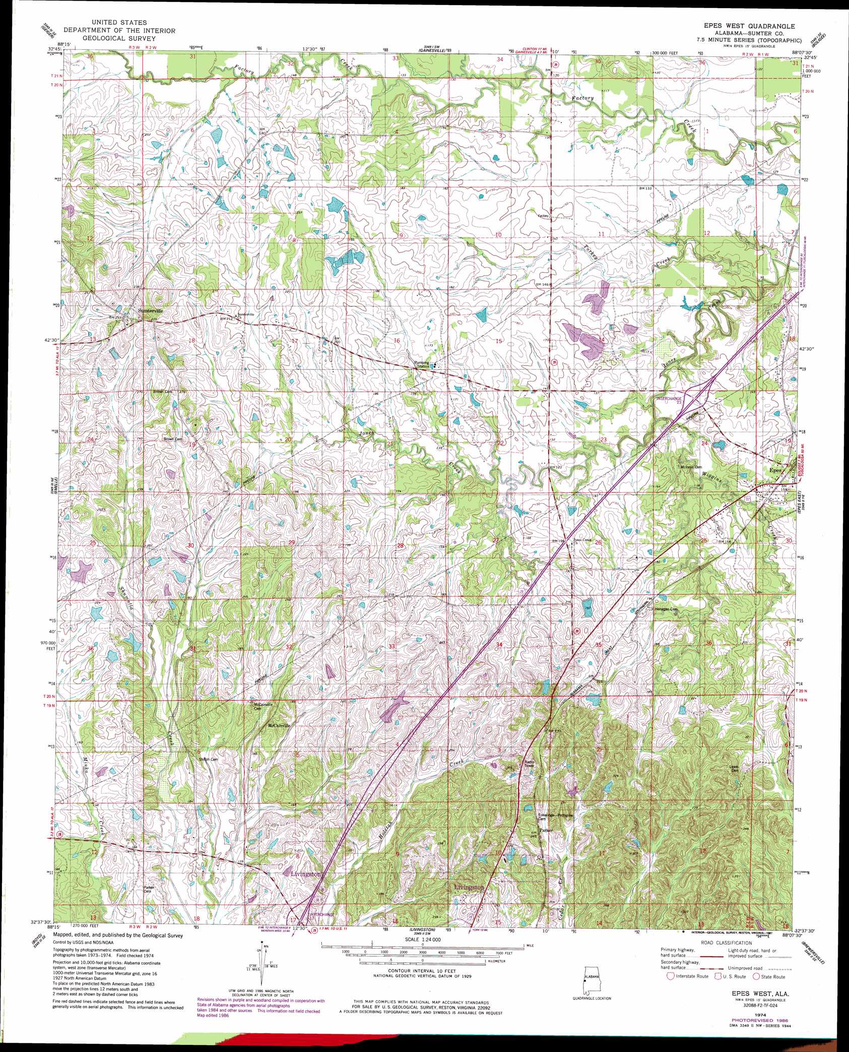
Epes West Topo Map Alabama
To zoom in, hover over the map of Epes West
USGS Topo Quad 32088f2 - 1:24,000 scale
| Topo Map Name: | Epes West |
| USGS Topo Quad ID: | 32088f2 |
| Print Size: | ca. 21 1/4" wide x 27" high |
| Southeast Coordinates: | 32.625° N latitude / 88.125° W longitude |
| Map Center Coordinates: | 32.6875° N latitude / 88.1875° W longitude |
| U.S. State: | AL |
| Filename: | o32088f2.jpg |
| Download Map JPG Image: | Epes West topo map 1:24,000 scale |
| Map Type: | Topographic |
| Topo Series: | 7.5´ |
| Map Scale: | 1:24,000 |
| Source of Map Images: | United States Geological Survey (USGS) |
| Alternate Map Versions: |
Epes West AL 1974, updated 1978 Download PDF Buy paper map Epes West AL 1974, updated 1987 Download PDF Buy paper map Epes West AL 2011 Download PDF Buy paper map Epes West AL 2014 Download PDF Buy paper map |
1:24,000 Topo Quads surrounding Epes West
Paulette |
Panola |
Warsaw |
West Greene |
Union |
Scooba |
Geiger |
Gainesville |
Boligee |
Eutaw |
Porterville |
Emelle |
Epes West |
Epes East |
Forkland |
Tamola |
Boyd |
Livingston |
Brewersville |
Mcdowell |
Kewanee |
York |
Bellamy |
Coatopa |
Jefferson |
> Back to 32088e1 at 1:100,000 scale
> Back to 32088a1 at 1:250,000 scale
> Back to U.S. Topo Maps home
Epes West topo map: Gazetteer
Epes West: Crossings
Interchange 17 elevation 54m 177′Interchange 23 elevation 41m 134′
Epes West: Populated Places
Epes elevation 52m 170′McCainville elevation 65m 213′
Parker elevation 71m 232′
Sumterville elevation 90m 295′
Epes West: Streams
Abe Branch elevation 42m 137′Cockerell Branch elevation 39m 127′
McCainville Creek elevation 37m 121′
Turkey Creek elevation 28m 91′
Wiggins Creek elevation 30m 98′
Epes West digital topo map on disk
Buy this Epes West topo map showing relief, roads, GPS coordinates and other geographical features, as a high-resolution digital map file on DVD:
Gulf Coast (LA, MS, AL, FL) & Southwestern Georgia
Buy digital topo maps: Gulf Coast (LA, MS, AL, FL) & Southwestern Georgia
 & Southwestern Georgia map DVD")