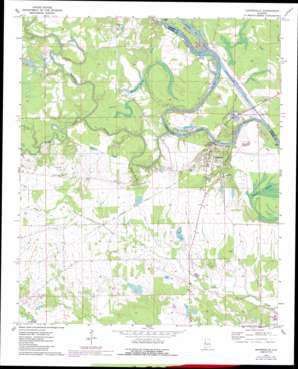
Gainesville Topo Map Alabama
To zoom in, hover over the map of Gainesville
USGS Topo Quad 32088g2 - 1:24,000 scale
| Topo Map Name: | Gainesville |
| USGS Topo Quad ID: | 32088g2 |
| Print Size: | ca. 21 1/4" wide x 27" high |
| Southeast Coordinates: | 32.75° N latitude / 88.125° W longitude |
| Map Center Coordinates: | 32.8125° N latitude / 88.1875° W longitude |
| U.S. State: | AL |
| Filename: | o32088g2.jpg |
| Download Map JPG Image: | Gainesville topo map 1:24,000 scale |
| Map Type: | Topographic |
| Topo Series: | 7.5´ |
| Map Scale: | 1:24,000 |
| Source of Map Images: | United States Geological Survey (USGS) |
| Alternate Map Versions: |
Gainesville AL 1970, updated 1972 Download PDF Buy paper map Gainesville AL 1970, updated 1987 Download PDF Buy paper map Gainesville AL 2011 Download PDF Buy paper map Gainesville AL 2014 Download PDF Buy paper map |
1:24,000 Topo Quads surrounding Gainesville
> Back to 32088e1 at 1:100,000 scale
> Back to 32088a1 at 1:250,000 scale
> Back to U.S. Topo Maps home
Gainesville topo map: Gazetteer
Gainesville: Bars
Chambers Bar elevation 33m 108′Gainesville Bar elevation 22m 72′
Holts Bar elevation 22m 72′
Lower Chicken Cock Bar elevation 33m 108′
Noxubee Bar elevation 22m 72′
Smiths Bar elevation 30m 98′
Upper Chicken Cock Bar elevation 33m 108′
Whitsetts Old Ford Bar elevation 23m 75′
Whitsitts Bar elevation 22m 72′
Gainesville: Bends
Nubbin Bend elevation 33m 108′Gainesville: Bridges
Tutwiler Bridge elevation 22m 72′Gainesville: Channels
Tennessee-Tombigbee Waterway elevation 33m 108′Gainesville: Cliffs
Cherry Bluff elevation 26m 85′Whitsetts Bluff elevation 23m 75′
Gainesville: Crossings
Gainesville Ferry (historical) elevation 22m 72′Smiths Ferry (historical) elevation 33m 108′
Whitsetts Ferry (historical) elevation 22m 72′
Gainesville: Dams
Buchanan Dam elevation 45m 147′Daisy Falls Dam elevation 46m 150′
Hill Ranch Dam elevation 49m 160′
P M Norwood Dam elevation 50m 164′
Sumter Farm and Stock Company Dam elevation 46m 150′
Sumter Farm and Stock Company Dam elevation 42m 137′
Gainesville: Islands
Colgins Island (historical) elevation 22m 72′Gainesville: Lakes
Buchannon Lake elevation 49m 160′Gibbs Pond elevation 49m 160′
Norwoods Pond elevation 50m 164′
Gainesville: Parks
Damsite East Bank Public Use Area elevation 34m 111′Damsite West Bank Public Use Area elevation 33m 108′
Forrest Memorial elevation 46m 150′
Gainesville Access Area elevation 28m 91′
Gainesville Historic District elevation 47m 154′
Main-Yankee Street Historic District elevation 49m 160′
Sumter Recreation Area elevation 33m 108′
Gainesville: Populated Places
Gainesville elevation 40m 131′Gainesville: Post Offices
Gainesville Post Office elevation 41m 134′Gainesville: Reservoirs
Barns Lake elevation 46m 150′Barns Pond elevation 42m 137′
Daisy Falls Lake elevation 46m 150′
Hill Ranch Pond elevation 49m 160′
Woodward Lakes elevation 35m 114′
Gainesville: Streams
Bodka Creek elevation 24m 78′Caney Creek elevation 27m 88′
Caney Creek elevation 27m 88′
Cedar Creek elevation 24m 78′
Folsum Branch elevation 25m 82′
Negro Slough elevation 22m 72′
Noxubee River elevation 33m 108′
Noxubee River elevation 23m 75′
Scuma Creek elevation 26m 85′
Turkey Paw Branch elevation 33m 108′
Gainesville: Swamps
Cypress Swamp elevation 31m 101′Gainesville digital topo map on disk
Buy this Gainesville topo map showing relief, roads, GPS coordinates and other geographical features, as a high-resolution digital map file on DVD:
Gulf Coast (LA, MS, AL, FL) & Southwestern Georgia
Buy digital topo maps: Gulf Coast (LA, MS, AL, FL) & Southwestern Georgia


