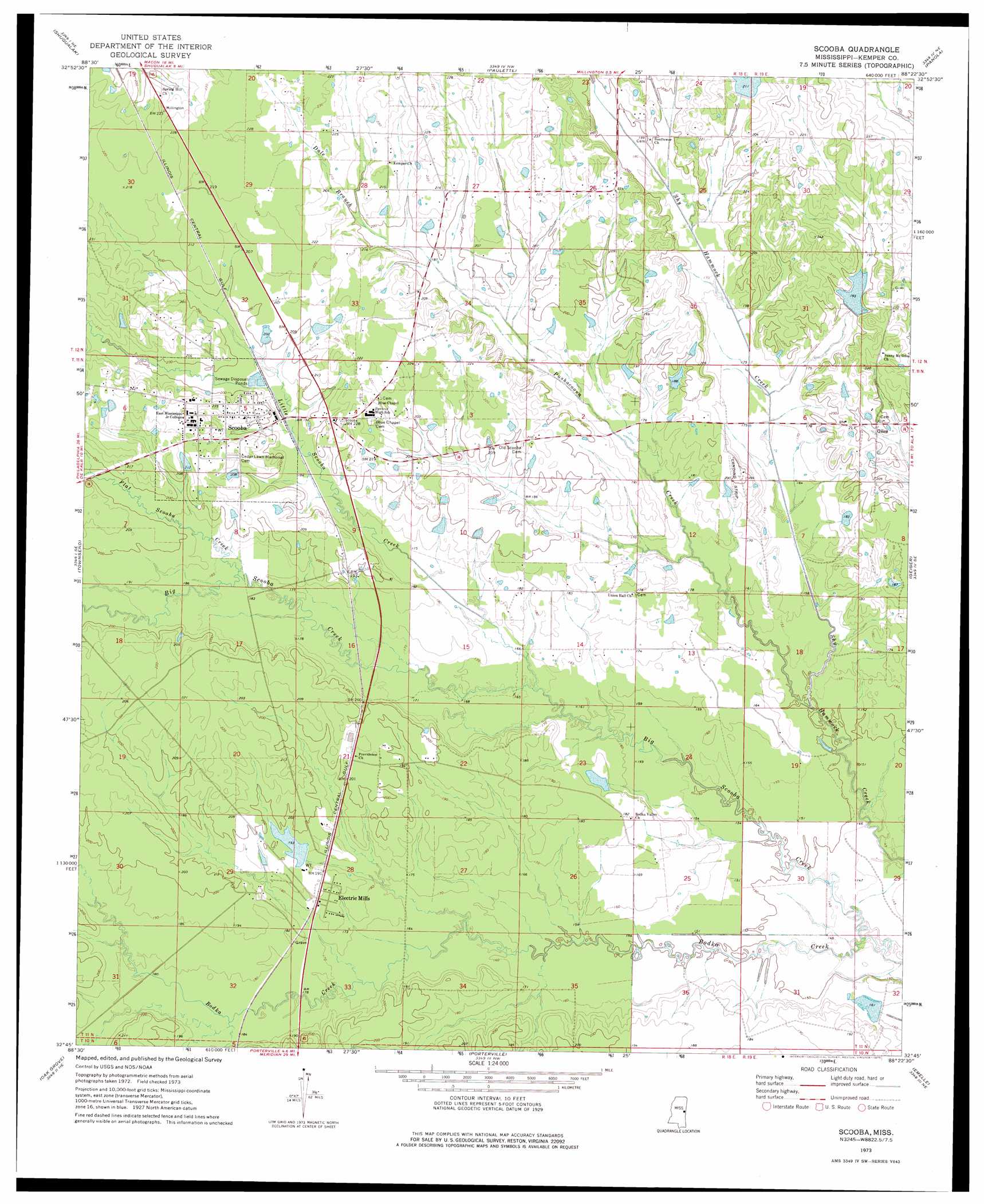
Scooba Topo Map Mississippi
To zoom in, hover over the map of Scooba
USGS Topo Quad 32088g4 - 1:24,000 scale
| Topo Map Name: | Scooba |
| USGS Topo Quad ID: | 32088g4 |
| Print Size: | ca. 21 1/4" wide x 27" high |
| Southeast Coordinates: | 32.75° N latitude / 88.375° W longitude |
| Map Center Coordinates: | 32.8125° N latitude / 88.4375° W longitude |
| U.S. State: | MS |
| Filename: | o32088g4.jpg |
| Download Map JPG Image: | Scooba topo map 1:24,000 scale |
| Map Type: | Topographic |
| Topo Series: | 7.5´ |
| Map Scale: | 1:24,000 |
| Source of Map Images: | United States Geological Survey (USGS) |
| Alternate Map Versions: |
Scooba MS 1973, updated 1975 Download PDF Buy paper map Scooba MS 2012 Download PDF Buy paper map Scooba MS 2015 Download PDF Buy paper map |
1:24,000 Topo Quads surrounding Scooba
Mashulaville |
Macon |
Mcleod |
Dancy |
Aliceville South |
Gholson |
Shuqualak |
Paulette |
Panola |
Warsaw |
De Kalb |
Townsend |
Scooba |
Geiger |
Gainesville |
Lauderdale Nw |
Oak Grove |
Porterville |
Emelle |
Epes West |
Daleville |
Lauderdale |
Tamola |
Boyd |
Livingston |
> Back to 32088e1 at 1:100,000 scale
> Back to 32088a1 at 1:250,000 scale
> Back to U.S. Topo Maps home
Scooba topo map: Gazetteer
Scooba: Airports
Giles Airport elevation 53m 173′Scooba: Dams
Carlton Fleming Pond Dam elevation 52m 170′Larry Bell Pond Dam elevation 42m 137′
Odessa Briggs Pond Dam elevation 63m 206′
Shammack Creek Structure 2 Dam elevation 63m 206′
Weyerhauser Lumber Company Pond Dam elevation 58m 190′
Scooba: Populated Places
Electric Mills elevation 58m 190′Giles elevation 63m 206′
Hatchette (historical) elevation 59m 193′
Old Scooba (historical) elevation 64m 209′
Scooba elevation 64m 209′
Scooba: Streams
Big Scooba Creek elevation 41m 134′Dale Branch elevation 62m 203′
Flat Scooba Creek elevation 55m 180′
Little Scooba Creek elevation 49m 160′
Pushacoona Creek elevation 46m 150′
Scooba digital topo map on disk
Buy this Scooba topo map showing relief, roads, GPS coordinates and other geographical features, as a high-resolution digital map file on DVD:
Gulf Coast (LA, MS, AL, FL) & Southwestern Georgia
Buy digital topo maps: Gulf Coast (LA, MS, AL, FL) & Southwestern Georgia
 & Southwestern Georgia map DVD")