Lynville Topo Map Mississippi
To zoom in, hover over the map of Lynville
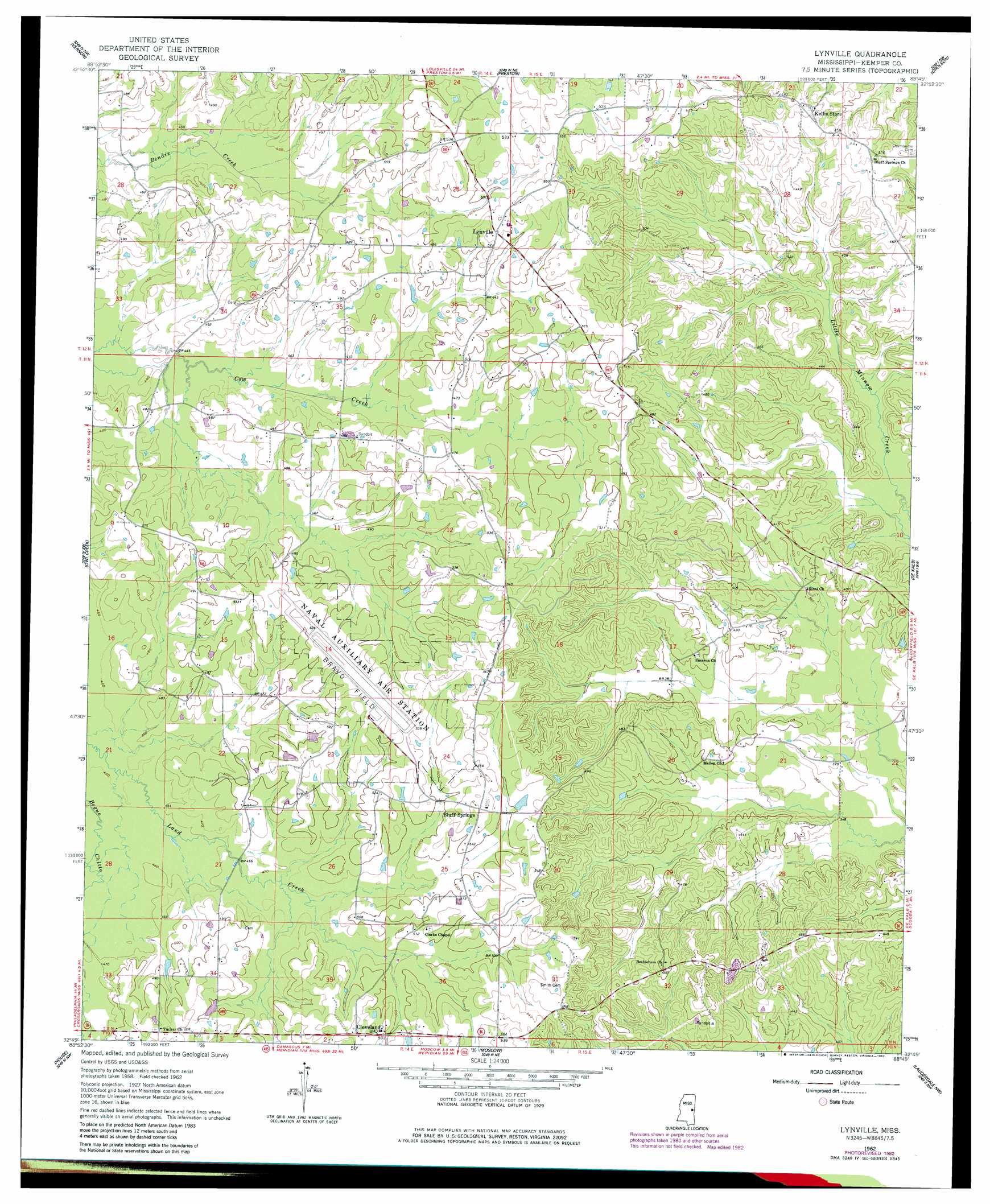
USGS Topo Quad 32088g7 - 1:24,000 scale
| Topo Map Name: | Lynville |
| USGS Topo Quad ID: | 32088g7 |
| Print Size: | ca. 21 1/4" wide x 27" high |
| Southeast Coordinates: | 32.75° N latitude / 88.75° W longitude |
| Map Center Coordinates: | 32.8125° N latitude / 88.8125° W longitude |
| U.S. State: | MS |
| Filename: | o32088g7.jpg |
| Download Map JPG Image: | Lynville topo map 1:24,000 scale |
| Map Type: | Topographic |
| Topo Series: | 7.5´ |
| Map Scale: | 1:24,000 |
| Source of Map Images: | United States Geological Survey (USGS) |
| Alternate Map Versions: |
Lynville MS 1962, updated 1963 Download PDF Buy paper map Lynville MS 1962, updated 1977 Download PDF Buy paper map Lynville MS 1962, updated 1982 Download PDF Buy paper map Lynville MS 2012 Download PDF Buy paper map Lynville MS 2015 Download PDF Buy paper map |
1:24,000 Topo Quads surrounding Lynville
Louisville South |
Boon |
Fearns Springs |
Mashulaville |
Macon |
Noxapater |
Vernon |
Preston |
Gholson |
Shuqualak |
Philadelphia |
Owl Creek |
Lynville |
De Kalb |
Townsend |
Deemer |
House |
Moscow |
Lauderdale Nw |
Oak Grove |
Union East |
Post |
Center Hill |
Daleville |
Lauderdale |
> Back to 32088e1 at 1:100,000 scale
> Back to 32088a1 at 1:250,000 scale
> Back to U.S. Topo Maps home
Lynville topo map: Gazetteer
Lynville: Airports
Bravo Field Outlying elevation 161m 528′Lynville: Populated Places
Bluff Springs elevation 158m 518′Cleveland elevation 159m 521′
Cow Creek (historical) elevation 148m 485′
Lynville elevation 158m 518′
Peden (historical) elevation 126m 413′
Lynville digital topo map on disk
Buy this Lynville topo map showing relief, roads, GPS coordinates and other geographical features, as a high-resolution digital map file on DVD:
Gulf Coast (LA, MS, AL, FL) & Southwestern Georgia
Buy digital topo maps: Gulf Coast (LA, MS, AL, FL) & Southwestern Georgia
 & Southwestern Georgia map DVD")