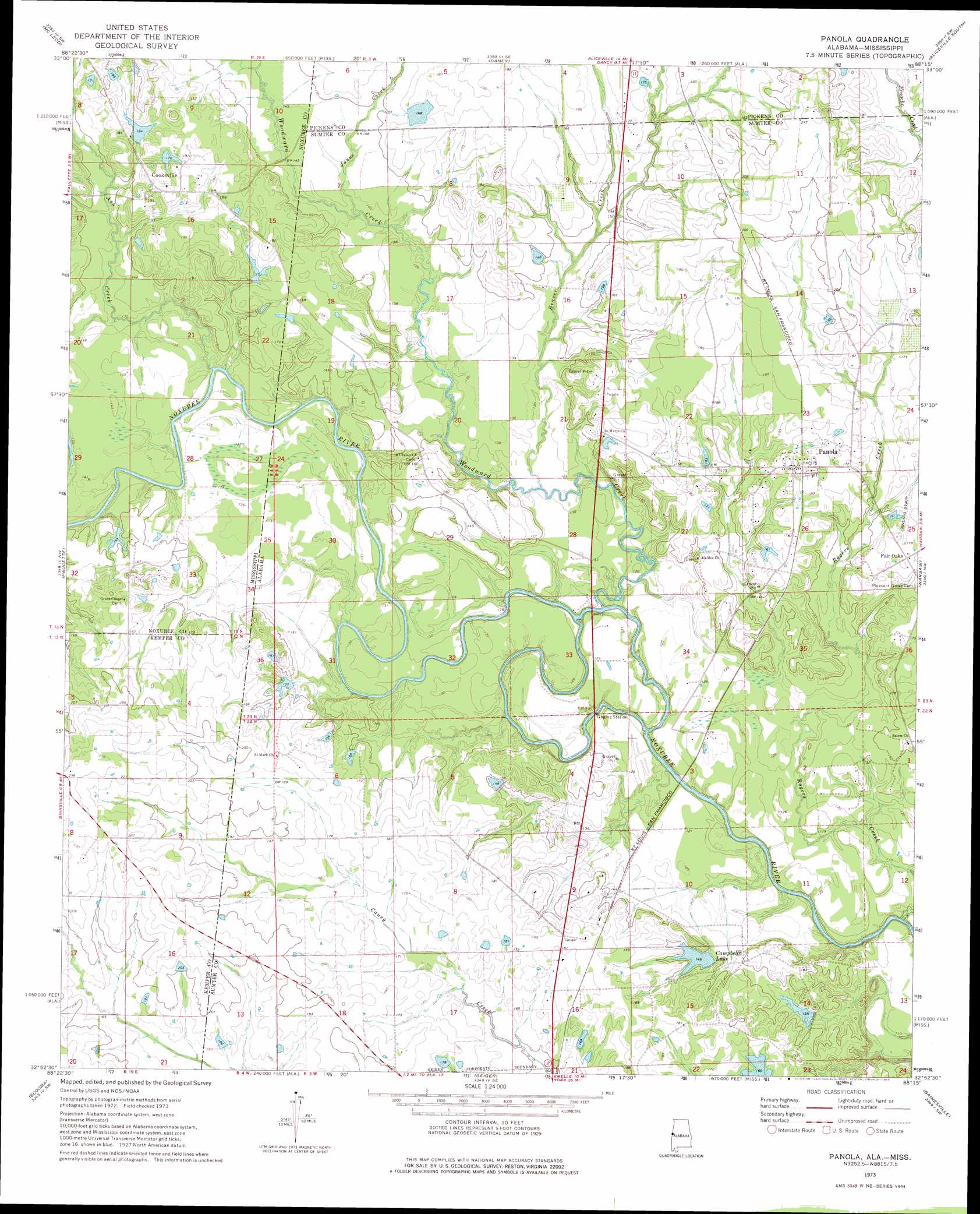
Panola Topo Map Alabama
To zoom in, hover over the map of Panola
USGS Topo Quad 32088h3 - 1:24,000 scale
| Topo Map Name: | Panola |
| USGS Topo Quad ID: | 32088h3 |
| Print Size: | ca. 21 1/4" wide x 27" high |
| Southeast Coordinates: | 32.875° N latitude / 88.25° W longitude |
| Map Center Coordinates: | 32.9375° N latitude / 88.3125° W longitude |
| U.S. States: | AL, MS |
| Filename: | o32088h3.jpg |
| Download Map JPG Image: | Panola topo map 1:24,000 scale |
| Map Type: | Topographic |
| Topo Series: | 7.5´ |
| Map Scale: | 1:24,000 |
| Source of Map Images: | United States Geological Survey (USGS) |
| Alternate Map Versions: |
Panola AL 1973, updated 1975 Download PDF Buy paper map Panola AL 1973, updated 1975 Download PDF Buy paper map Panola AL 2011 Download PDF Buy paper map Panola AL 2014 Download PDF Buy paper map |
1:24,000 Topo Quads surrounding Panola
Brooksville |
Cliftonville |
Pickensville |
Aliceville North |
Cunningham |
Macon |
Mcleod |
Dancy |
Aliceville South |
Pleasant Ridge |
Shuqualak |
Paulette |
Panola |
Warsaw |
West Greene |
Townsend |
Scooba |
Geiger |
Gainesville |
Boligee |
Oak Grove |
Porterville |
Emelle |
Epes West |
Epes East |
> Back to 32088e1 at 1:100,000 scale
> Back to 32088a1 at 1:250,000 scale
> Back to U.S. Topo Maps home
Panola topo map: Gazetteer
Panola: Areas
Wild Horse Prairie elevation 63m 206′Panola: Channels
The Cutt Off elevation 30m 98′Panola: Crossings
Noxubee Ferry (historical) elevation 34m 111′Wall Ferry (historical) elevation 34m 111′
Panola: Dams
Sparkman Lake Dam elevation 56m 183′Sumter Farm and Stock Company Dam elevation 54m 177′
Sumter Farm and Stock Company Dam elevation 42m 137′
Panola: Islands
Noxubee Island elevation 38m 124′Panola: Populated Places
Cooksville elevation 56m 183′Fair Oaks elevation 54m 177′
Panola elevation 55m 180′
Panola: Post Offices
Panola Post Office elevation 55m 180′Panola: Reservoirs
Campbells Lake elevation 43m 141′Sumter Lake Number Four elevation 54m 177′
Panola: Streams
Ash Creek elevation 34m 111′Beaver Creek elevation 37m 121′
Duck Pond Branch elevation 43m 141′
Duck Pond Branch elevation 43m 141′
Jones Creek elevation 40m 131′
Rogers Creek elevation 30m 98′
Woodward Creek elevation 30m 98′
Woodward Creek elevation 31m 101′
Panola digital topo map on disk
Buy this Panola topo map showing relief, roads, GPS coordinates and other geographical features, as a high-resolution digital map file on DVD:
Gulf Coast (LA, MS, AL, FL) & Southwestern Georgia
Buy digital topo maps: Gulf Coast (LA, MS, AL, FL) & Southwestern Georgia
 & Southwestern Georgia map DVD")