Sebastopol Topo Map Mississippi
To zoom in, hover over the map of Sebastopol
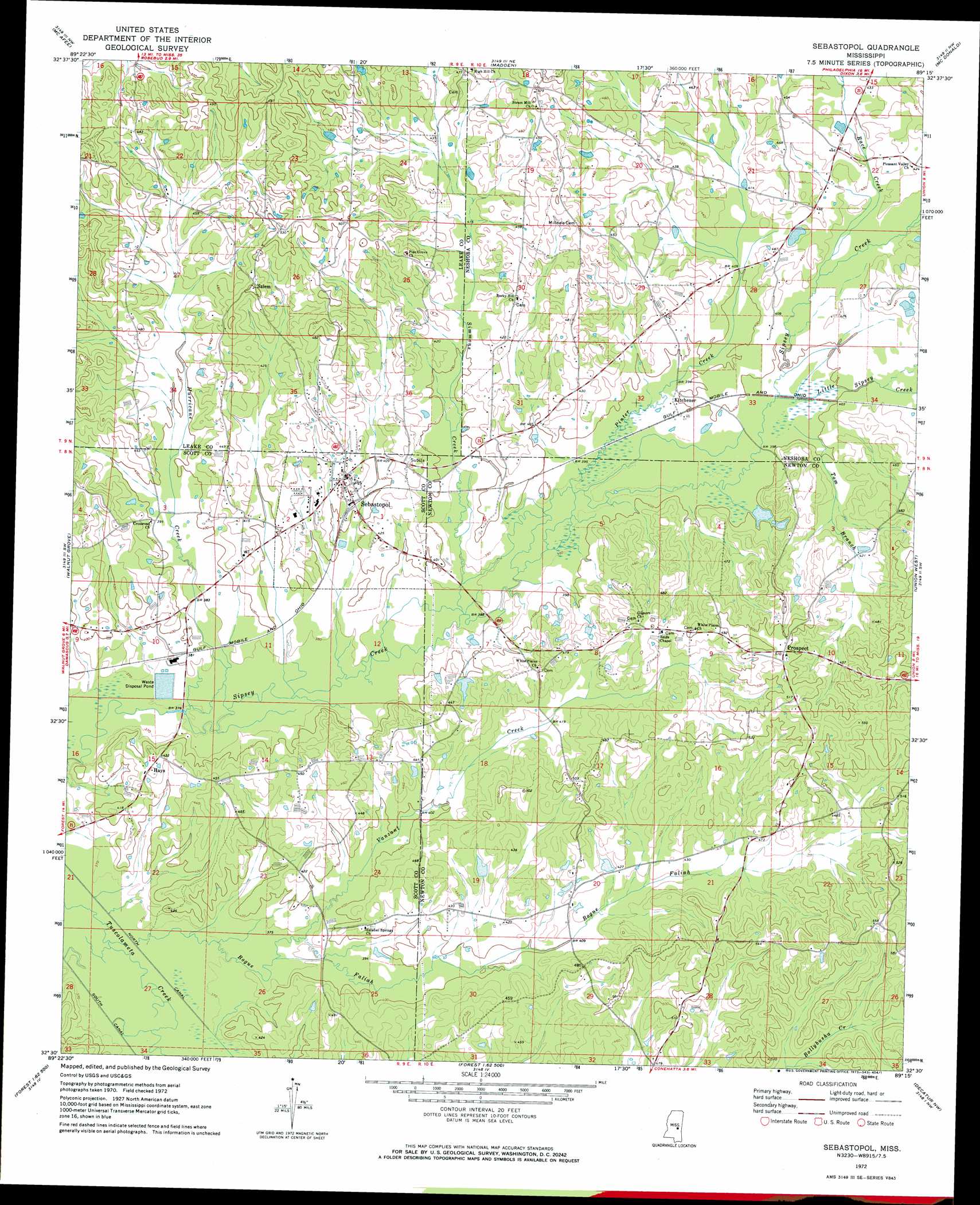
USGS Topo Quad 32089e3 - 1:24,000 scale
| Topo Map Name: | Sebastopol |
| USGS Topo Quad ID: | 32089e3 |
| Print Size: | ca. 21 1/4" wide x 27" high |
| Southeast Coordinates: | 32.5° N latitude / 89.25° W longitude |
| Map Center Coordinates: | 32.5625° N latitude / 89.3125° W longitude |
| U.S. State: | MS |
| Filename: | o32089e3.jpg |
| Download Map JPG Image: | Sebastopol topo map 1:24,000 scale |
| Map Type: | Topographic |
| Topo Series: | 7.5´ |
| Map Scale: | 1:24,000 |
| Source of Map Images: | United States Geological Survey (USGS) |
| Alternate Map Versions: |
Sebastopol MS 1972, updated 1973 Download PDF Buy paper map Sebastopol MS 2012 Download PDF Buy paper map Sebastopol MS 2015 Download PDF Buy paper map |
1:24,000 Topo Quads surrounding Sebastopol
Conway |
Renfroe |
Edinburg |
Pearl River |
Philadelphia |
Carthage |
Mcafee |
Madden |
Mcdonald |
Deemer |
Lena |
Walnut Grove |
Sebastopol |
Union West |
Union East |
Hillsboro |
Harperville |
Conehatta |
Decatur Nw |
Decatur |
Pulaski |
Forest |
Lake |
Newton |
Hickory |
> Back to 32089e1 at 1:100,000 scale
> Back to 32088a1 at 1:250,000 scale
> Back to U.S. Topo Maps home
Sebastopol topo map: Gazetteer
Sebastopol: Dams
Don Landrum Lake Dam elevation 138m 452′Green Acre Farm Sewage Pond Dam elevation 112m 367′
R C Camp Lake Dam elevation 130m 426′
Sebastopol: Populated Places
Greenfield (historical) elevation 134m 439′Hays elevation 129m 423′
High Hill elevation 146m 479′
Kitchener elevation 121m 396′
Prospect elevation 155m 508′
Salem elevation 151m 495′
Sebastopol elevation 128m 419′
Sebastopol: Springs
Sulphur Spring elevation 140m 459′Sebastopol: Streams
Bogue Faliah elevation 110m 360′Hurricane Creek elevation 112m 367′
Little Sipsey Creek elevation 119m 390′
Pinter Creek elevation 118m 387′
Race Creek elevation 124m 406′
Simmons Creek elevation 115m 377′
Tom Branch elevation 120m 393′
Vanzant Creek elevation 115m 377′
Sebastopol digital topo map on disk
Buy this Sebastopol topo map showing relief, roads, GPS coordinates and other geographical features, as a high-resolution digital map file on DVD:
Gulf Coast (LA, MS, AL, FL) & Southwestern Georgia
Buy digital topo maps: Gulf Coast (LA, MS, AL, FL) & Southwestern Georgia
 & Southwestern Georgia map DVD")