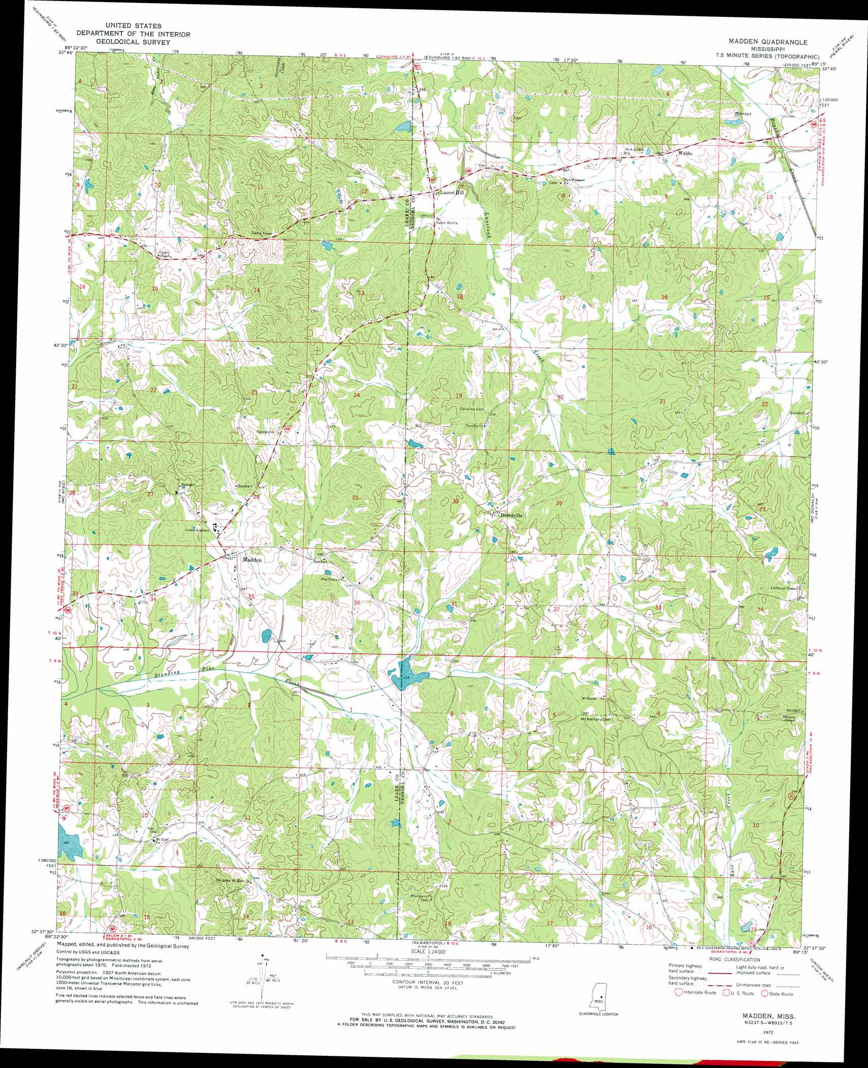
Madden Topo Map Mississippi
To zoom in, hover over the map of Madden
USGS Topo Quad 32089f3 - 1:24,000 scale
| Topo Map Name: | Madden |
| USGS Topo Quad ID: | 32089f3 |
| Print Size: | ca. 21 1/4" wide x 27" high |
| Southeast Coordinates: | 32.625° N latitude / 89.25° W longitude |
| Map Center Coordinates: | 32.6875° N latitude / 89.3125° W longitude |
| U.S. State: | MS |
| Filename: | o32089f3.jpg |
| Download Map JPG Image: | Madden topo map 1:24,000 scale |
| Map Type: | Topographic |
| Topo Series: | 7.5´ |
| Map Scale: | 1:24,000 |
| Source of Map Images: | United States Geological Survey (USGS) |
| Alternate Map Versions: |
Madden MS 1972, updated 1973 Download PDF Buy paper map Madden MS 2012 Download PDF Buy paper map Madden MS 2015 Download PDF Buy paper map |
1:24,000 Topo Quads surrounding Madden
Singleton |
Zama |
Four Corners |
Plattsburg |
Noxapater |
Conway |
Renfroe |
Edinburg |
Pearl River |
Philadelphia |
Carthage |
Mcafee |
Madden |
Mcdonald |
Deemer |
Lena |
Walnut Grove |
Sebastopol |
Union West |
Union East |
Hillsboro |
Harperville |
Conehatta |
Decatur Nw |
Decatur |
> Back to 32089e1 at 1:100,000 scale
> Back to 32088a1 at 1:250,000 scale
> Back to U.S. Topo Maps home
Madden topo map: Gazetteer
Madden: Dams
H Pilgrim Lake Dam elevation 128m 419′W C Majors Pond Dam elevation 122m 400′
Madden: Populated Places
Dowdville elevation 152m 498′Laurel Hill elevation 129m 423′
Madden elevation 135m 442′
Waldo elevation 150m 492′
Madden digital topo map on disk
Buy this Madden topo map showing relief, roads, GPS coordinates and other geographical features, as a high-resolution digital map file on DVD:
Gulf Coast (LA, MS, AL, FL) & Southwestern Georgia
Buy digital topo maps: Gulf Coast (LA, MS, AL, FL) & Southwestern Georgia
 & Southwestern Georgia map DVD")