Renfroe Topo Map Mississippi
To zoom in, hover over the map of Renfroe
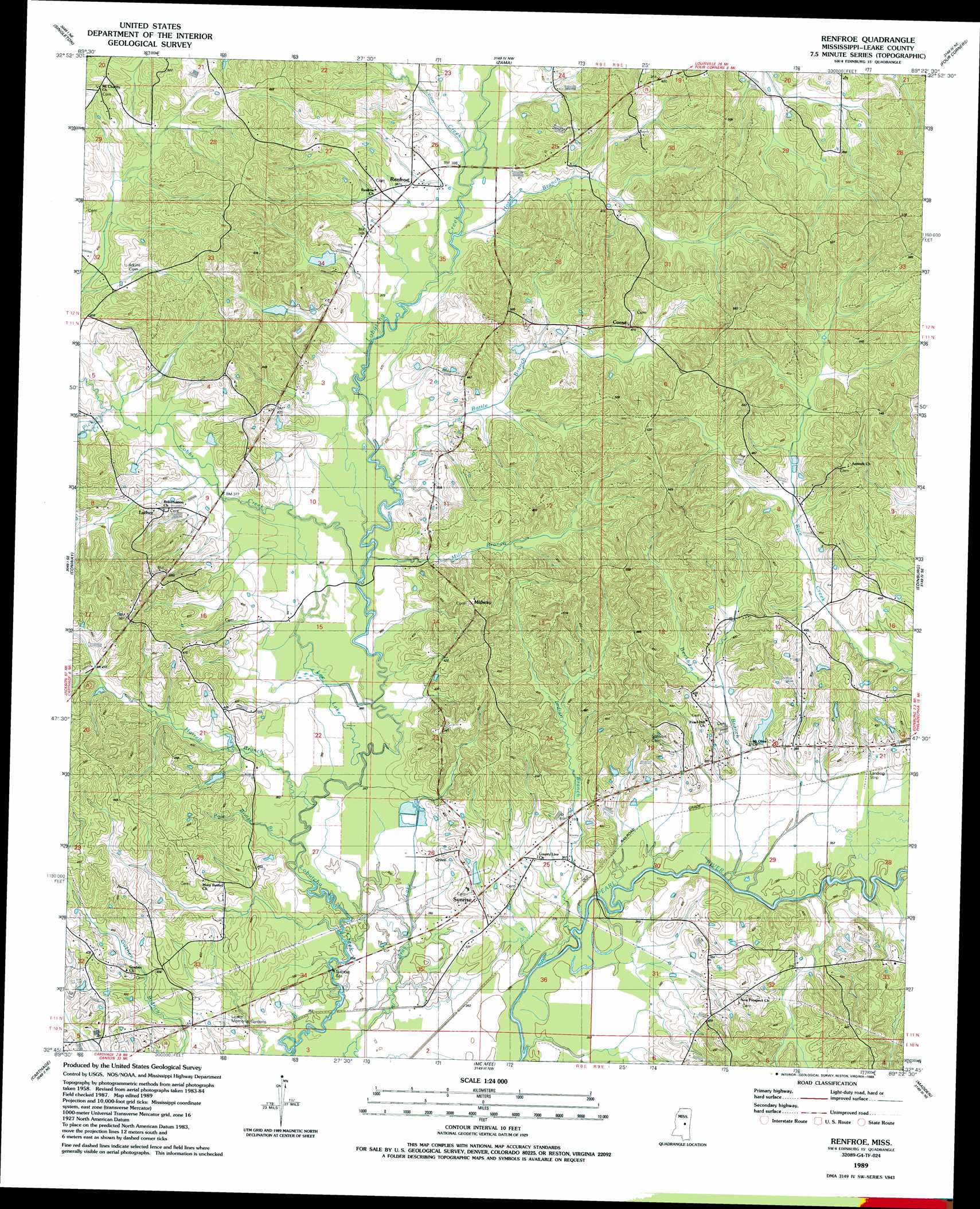
USGS Topo Quad 32089g4 - 1:24,000 scale
| Topo Map Name: | Renfroe |
| USGS Topo Quad ID: | 32089g4 |
| Print Size: | ca. 21 1/4" wide x 27" high |
| Southeast Coordinates: | 32.75° N latitude / 89.375° W longitude |
| Map Center Coordinates: | 32.8125° N latitude / 89.4375° W longitude |
| U.S. State: | MS |
| Filename: | o32089g4.jpg |
| Download Map JPG Image: | Renfroe topo map 1:24,000 scale |
| Map Type: | Topographic |
| Topo Series: | 7.5´ |
| Map Scale: | 1:24,000 |
| Source of Map Images: | United States Geological Survey (USGS) |
| Alternate Map Versions: |
Renfroe MS 1989, updated 1989 Download PDF Buy paper map Renfroe MS 2012 Download PDF Buy paper map Renfroe MS 2015 Download PDF Buy paper map |
1:24,000 Topo Quads surrounding Renfroe
Mcadams |
Kosciusko |
Ethel South |
Ethel Se |
Louisville Sw |
Joseph |
Singleton |
Zama |
Four Corners |
Plattsburg |
Thomastown |
Conway |
Renfroe |
Edinburg |
Pearl River |
Ofahoma |
Carthage |
Mcafee |
Madden |
Mcdonald |
Ludlow |
Lena |
Walnut Grove |
Sebastopol |
Union West |
> Back to 32089e1 at 1:100,000 scale
> Back to 32088a1 at 1:250,000 scale
> Back to U.S. Topo Maps home
Renfroe topo map: Gazetteer
Renfroe: Dams
R and R Farm Ponds Dam elevation 119m 390′Rance Johnston Catfish Pond Dam elevation 127m 416′
Smith Pond Dam elevation 110m 360′
Renfroe: Populated Places
Battle Bluff elevation 122m 400′Coosa elevation 140m 459′
Goshen elevation 131m 429′
Luther elevation 122m 400′
Midway elevation 144m 472′
Pearl Hill elevation 119m 390′
Renfroe elevation 118m 387′
Sunrise elevation 120m 393′
Williston elevation 115m 377′
Renfroe: Streams
Battle Branch elevation 110m 360′Beckham Branch elevation 106m 347′
Cobbs Creek elevation 108m 354′
Coon Creek elevation 113m 370′
Harrell Branch elevation 107m 351′
Horne Branch elevation 111m 364′
Indian Branch elevation 103m 337′
Lee Lake elevation 107m 351′
Mill Branch elevation 110m 360′
Pickins Creek elevation 116m 380′
Pole Bridge Branch elevation 106m 347′
Standing Cypress Creek elevation 104m 341′
Renfroe digital topo map on disk
Buy this Renfroe topo map showing relief, roads, GPS coordinates and other geographical features, as a high-resolution digital map file on DVD:
Gulf Coast (LA, MS, AL, FL) & Southwestern Georgia
Buy digital topo maps: Gulf Coast (LA, MS, AL, FL) & Southwestern Georgia
 & Southwestern Georgia map DVD")