Plattsburg Topo Map Mississippi
To zoom in, hover over the map of Plattsburg
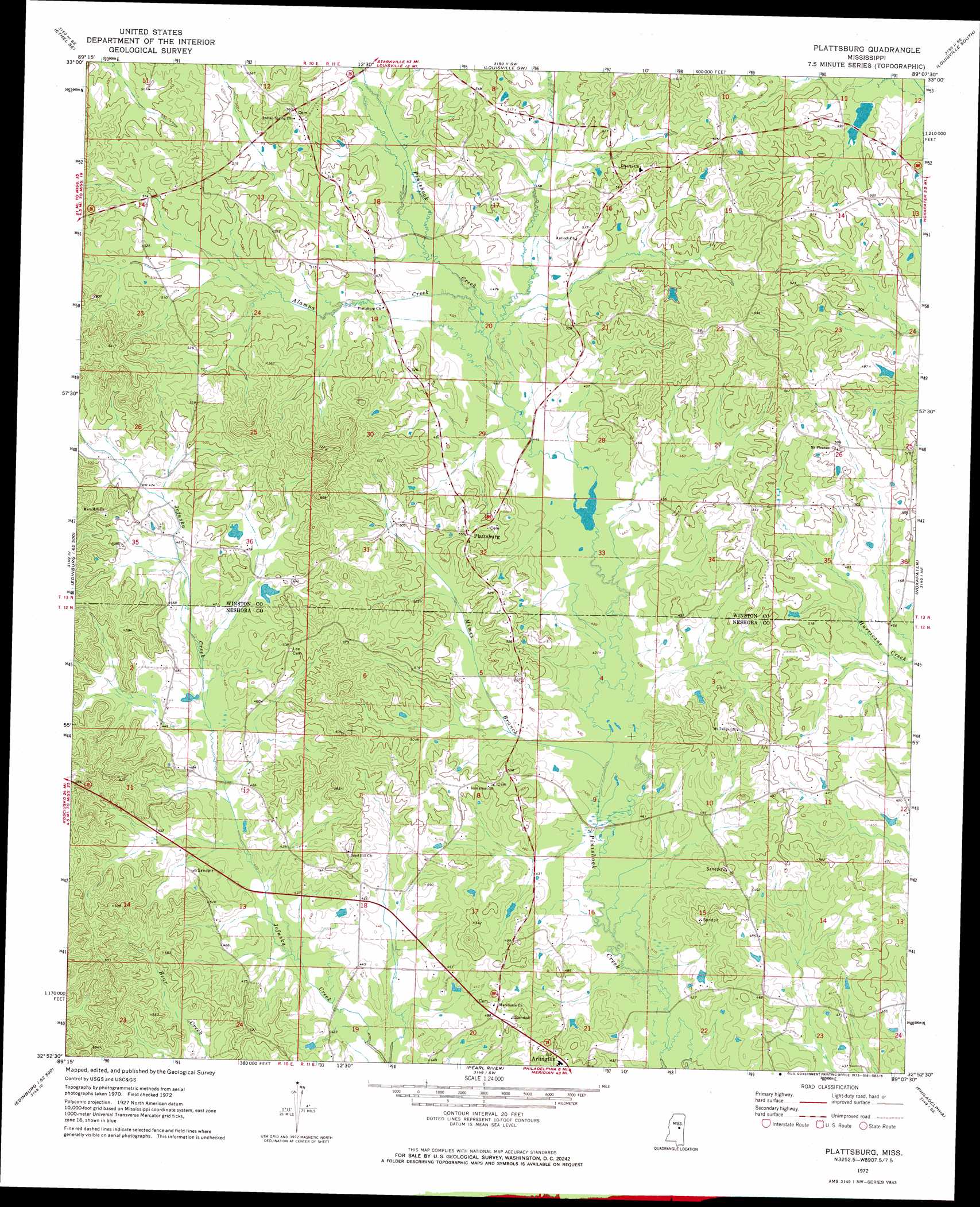
USGS Topo Quad 32089h2 - 1:24,000 scale
| Topo Map Name: | Plattsburg |
| USGS Topo Quad ID: | 32089h2 |
| Print Size: | ca. 21 1/4" wide x 27" high |
| Southeast Coordinates: | 32.875° N latitude / 89.125° W longitude |
| Map Center Coordinates: | 32.9375° N latitude / 89.1875° W longitude |
| U.S. State: | MS |
| Filename: | o32089h2.jpg |
| Download Map JPG Image: | Plattsburg topo map 1:24,000 scale |
| Map Type: | Topographic |
| Topo Series: | 7.5´ |
| Map Scale: | 1:24,000 |
| Source of Map Images: | United States Geological Survey (USGS) |
| Alternate Map Versions: |
Plattsburg MS 1972, updated 1973 Download PDF Buy paper map Plattsburg MS 2012 Download PDF Buy paper map Plattsburg MS 2015 Download PDF Buy paper map |
1:24,000 Topo Quads surrounding Plattsburg
Ethel North |
Mccool |
Highpoint |
Louisville North |
Betheden |
Ethel South |
Ethel Se |
Louisville Sw |
Louisville South |
Boon |
Zama |
Four Corners |
Plattsburg |
Noxapater |
Vernon |
Renfroe |
Edinburg |
Pearl River |
Philadelphia |
Owl Creek |
Mcafee |
Madden |
Mcdonald |
Deemer |
House |
> Back to 32089e1 at 1:100,000 scale
> Back to 32088a1 at 1:250,000 scale
> Back to U.S. Topo Maps home
Plattsburg topo map: Gazetteer
Plattsburg: Dams
Deweese Lake Dam elevation 161m 528′Son Vine Lake Dam elevation 136m 446′
Watkins Lake Dam elevation 140m 459′
Plattsburg: Populated Places
Arlington elevation 159m 521′Finis Hook (historical) elevation 146m 479′
Liberty elevation 168m 551′
Plattsburg elevation 159m 521′
Plattsburg: Streams
Alampa Creek elevation 135m 442′Mimes Branch elevation 128m 419′
Plattsburg digital topo map on disk
Buy this Plattsburg topo map showing relief, roads, GPS coordinates and other geographical features, as a high-resolution digital map file on DVD:
Gulf Coast (LA, MS, AL, FL) & Southwestern Georgia
Buy digital topo maps: Gulf Coast (LA, MS, AL, FL) & Southwestern Georgia
 & Southwestern Georgia map DVD")