Newport Topo Map Mississippi
To zoom in, hover over the map of Newport
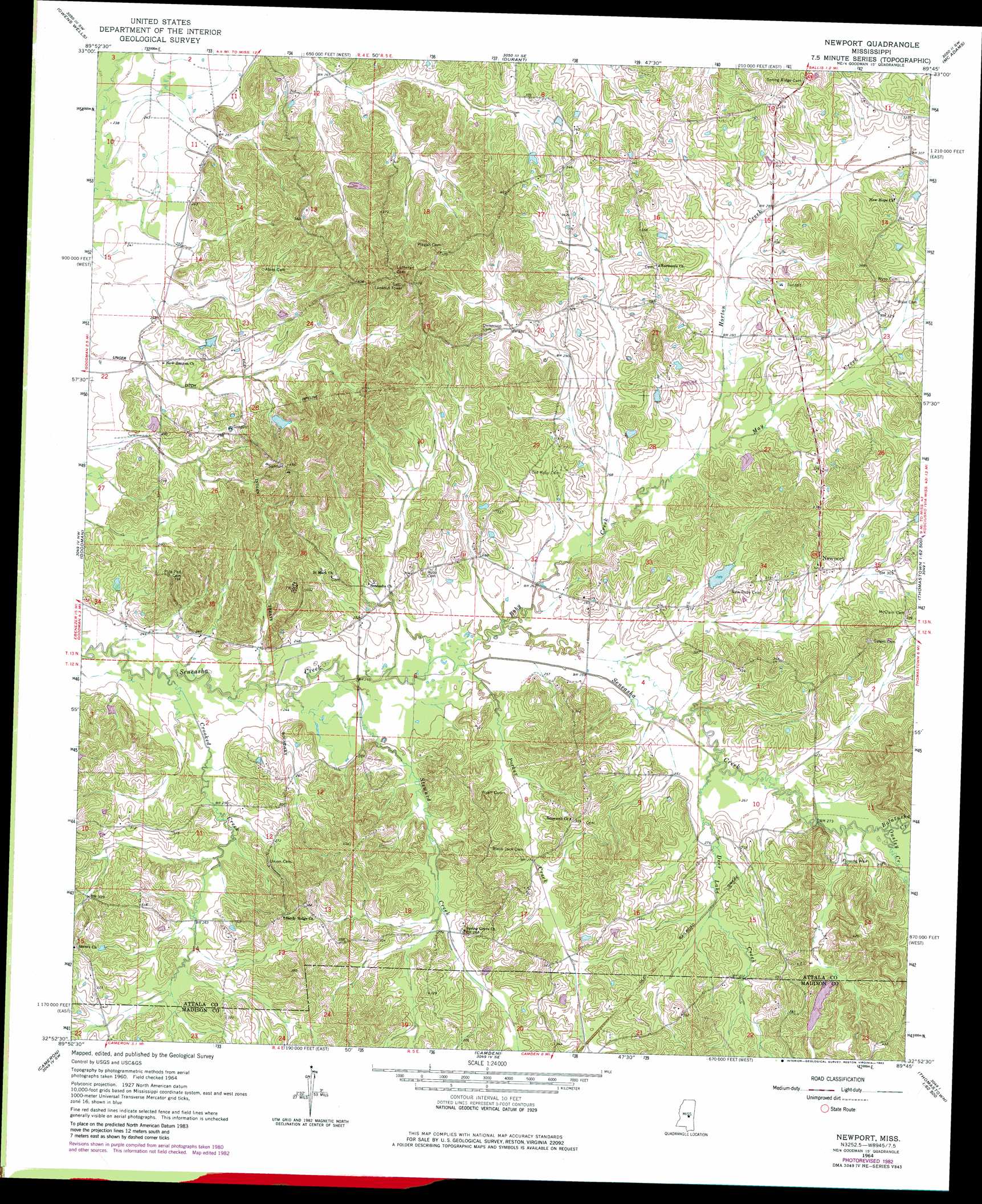
USGS Topo Quad 32089h7 - 1:24,000 scale
| Topo Map Name: | Newport |
| USGS Topo Quad ID: | 32089h7 |
| Print Size: | ca. 21 1/4" wide x 27" high |
| Southeast Coordinates: | 32.875° N latitude / 89.75° W longitude |
| Map Center Coordinates: | 32.9375° N latitude / 89.8125° W longitude |
| U.S. State: | MS |
| Filename: | o32089h7.jpg |
| Download Map JPG Image: | Newport topo map 1:24,000 scale |
| Map Type: | Topographic |
| Topo Series: | 7.5´ |
| Map Scale: | 1:24,000 |
| Source of Map Images: | United States Geological Survey (USGS) |
| Alternate Map Versions: |
Newport MS 1964, updated 1965 Download PDF Buy paper map Newport MS 1964, updated 1982 Download PDF Buy paper map Newport MS 2012 Download PDF Buy paper map Newport MS 2015 Download PDF Buy paper map |
1:24,000 Topo Quads surrounding Newport
Lexington North |
Bowling Green |
West |
Hesterville |
Kosciusko Ne |
Lexington South |
Owens Wells |
Durant |
Mcadams |
Kosciusko |
Ebenezer |
Goodman |
Newport |
Joseph |
Singleton |
Vaughan |
Cameron |
Camden |
Thomastown |
Conway |
Way |
Sharon |
Farmhaven |
Ofahoma |
Carthage |
> Back to 32089e1 at 1:100,000 scale
> Back to 32088a1 at 1:250,000 scale
> Back to U.S. Topo Maps home
Newport topo map: Gazetteer
Newport: Canals
Unger Ditch elevation 76m 249′Newport: Dams
Francis Lake Dam elevation 100m 328′McDaniel Lake Dam elevation 84m 275′
Roy Barrett Lake Dam elevation 97m 318′
Smithson Lake Dam elevation 87m 285′
Newport: Populated Places
Branchville (historical) elevation 81m 265′New Hope (historical) elevation 106m 347′
Newport elevation 98m 321′
Shrock (historical) elevation 110m 360′
Newport: Post Offices
Waugh Post Office (historical) elevation 82m 269′Newport: Streams
Bolatusha Creek elevation 82m 269′Crooked Creek elevation 70m 229′
Deer Lake Creek elevation 79m 259′
Horton Creek elevation 80m 262′
May Creek elevation 80m 262′
Ousley Creek elevation 82m 269′
Parker Creek elevation 74m 242′
Roby Creek elevation 74m 242′
Steward Creek elevation 73m 239′
Newport digital topo map on disk
Buy this Newport topo map showing relief, roads, GPS coordinates and other geographical features, as a high-resolution digital map file on DVD:
Gulf Coast (LA, MS, AL, FL) & Southwestern Georgia
Buy digital topo maps: Gulf Coast (LA, MS, AL, FL) & Southwestern Georgia
 & Southwestern Georgia map DVD")