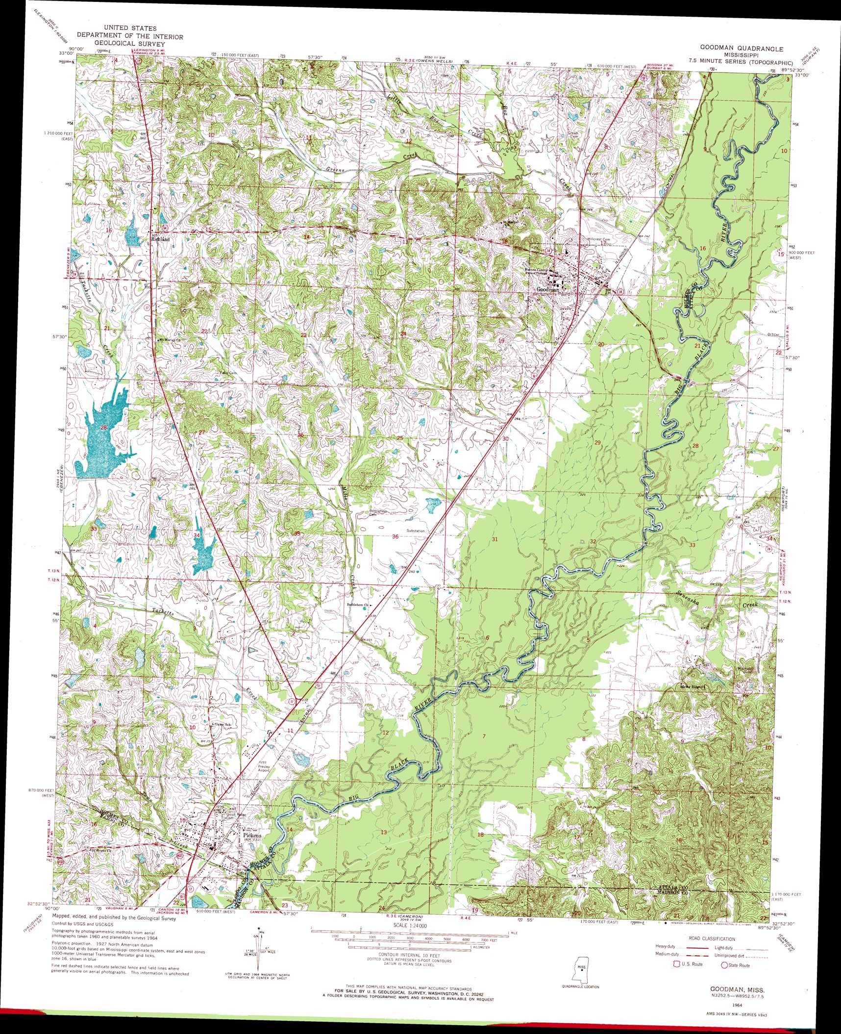
Goodman Topo Map Mississippi
To zoom in, hover over the map of Goodman
USGS Topo Quad 32089h8 - 1:24,000 scale
| Topo Map Name: | Goodman |
| USGS Topo Quad ID: | 32089h8 |
| Print Size: | ca. 21 1/4" wide x 27" high |
| Southeast Coordinates: | 32.875° N latitude / 89.875° W longitude |
| Map Center Coordinates: | 32.9375° N latitude / 89.9375° W longitude |
| U.S. State: | MS |
| Filename: | o32089h8.jpg |
| Download Map JPG Image: | Goodman topo map 1:24,000 scale |
| Map Type: | Topographic |
| Topo Series: | 7.5´ |
| Map Scale: | 1:24,000 |
| Source of Map Images: | United States Geological Survey (USGS) |
| Alternate Map Versions: |
Goodman MS 1964, updated 1965 Download PDF Buy paper map Goodman MS 1964, updated 1982 Download PDF Buy paper map Goodman MS 2012 Download PDF Buy paper map Goodman MS 2015 Download PDF Buy paper map |
1:24,000 Topo Quads surrounding Goodman
Tchula |
Lexington North |
Bowling Green |
West |
Hesterville |
Howard |
Lexington South |
Owens Wells |
Durant |
Mcadams |
Zeiglerville |
Ebenezer |
Goodman |
Newport |
Joseph |
Linwood |
Vaughan |
Cameron |
Camden |
Thomastown |
Berryville |
Way |
Sharon |
Farmhaven |
Ofahoma |
> Back to 32089e1 at 1:100,000 scale
> Back to 32088a1 at 1:250,000 scale
> Back to U.S. Topo Maps home
Goodman topo map: Gazetteer
Goodman: Airports
Presleys Airport elevation 71m 232′Goodman: Crossings
Interchange 144 elevation 92m 301′Interchange 146 elevation 104m 341′
Williams Ferry (historical) elevation 67m 219′
Goodman: Dams
Bridgeforth Lake Dam elevation 64m 209′Holmes Junior College Lake Dam elevation 92m 301′
Mississippi No Name 30 Dam elevation 92m 301′
Mississippi No Name 34 Dam elevation 73m 239′
Pickens Sewage Lagoon Dam elevation 67m 219′
Tackett Watershed 6 Dam elevation 79m 259′
Tackett Watershed 9 Dam elevation 81m 265′
Goodman: Populated Places
Goodman elevation 81m 265′Pickens elevation 72m 236′
Richland elevation 99m 324′
Valena (historical) elevation 70m 229′
Goodman: Streams
Box Creek elevation 66m 216′Greens Creek elevation 73m 239′
Little Box Creek elevation 74m 242′
Mills Creek elevation 63m 206′
Seneasha Creek elevation 65m 213′
Tacketts Creek elevation 63m 206′
Town Creek elevation 63m 206′
Goodman digital topo map on disk
Buy this Goodman topo map showing relief, roads, GPS coordinates and other geographical features, as a high-resolution digital map file on DVD:
Gulf Coast (LA, MS, AL, FL) & Southwestern Georgia
Buy digital topo maps: Gulf Coast (LA, MS, AL, FL) & Southwestern Georgia
 & Southwestern Georgia map DVD")