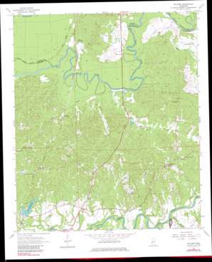
Willows Topo Map Mississippi
To zoom in, hover over the map of Willows
USGS Topo Quad 32090a8 - 1:24,000 scale
| Topo Map Name: | Willows |
| USGS Topo Quad ID: | 32090a8 |
| Print Size: | ca. 21 1/4" wide x 27" high |
| Southeast Coordinates: | 32° N latitude / 90.875° W longitude |
| Map Center Coordinates: | 32.0625° N latitude / 90.9375° W longitude |
| U.S. State: | MS |
| Filename: | o32090a8.jpg |
| Download Map JPG Image: | Willows topo map 1:24,000 scale |
| Map Type: | Topographic |
| Topo Series: | 7.5´ |
| Map Scale: | 1:24,000 |
| Source of Map Images: | United States Geological Survey (USGS) |
| Alternate Map Versions: |
Willows MS 1963, updated 1964 Download PDF Buy paper map Willows MS 1963, updated 1981 Download PDF Buy paper map Willows MS 1963, updated 1981 Download PDF Buy paper map Willows MS 2012 Download PDF Buy paper map Willows MS 2015 Download PDF Buy paper map |
1:24,000 Topo Quads surrounding Willows
> Back to 32090a1 at 1:100,000 scale
> Back to 32090a1 at 1:250,000 scale
> Back to U.S. Topo Maps home
Willows topo map: Gazetteer
Willows: Bridges
Hankinson Bridge (historical) elevation 19m 62′Willows: Crossings
Grindstone Ford elevation 27m 88′Hankinsons Ferry (historical) elevation 19m 62′
Thompsons Ferry (historical) elevation 16m 52′
Willows: Dams
Lake Claiborne Dam elevation 35m 114′Willows: Populated Places
Allen elevation 32m 104′Galloway elevation 28m 91′
Hankinson elevation 43m 141′
Ingleside elevation 76m 249′
Oaklawn elevation 31m 101′
Willows elevation 92m 301′
Willows: Reservoirs
Lake Claiborne elevation 49m 160′Willows: Streams
Big Bogue Desha elevation 16m 52′Blackman Bayou elevation 19m 62′
Drakes Bayou elevation 17m 55′
Fairview Branch elevation 22m 72′
Gunns Bayou elevation 20m 65′
Kennison Creek elevation 22m 72′
Lick Branch elevation 25m 82′
Little Bogue Desha elevation 18m 59′
Whisky Branch elevation 27m 88′
Willis Creek elevation 17m 55′
Wrights Creek elevation 18m 59′
Willows digital topo map on disk
Buy this Willows topo map showing relief, roads, GPS coordinates and other geographical features, as a high-resolution digital map file on DVD:


