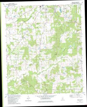
Terry Nw Topo Map Mississippi
To zoom in, hover over the map of Terry Nw
USGS Topo Quad 32090b4 - 1:24,000 scale
| Topo Map Name: | Terry Nw |
| USGS Topo Quad ID: | 32090b4 |
| Print Size: | ca. 21 1/4" wide x 27" high |
| Southeast Coordinates: | 32.125° N latitude / 90.375° W longitude |
| Map Center Coordinates: | 32.1875° N latitude / 90.4375° W longitude |
| U.S. State: | MS |
| Filename: | o32090b4.jpg |
| Download Map JPG Image: | Terry Nw topo map 1:24,000 scale |
| Map Type: | Topographic |
| Topo Series: | 7.5´ |
| Map Scale: | 1:24,000 |
| Source of Map Images: | United States Geological Survey (USGS) |
| Alternate Map Versions: |
Terry NW MS 1971, updated 1973 Download PDF Buy paper map Terry NW MS 1980, updated 1980 Download PDF Buy paper map Terry NW MS 2012 Download PDF Buy paper map Terry NW MS 2015 Download PDF Buy paper map |
1:24,000 Topo Quads surrounding Terry Nw
> Back to 32090a1 at 1:100,000 scale
> Back to 32090a1 at 1:250,000 scale
> Back to U.S. Topo Maps home
Terry Nw topo map: Gazetteer
Terry Nw: Dams
Alexanders Lake Dam elevation 99m 324′Dehmer Pond Dam elevation 104m 341′
Doctor David Holmes Dam elevation 105m 344′
Holiday Lake Dam elevation 71m 232′
Holmes Lake Dam elevation 111m 364′
John Crechelle Lake Dam elevation 73m 239′
Newmans Lake Dam elevation 83m 272′
Raymond Lake Dam elevation 100m 328′
Rice Lake Dam elevation 97m 318′
Wilson Pond Dam elevation 103m 337′
Terry Nw: Populated Places
Dry Grove elevation 114m 374′Fairchilds Crossroads elevation 74m 242′
Midway elevation 122m 400′
Palestine elevation 119m 390′
Terry Nw: Reservoirs
Bar S Lake elevation 98m 321′Jomar Lake elevation 92m 301′
Raymond Lake elevation 92m 301′
Terry Nw: Streams
Anderson Creek elevation 71m 232′Elda Hill Creek elevation 77m 252′
McDonald Creek elevation 60m 196′
Snake Creek elevation 74m 242′
Terry Nw digital topo map on disk
Buy this Terry Nw topo map showing relief, roads, GPS coordinates and other geographical features, as a high-resolution digital map file on DVD:


