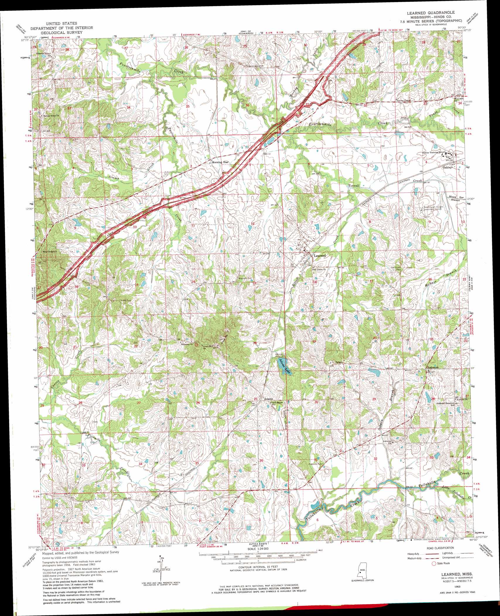
Learned Topo Map Mississippi
To zoom in, hover over the map of Learned
USGS Topo Quad 32090b5 - 1:24,000 scale
| Topo Map Name: | Learned |
| USGS Topo Quad ID: | 32090b5 |
| Print Size: | ca. 21 1/4" wide x 27" high |
| Southeast Coordinates: | 32.125° N latitude / 90.5° W longitude |
| Map Center Coordinates: | 32.1875° N latitude / 90.5625° W longitude |
| U.S. State: | MS |
| Filename: | o32090b5.jpg |
| Download Map JPG Image: | Learned topo map 1:24,000 scale |
| Map Type: | Topographic |
| Topo Series: | 7.5´ |
| Map Scale: | 1:24,000 |
| Source of Map Images: | United States Geological Survey (USGS) |
| Alternate Map Versions: |
Learned MS 1963, updated 1964 Download PDF Buy paper map Learned MS 1963, updated 1976 Download PDF Buy paper map Learned MS 1963, updated 1983 Download PDF Buy paper map Learned MS 2012 Download PDF Buy paper map Learned MS 2015 Download PDF Buy paper map |
1:24,000 Topo Quads surrounding Learned
Redwood |
Oak Ridge |
Queens Hill Lake |
Brownsville |
Pocahontas |
Vicksburg East |
Bovina |
Edwards |
Raymond |
Clinton |
Big Black |
Cayuga |
Learned |
Terry Nw |
New Byram |
Carlisle |
Utica West |
Utica East |
Dabney Crossroads |
Terry |
Hermanville |
Dentville Nw |
Dentville |
Gallman |
Crystal Springs |
> Back to 32090a1 at 1:100,000 scale
> Back to 32090a1 at 1:250,000 scale
> Back to U.S. Topo Maps home
Learned topo map: Gazetteer
Learned: Dams
Adams Lake Dam elevation 74m 242′Brocks Pond Dam elevation 93m 305′
Crawford Pond Dam elevation 68m 223′
Dudley Nobel Pond Dam elevation 67m 219′
Osborns Lake Dam elevation 91m 298′
Learned: Populated Places
Adams elevation 82m 269′Learned elevation 62m 203′
Lebanon elevation 92m 301′
Morning Star elevation 53m 173′
Oakley elevation 60m 196′
Salem elevation 95m 311′
Learned: Reservoirs
Adams Lake elevation 74m 242′Bush Pond elevation 64m 209′
Learned: Ridges
Roach Ridge elevation 89m 291′Learned: Streams
Bitter Creek elevation 50m 164′Hamilton Creek elevation 59m 193′
Little Tallahalla Creek elevation 66m 216′
McNair Branch elevation 59m 193′
Moore Spring Branch elevation 55m 180′
Osburn Branch elevation 63m 206′
Simms Creek elevation 46m 150′
Snake Creek elevation 52m 170′
Terrell Creek elevation 49m 160′
Turkey Creek elevation 46m 150′
Twelvemile Creek elevation 44m 144′
Learned digital topo map on disk
Buy this Learned topo map showing relief, roads, GPS coordinates and other geographical features, as a high-resolution digital map file on DVD: