Tinsley Topo Map Mississippi
To zoom in, hover over the map of Tinsley
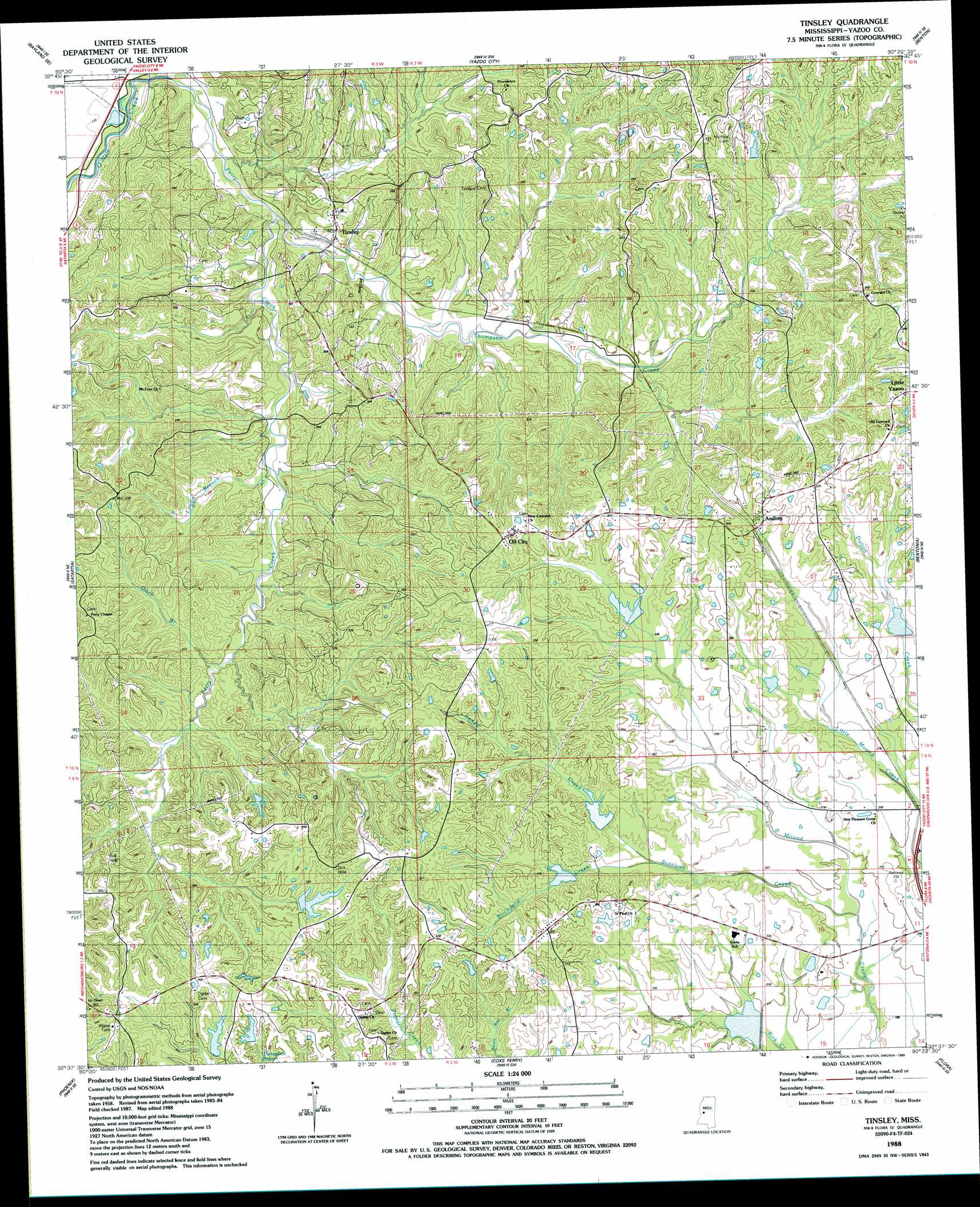
USGS Topo Quad 32090f4 - 1:24,000 scale
| Topo Map Name: | Tinsley |
| USGS Topo Quad ID: | 32090f4 |
| Print Size: | ca. 21 1/4" wide x 27" high |
| Southeast Coordinates: | 32.625° N latitude / 90.375° W longitude |
| Map Center Coordinates: | 32.6875° N latitude / 90.4375° W longitude |
| U.S. State: | MS |
| Filename: | o32090f4.jpg |
| Download Map JPG Image: | Tinsley topo map 1:24,000 scale |
| Map Type: | Topographic |
| Topo Series: | 7.5´ |
| Map Scale: | 1:24,000 |
| Source of Map Images: | United States Geological Survey (USGS) |
| Alternate Map Versions: |
Tinsley MS 1988, updated 1989 Download PDF Buy paper map Tinsley MS 2012 Download PDF Buy paper map Tinsley MS 2015 Download PDF Buy paper map |
1:24,000 Topo Quads surrounding Tinsley
Bayland |
Louise |
Carter |
Eden |
Zeiglerville |
Holly Bluff |
Bayland Se |
Yazoo City |
Benton |
Linwood |
Lucre |
Satartia |
Tinsley |
Bentonia |
Berryville |
Eldorado |
Phoenix |
Coxs Ferry |
Flora |
Charlton |
Oak Ridge |
Queens Hill Lake |
Brownsville |
Pocahontas |
Ridgeland |
> Back to 32090e1 at 1:100,000 scale
> Back to 32090a1 at 1:250,000 scale
> Back to U.S. Topo Maps home
Tinsley topo map: Gazetteer
Tinsley: Dams
Bentonia Watershed Structure 1 Dam elevation 73m 239′Bentonia Watershed Structure 2 Dam elevation 73m 239′
Bentonia Watershed Structure 3 Dam elevation 91m 298′
Bentonia Watershed Structure 4 Dam elevation 69m 226′
Bentonia Watershed Structure 5 Dam elevation 73m 239′
Bentonia Watershed Structure 7 Dam elevation 55m 180′
Bill Link Pond Dam elevation 88m 288′
Ralph Fears Lake Dam elevation 86m 282′
V W Landen Pond Dam elevation 83m 272′
Tinsley: Oilfields
Tinsley Oil Field elevation 91m 298′Tinsley: Populated Places
Anding elevation 86m 282′Chethams (historical) elevation 99m 324′
Oil City elevation 104m 341′
Tinsley elevation 67m 219′
Tinsley: Post Offices
Tinsley Post Office elevation 49m 160′Tinsley: Streams
Brickyard Creek elevation 72m 236′Ditch Branch elevation 57m 187′
Logan Branch elevation 48m 157′
Perry Creek elevation 32m 104′
Sandy Creek elevation 72m 236′
Scotland Creek elevation 55m 180′
Thompson Creek elevation 39m 127′
Tinsley digital topo map on disk
Buy this Tinsley topo map showing relief, roads, GPS coordinates and other geographical features, as a high-resolution digital map file on DVD: