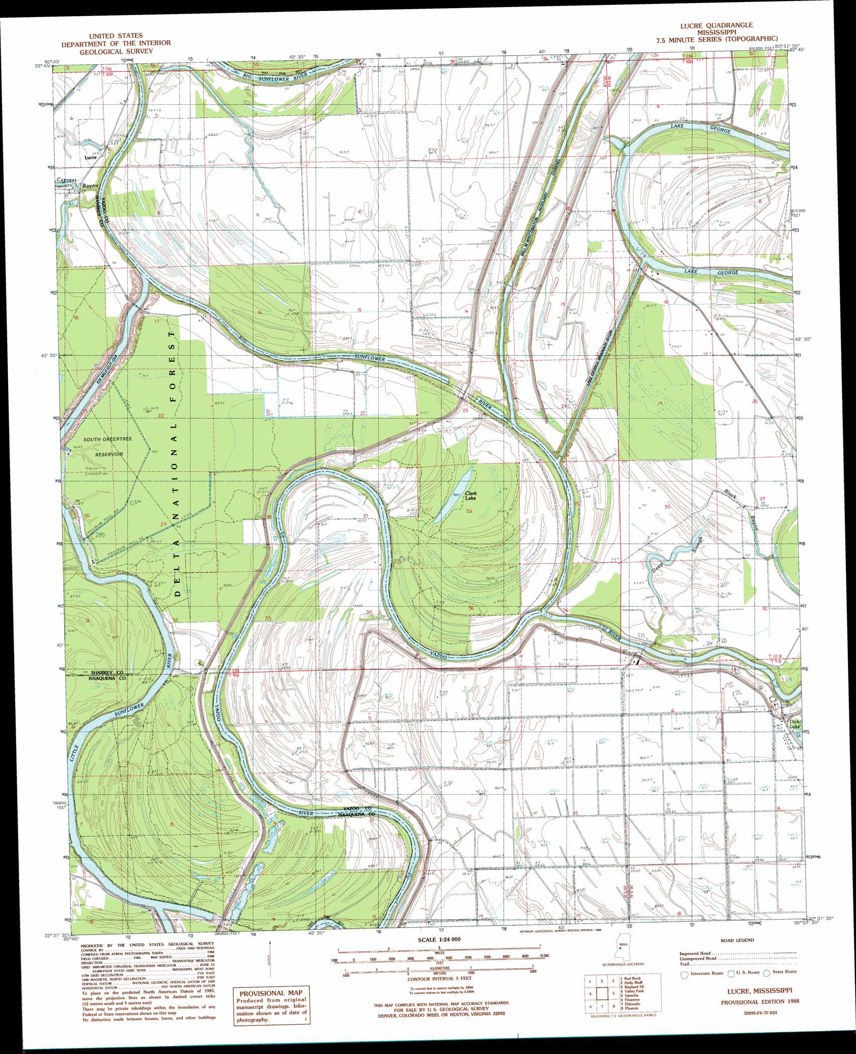
Lucre Topo Map Mississippi
To zoom in, hover over the map of Lucre
USGS Topo Quad 32090f6 - 1:24,000 scale
| Topo Map Name: | Lucre |
| USGS Topo Quad ID: | 32090f6 |
| Print Size: | ca. 21 1/4" wide x 27" high |
| Southeast Coordinates: | 32.625° N latitude / 90.625° W longitude |
| Map Center Coordinates: | 32.6875° N latitude / 90.6875° W longitude |
| U.S. State: | MS |
| Filename: | o32090f6.jpg |
| Download Map JPG Image: | Lucre topo map 1:24,000 scale |
| Map Type: | Topographic |
| Topo Series: | 7.5´ |
| Map Scale: | 1:24,000 |
| Source of Map Images: | United States Geological Survey (USGS) |
| Alternate Map Versions: |
Lucre MS 1988, updated 1988 Download PDF Buy paper map Lucre MS 2000, updated 2002 Download PDF Buy paper map Lucre MS 2012 Download PDF Buy paper map Lucre MS 2015 Download PDF Buy paper map |
| FStopo: | US Forest Service topo Lucre is available: Download FStopo PDF Download FStopo TIF |
1:24,000 Topo Quads surrounding Lucre
Rolling Fork West |
Rolling Fork East |
Bayland |
Louise |
Carter |
Cary |
Red Rock |
Holly Bluff |
Bayland Se |
Yazoo City |
Onward |
Valley Park |
Lucre |
Satartia |
Tinsley |
Cane Bayou |
Floweree |
Eldorado |
Phoenix |
Coxs Ferry |
Long Lake |
Redwood |
Oak Ridge |
Queens Hill Lake |
Brownsville |
> Back to 32090e1 at 1:100,000 scale
> Back to 32090a1 at 1:250,000 scale
> Back to U.S. Topo Maps home
Lucre topo map: Gazetteer
Lucre: Canals
Lake George Drainage Ditch elevation 25m 82′Lucre: Guts
Black Bayou elevation 24m 78′Deep Slough elevation 28m 91′
Six Mile Cut-Off elevation 20m 65′
Lucre: Lakes
Clark Lake elevation 27m 88′Lucre: Levees
Yazoo Backwater Levee elevation 32m 104′Lucre: Populated Places
Fairview Landing elevation 29m 95′Harworth elevation 28m 91′
Lucre: Reservoirs
South Greentree Reservoir elevation 27m 88′Lucre: Streams
Big Sunflower River elevation 22m 72′Cypress Bayou elevation 21m 68′
Little Sunflower River elevation 20m 65′
Lucre digital topo map on disk
Buy this Lucre topo map showing relief, roads, GPS coordinates and other geographical features, as a high-resolution digital map file on DVD: