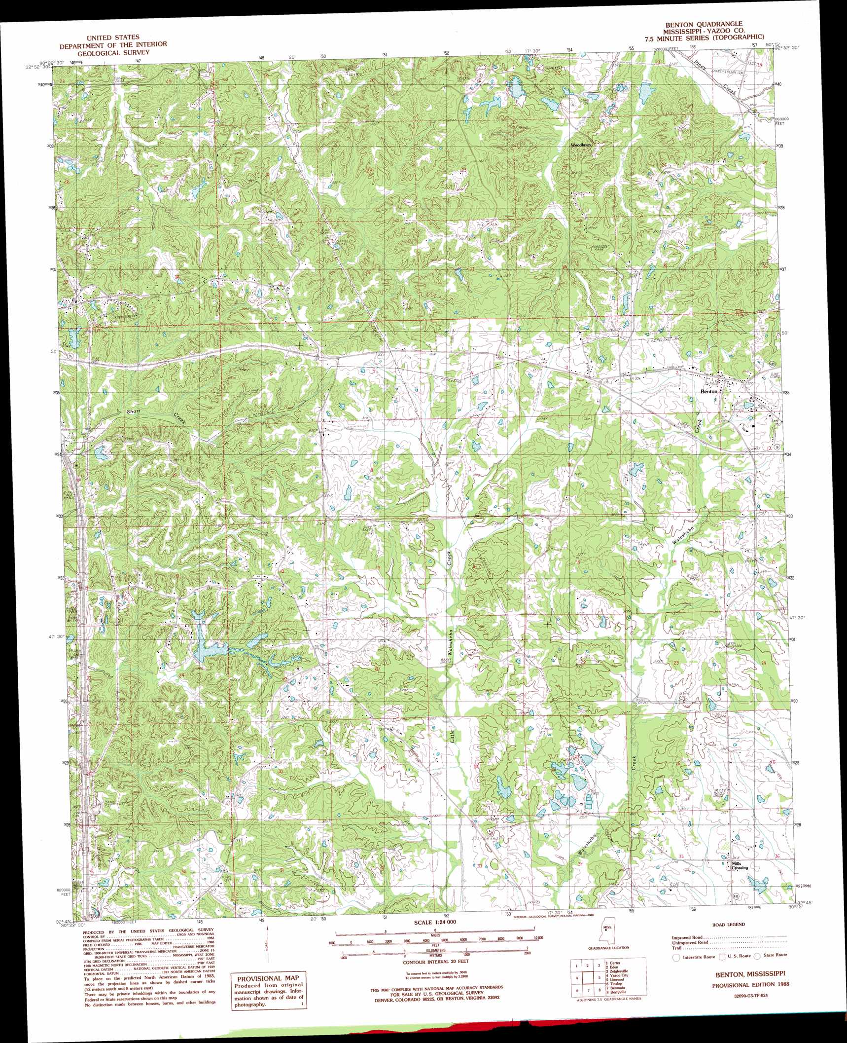
Benton Topo Map Mississippi
To zoom in, hover over the map of Benton
USGS Topo Quad 32090g3 - 1:24,000 scale
| Topo Map Name: | Benton |
| USGS Topo Quad ID: | 32090g3 |
| Print Size: | ca. 21 1/4" wide x 27" high |
| Southeast Coordinates: | 32.75° N latitude / 90.25° W longitude |
| Map Center Coordinates: | 32.8125° N latitude / 90.3125° W longitude |
| U.S. State: | MS |
| Filename: | o32090g3.jpg |
| Download Map JPG Image: | Benton topo map 1:24,000 scale |
| Map Type: | Topographic |
| Topo Series: | 7.5´ |
| Map Scale: | 1:24,000 |
| Source of Map Images: | United States Geological Survey (USGS) |
| Alternate Map Versions: |
Benton MS 1988, updated 1988 Download PDF Buy paper map Benton MS 2012 Download PDF Buy paper map Benton MS 2015 Download PDF Buy paper map |
1:24,000 Topo Quads surrounding Benton
Midnight |
Silver City |
Thornton |
Howard |
Lexington South |
Louise |
Carter |
Eden |
Zeiglerville |
Ebenezer |
Bayland Se |
Yazoo City |
Benton |
Linwood |
Vaughan |
Satartia |
Tinsley |
Bentonia |
Berryville |
Way |
Phoenix |
Coxs Ferry |
Flora |
Charlton |
Canton |
> Back to 32090e1 at 1:100,000 scale
> Back to 32090a1 at 1:250,000 scale
> Back to U.S. Topo Maps home
Benton topo map: Gazetteer
Benton: Dams
Anderson Catfish Pond Dam elevation 103m 337′Anderson Lake Dam elevation 77m 252′
Forest Park Club Lake Dam elevation 75m 246′
Fouche Lake Dam elevation 82m 269′
Lear Lake Dam elevation 63m 206′
McGraw Lake Dam elevation 76m 249′
Piney Creek Watershed Y-38-26 Dam elevation 64m 209′
Williams Lake Dam elevation 108m 354′
Benton: Populated Places
Benton elevation 104m 341′Bethesda (historical) elevation 107m 351′
Cedar Hill (historical) elevation 91m 298′
Hilton (historical) elevation 105m 344′
Roadside elevation 104m 341′
Woodlawn elevation 98m 321′
Benton digital topo map on disk
Buy this Benton topo map showing relief, roads, GPS coordinates and other geographical features, as a high-resolution digital map file on DVD: