Rolling Fork West Topo Map Mississippi
To zoom in, hover over the map of Rolling Fork West
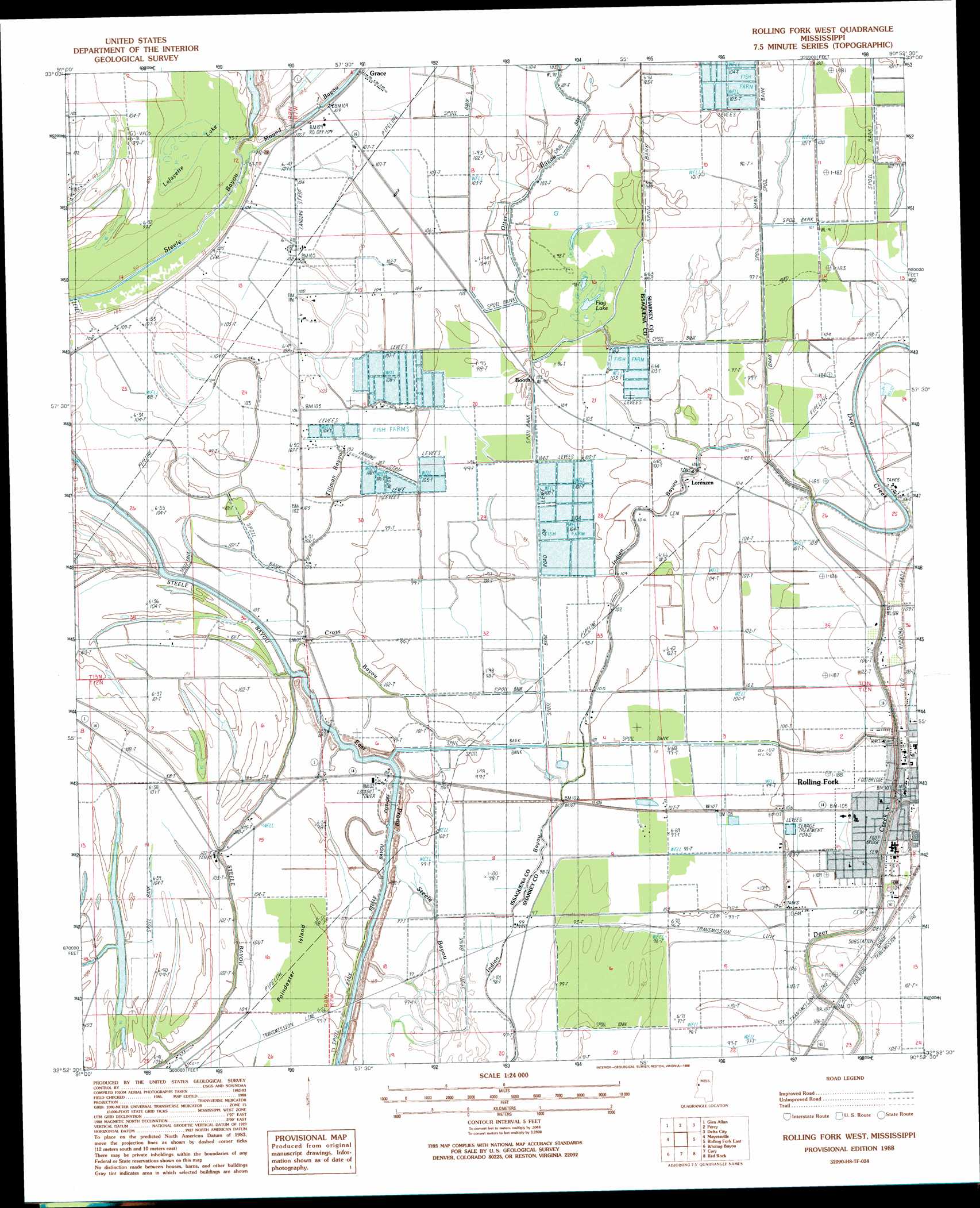
USGS Topo Quad 32090h8 - 1:24,000 scale
| Topo Map Name: | Rolling Fork West |
| USGS Topo Quad ID: | 32090h8 |
| Print Size: | ca. 21 1/4" wide x 27" high |
| Southeast Coordinates: | 32.875° N latitude / 90.875° W longitude |
| Map Center Coordinates: | 32.9375° N latitude / 90.9375° W longitude |
| U.S. State: | MS |
| Filename: | o32090h8.jpg |
| Download Map JPG Image: | Rolling Fork West topo map 1:24,000 scale |
| Map Type: | Topographic |
| Topo Series: | 7.5´ |
| Map Scale: | 1:24,000 |
| Source of Map Images: | United States Geological Survey (USGS) |
| Alternate Map Versions: |
Rolling Fork West MS 1988, updated 1988 Download PDF Buy paper map Rolling Fork West MS 2012 Download PDF Buy paper map Rolling Fork West MS 2015 Download PDF Buy paper map |
1:24,000 Topo Quads surrounding Rolling Fork West
Eminence |
Avon |
Swan Lake Nw |
Hollandale |
Midnight Nw |
Readland |
Glen Allan |
Percy |
Delta City |
Richey |
Millikin |
Mayersville |
Rolling Fork West |
Rolling Fork East |
Bayland |
Lake Providence |
Whiting Bayou |
Cary |
Red Rock |
Holly Bluff |
Transylvania |
Fitler |
Onward |
Valley Park |
Lucre |
> Back to 32090e1 at 1:100,000 scale
> Back to 32090a1 at 1:250,000 scale
> Back to U.S. Topo Maps home
Rolling Fork West topo map: Gazetteer
Rolling Fork West: Airports
Eagle Airport elevation 32m 104′Rolling Fork West: Canals
Steele Bayou Cutoff elevation 30m 98′Rolling Fork West: Dams
Sam Harris Catfish Ponds Dam elevation 29m 95′Rolling Fork West: Guts
Gross Bayou elevation 30m 98′Rolling Fork West: Islands
Poindexter Island elevation 28m 91′Rolling Fork West: Parks
Indian Bayou State Wildlife Area elevation 28m 91′Rolling Fork West: Populated Places
Booth elevation 32m 104′Grace elevation 29m 95′
Lorenzen elevation 33m 108′
Rolling Fork elevation 32m 104′
Rolling Fork West: Streams
Mound Bayou elevation 27m 88′Otter Bayou elevation 29m 95′
Tillman Bayou elevation 26m 85′
Rolling Fork West: Swamps
Flag Lake elevation 29m 95′Lafayette Lake elevation 29m 95′
Rolling Fork West digital topo map on disk
Buy this Rolling Fork West topo map showing relief, roads, GPS coordinates and other geographical features, as a high-resolution digital map file on DVD: