Westwood Topo Map Louisiana
To zoom in, hover over the map of Westwood
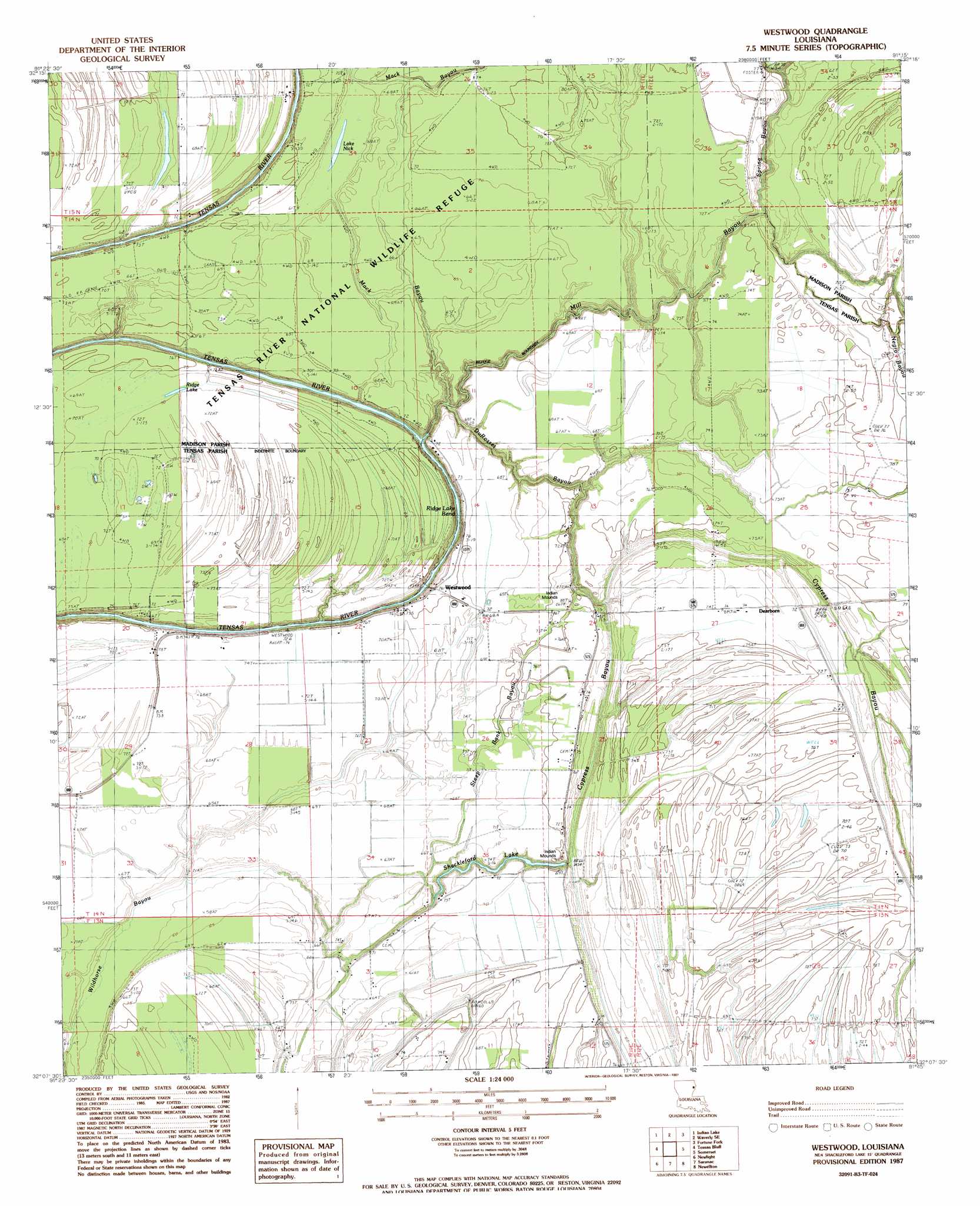
USGS Topo Quad 32091b3 - 1:24,000 scale
| Topo Map Name: | Westwood |
| USGS Topo Quad ID: | 32091b3 |
| Print Size: | ca. 21 1/4" wide x 27" high |
| Southeast Coordinates: | 32.125° N latitude / 91.25° W longitude |
| Map Center Coordinates: | 32.1875° N latitude / 91.3125° W longitude |
| U.S. State: | LA |
| Filename: | o32091b3.jpg |
| Download Map JPG Image: | Westwood topo map 1:24,000 scale |
| Map Type: | Topographic |
| Topo Series: | 7.5´ |
| Map Scale: | 1:24,000 |
| Source of Map Images: | United States Geological Survey (USGS) |
| Alternate Map Versions: |
Westwood LA 1987, updated 1987 Download PDF Buy paper map Westwood LA 1998, updated 2003 Download PDF Buy paper map Westwood LA 2012 Download PDF Buy paper map Westwood LA 2015 Download PDF Buy paper map |
1:24,000 Topo Quads surrounding Westwood
Dunn |
Africa Lake |
Tendal |
Tallulah |
Ashly |
Lamar |
Indian Lake |
Waverly Se |
Fortune Fork |
Mound |
Crowville |
Tensas Bluff |
Westwood |
Somerset |
Bedford |
Como |
Newlight |
Saranac |
Newellton |
Grand Gulf |
Oakley |
Gretna Green |
Lake Bruin |
Saint Joseph |
Widows Creek |
> Back to 32091a1 at 1:100,000 scale
> Back to 32090a1 at 1:250,000 scale
> Back to U.S. Topo Maps home
Westwood topo map: Gazetteer
Westwood: Areas
The Glade elevation 20m 65′Westwood: Bends
Ridge Lake Bend elevation 21m 68′Westwood: Guts
Cypress Bayou elevation 17m 55′Du Rosset Bayou elevation 14m 45′
Mill Bayou elevation 20m 65′
Steep Bank Bayou elevation 23m 75′
Wildhorse Bayou elevation 20m 65′
Westwood: Lakes
Lake Nick elevation 18m 59′Ridge Lake elevation 21m 68′
Shackleford Lake elevation 17m 55′
Westwood: Populated Places
Dearborn elevation 22m 72′Westwood elevation 17m 55′
Wildcat elevation 21m 68′
Westwood: Ridges
Newells Ridge elevation 22m 72′Westwood digital topo map on disk
Buy this Westwood topo map showing relief, roads, GPS coordinates and other geographical features, as a high-resolution digital map file on DVD: