Liddieville Topo Map Louisiana
To zoom in, hover over the map of Liddieville
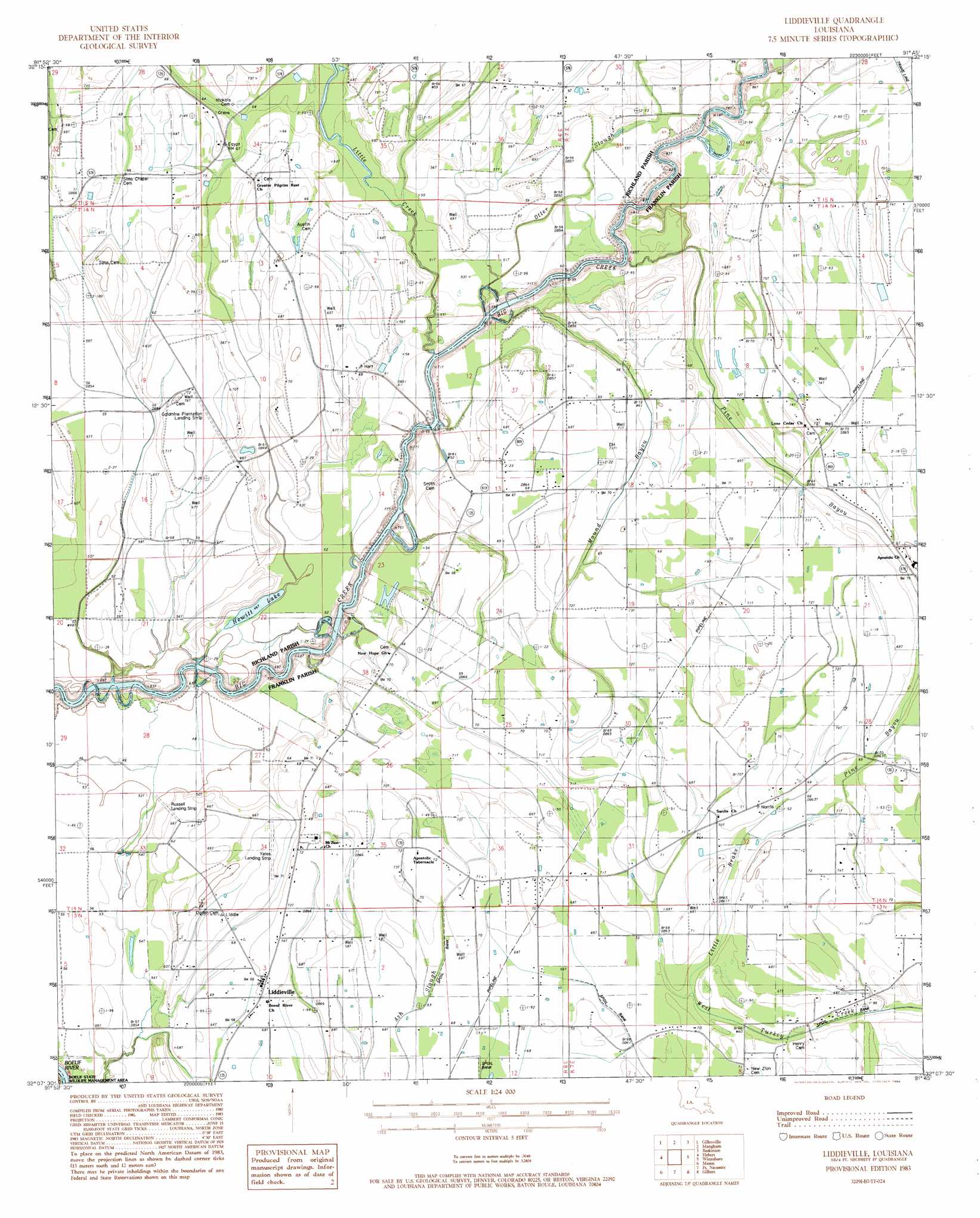
USGS Topo Quad 32091b7 - 1:24,000 scale
| Topo Map Name: | Liddieville |
| USGS Topo Quad ID: | 32091b7 |
| Print Size: | ca. 21 1/4" wide x 27" high |
| Southeast Coordinates: | 32.125° N latitude / 91.75° W longitude |
| Map Center Coordinates: | 32.1875° N latitude / 91.8125° W longitude |
| U.S. State: | LA |
| Filename: | o32091b7.jpg |
| Download Map JPG Image: | Liddieville topo map 1:24,000 scale |
| Map Type: | Topographic |
| Topo Series: | 7.5´ |
| Map Scale: | 1:24,000 |
| Source of Map Images: | United States Geological Survey (USGS) |
| Alternate Map Versions: |
Liddieville LA 1983, updated 1984 Download PDF Buy paper map Liddieville LA 2012 Download PDF Buy paper map Liddieville LA 2015 Download PDF Buy paper map |
1:24,000 Topo Quads surrounding Liddieville
Monroe South |
Crew Lake |
Rayville |
Bee Bayou |
Dunn |
Bosco |
Gilleyville |
Mangham |
Baskinton |
Lamar |
Riverton |
Hebert |
Liddieville |
Winnsboro |
Crowville |
Columbia |
Mason |
Fort Necessity |
Gilbert |
Como |
Holum |
Enterprise |
Extension |
Wisner |
Oakley |
> Back to 32091a1 at 1:100,000 scale
> Back to 32090a1 at 1:250,000 scale
> Back to U.S. Topo Maps home
Liddieville topo map: Gazetteer
Liddieville: Airports
Goldmine Plantation Landing Strip elevation 21m 68′Liddieville Airport elevation 22m 72′
Russell Airport elevation 18m 59′
Yates Landing Strip elevation 22m 72′
Liddieville: Guts
Mound Bayou elevation 20m 65′Liddieville: Lakes
Hewitt Lake elevation 14m 45′Liddieville: Populated Places
Liddieville elevation 21m 68′Liddieville: Streams
Little Brake elevation 19m 62′Little Creek elevation 14m 45′
Pine Bayou elevation 14m 45′
Pine Bayou elevation 17m 55′
Liddieville digital topo map on disk
Buy this Liddieville topo map showing relief, roads, GPS coordinates and other geographical features, as a high-resolution digital map file on DVD: