Tallulah Topo Map Louisiana
To zoom in, hover over the map of Tallulah
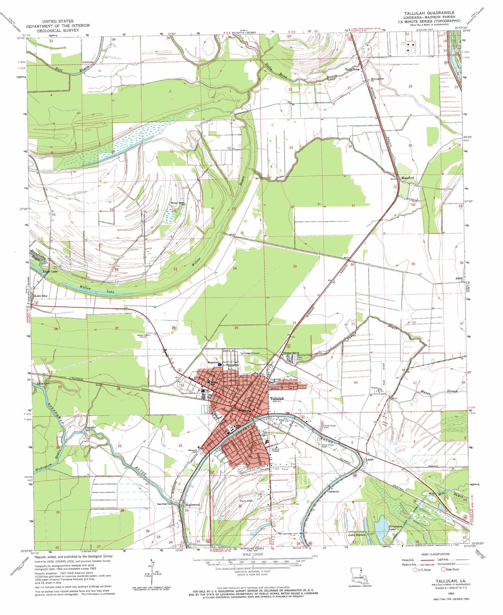
USGS Topo Quad 32091d2 - 1:24,000 scale
| Topo Map Name: | Tallulah |
| USGS Topo Quad ID: | 32091d2 |
| Print Size: | ca. 21 1/4" wide x 27" high |
| Southeast Coordinates: | 32.375° N latitude / 91.125° W longitude |
| Map Center Coordinates: | 32.4375° N latitude / 91.1875° W longitude |
| U.S. State: | LA |
| Filename: | o32091d2.jpg |
| Download Map JPG Image: | Tallulah topo map 1:24,000 scale |
| Map Type: | Topographic |
| Topo Series: | 7.5´ |
| Map Scale: | 1:24,000 |
| Source of Map Images: | United States Geological Survey (USGS) |
| Alternate Map Versions: |
Tallulah LA 1909 Download PDF Buy paper map Tallulah LA 1963, updated 1964 Download PDF Buy paper map Tallulah LA 1994, updated 1997 Download PDF Buy paper map Tallulah LA 2012 Download PDF Buy paper map Tallulah LA 2015 Download PDF Buy paper map |
1:24,000 Topo Quads surrounding Tallulah
Pioneer |
Caraway Lake |
Transylvania |
Fitler |
Onward |
Epps |
Panther Lake |
Sondheimer |
Eagle Bend |
Cane Bayou |
Africa Lake |
Tendal |
Tallulah |
Ashly |
Long Lake |
Indian Lake |
Waverly Se |
Fortune Fork |
Mound |
Vicksburg West |
Tensas Bluff |
Westwood |
Somerset |
Bedford |
Yokena |
> Back to 32091a1 at 1:100,000 scale
> Back to 32090a1 at 1:250,000 scale
> Back to U.S. Topo Maps home
Tallulah topo map: Gazetteer
Tallulah: Airports
Marlin Airport elevation 23m 75′Scott Airport elevation 25m 82′
Tallulah: Canals
Grassy Lake Canal elevation 23m 75′Tallulah: Crossings
Interchange 171 elevation 25m 82′Tallulah: Guts
Talla Bena Bayou elevation 22m 72′Tallulah: Lakes
Eagle Lake elevation 18m 59′Lake One elevation 22m 72′
Willow Lake elevation 19m 62′
Tallulah: Populated Places
Englewood elevation 24m 78′Lums elevation 25m 82′
Mansford elevation 26m 85′
Richmond elevation 23m 75′
Talla Bena elevation 26m 85′
Tallulah elevation 26m 85′
Tallulah: Streams
Brushy Bayou elevation 24m 78′Macon Slough elevation 26m 85′
Panola Bayou elevation 20m 65′
Willow Bayou elevation 19m 62′
Tallulah digital topo map on disk
Buy this Tallulah topo map showing relief, roads, GPS coordinates and other geographical features, as a high-resolution digital map file on DVD: