Tendal Topo Map Louisiana
To zoom in, hover over the map of Tendal
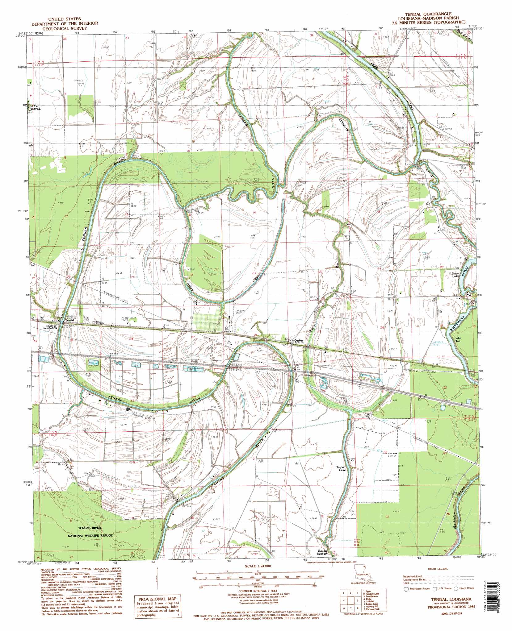
USGS Topo Quad 32091d3 - 1:24,000 scale
| Topo Map Name: | Tendal |
| USGS Topo Quad ID: | 32091d3 |
| Print Size: | ca. 21 1/4" wide x 27" high |
| Southeast Coordinates: | 32.375° N latitude / 91.25° W longitude |
| Map Center Coordinates: | 32.4375° N latitude / 91.3125° W longitude |
| U.S. State: | LA |
| Filename: | o32091d3.jpg |
| Download Map JPG Image: | Tendal topo map 1:24,000 scale |
| Map Type: | Topographic |
| Topo Series: | 7.5´ |
| Map Scale: | 1:24,000 |
| Source of Map Images: | United States Geological Survey (USGS) |
| Alternate Map Versions: |
Tendal LA 1986, updated 1987 Download PDF Buy paper map Tendal LA 1986, updated 1987 Download PDF Buy paper map Tendal LA 2012 Download PDF Buy paper map Tendal LA 2015 Download PDF Buy paper map |
1:24,000 Topo Quads surrounding Tendal
Bear Skin |
Pioneer |
Caraway Lake |
Transylvania |
Fitler |
Congo Creek |
Epps |
Panther Lake |
Sondheimer |
Eagle Bend |
Dunn |
Africa Lake |
Tendal |
Tallulah |
Ashly |
Lamar |
Indian Lake |
Waverly Se |
Fortune Fork |
Mound |
Crowville |
Tensas Bluff |
Westwood |
Somerset |
Bedford |
> Back to 32091a1 at 1:100,000 scale
> Back to 32090a1 at 1:250,000 scale
> Back to U.S. Topo Maps home
Tendal topo map: Gazetteer
Tendal: Airports
4B Ranch Airport elevation 24m 78′Tendal: Lakes
Bear Lake elevation 21m 68′Despair Lake elevation 24m 78′
Tendal: Populated Places
Quebec elevation 24m 78′Tendal elevation 20m 65′
Tendal: Streams
Bayou Despair elevation 23m 75′Island Chute elevation 22m 72′
Tensas Bayou elevation 24m 78′
Tendal digital topo map on disk
Buy this Tendal topo map showing relief, roads, GPS coordinates and other geographical features, as a high-resolution digital map file on DVD: