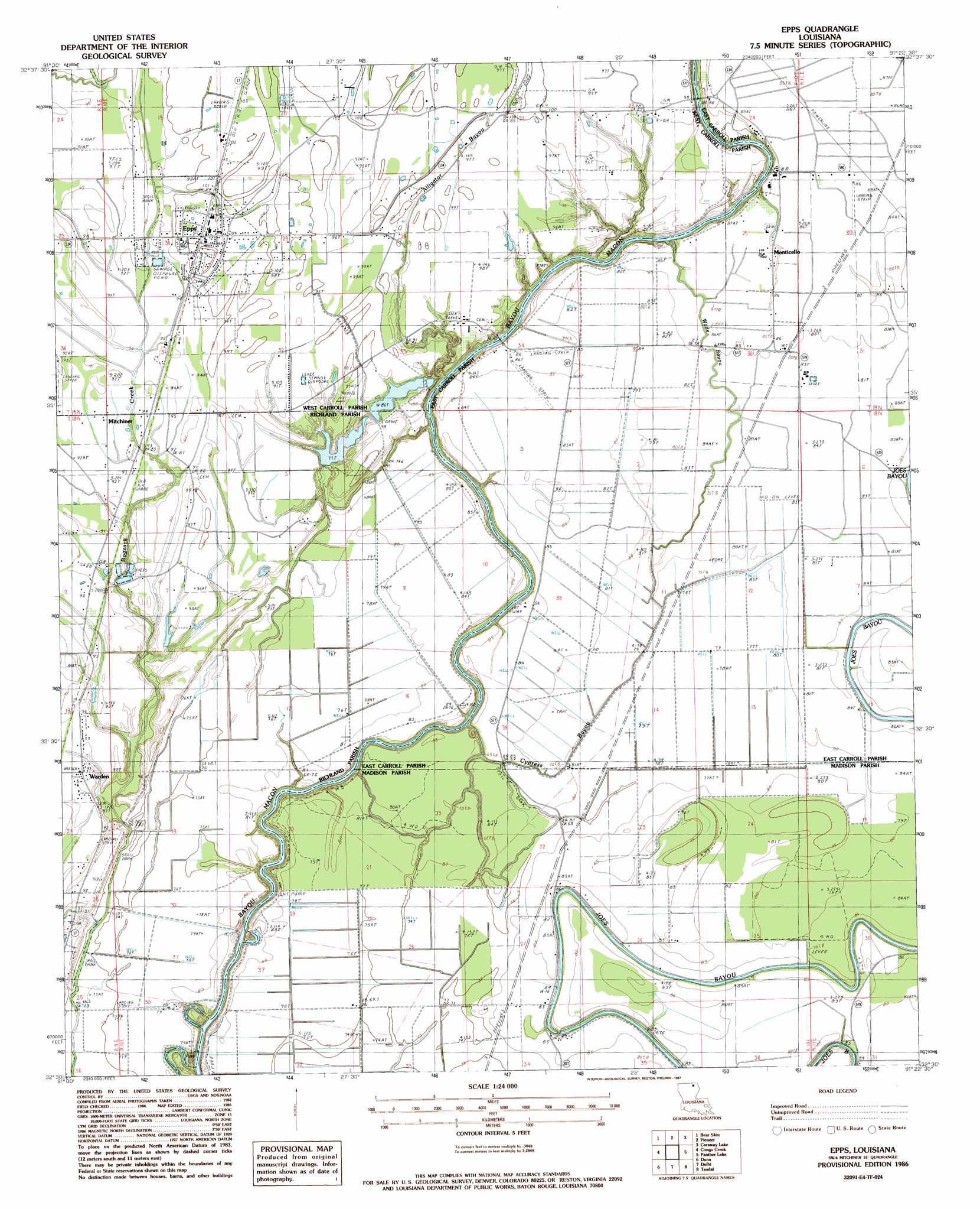
Epps Topo Map Louisiana
To zoom in, hover over the map of Epps
USGS Topo Quad 32091e4 - 1:24,000 scale
| Topo Map Name: | Epps |
| USGS Topo Quad ID: | 32091e4 |
| Print Size: | ca. 21 1/4" wide x 27" high |
| Southeast Coordinates: | 32.5° N latitude / 91.375° W longitude |
| Map Center Coordinates: | 32.5625° N latitude / 91.4375° W longitude |
| U.S. State: | LA |
| Filename: | o32091e4.jpg |
| Download Map JPG Image: | Epps topo map 1:24,000 scale |
| Map Type: | Topographic |
| Topo Series: | 7.5´ |
| Map Scale: | 1:24,000 |
| Source of Map Images: | United States Geological Survey (USGS) |
| Alternate Map Versions: |
Epps LA 1986, updated 1987 Download PDF Buy paper map Epps LA 2012 Download PDF Buy paper map Epps LA 2015 Download PDF Buy paper map |
1:24,000 Topo Quads surrounding Epps
Bonita Sw |
Goodwill |
Oak Grove |
Baxter Bayou |
Lake Providence |
Whitney Island North |
Bear Skin |
Pioneer |
Caraway Lake |
Transylvania |
Whitney Island South |
Congo Creek |
Epps |
Panther Lake |
Sondheimer |
Bee Bayou |
Dunn |
Africa Lake |
Tendal |
Tallulah |
Baskinton |
Lamar |
Indian Lake |
Waverly Se |
Fortune Fork |
> Back to 32091e1 at 1:100,000 scale
> Back to 32090a1 at 1:250,000 scale
> Back to U.S. Topo Maps home
Epps topo map: Gazetteer
Epps: Crossings
Epps Ferry (historical) elevation 18m 59′Epps: Dams
Epps Lodge Lake Dam elevation 27m 88′Murphys Lake West End Dam elevation 25m 82′
Epps: Guts
Cypress Bayou elevation 23m 75′Wade Bayou elevation 24m 78′
Epps: Populated Places
Epps elevation 30m 98′Mitchiner elevation 28m 91′
Monticello elevation 26m 85′
Warden elevation 27m 88′
Epps: Post Offices
Warden Post Office elevation 27m 88′Epps: Streams
Bogzack Creek elevation 27m 88′Epps digital topo map on disk
Buy this Epps topo map showing relief, roads, GPS coordinates and other geographical features, as a high-resolution digital map file on DVD: