Caraway Lake Topo Map Louisiana
To zoom in, hover over the map of Caraway Lake
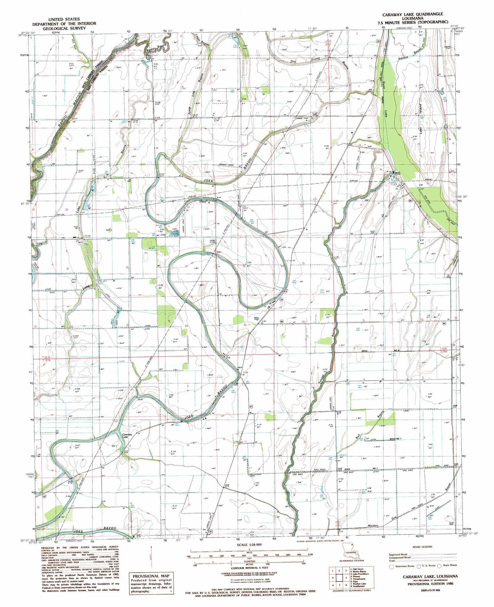
USGS Topo Quad 32091f3 - 1:24,000 scale
| Topo Map Name: | Caraway Lake |
| USGS Topo Quad ID: | 32091f3 |
| Print Size: | ca. 21 1/4" wide x 27" high |
| Southeast Coordinates: | 32.625° N latitude / 91.25° W longitude |
| Map Center Coordinates: | 32.6875° N latitude / 91.3125° W longitude |
| U.S. State: | LA |
| Filename: | o32091f3.jpg |
| Download Map JPG Image: | Caraway Lake topo map 1:24,000 scale |
| Map Type: | Topographic |
| Topo Series: | 7.5´ |
| Map Scale: | 1:24,000 |
| Source of Map Images: | United States Geological Survey (USGS) |
| Alternate Map Versions: |
Caraway Lake LA 1986, updated 1987 Download PDF Buy paper map Caraway Lake LA 2012 Download PDF Buy paper map Caraway Lake LA 2015 Download PDF Buy paper map |
1:24,000 Topo Quads surrounding Caraway Lake
Laark |
Fiske |
Kilbourne |
Millikin |
Mayersville |
Goodwill |
Oak Grove |
Baxter Bayou |
Lake Providence |
Whiting Bayou |
Bear Skin |
Pioneer |
Caraway Lake |
Transylvania |
Fitler |
Congo Creek |
Epps |
Panther Lake |
Sondheimer |
Eagle Bend |
Dunn |
Africa Lake |
Tendal |
Tallulah |
Ashly |
> Back to 32091e1 at 1:100,000 scale
> Back to 32090a1 at 1:250,000 scale
> Back to U.S. Topo Maps home
Caraway Lake topo map: Gazetteer
Caraway Lake: Canals
Tensas Ditch elevation 22m 72′Caraway Lake: Guts
Bull Bayou elevation 24m 78′Jump Log Bayou elevation 24m 78′
Caraway Lake: Islands
Lost Island elevation 28m 91′Caraway Lake: Lakes
Caraway Lake elevation 23m 75′Swan Lake elevation 22m 72′
Caraway Lake: Streams
Baxter Bayou elevation 19m 62′Dry Prong Bayou elevation 24m 78′
Caraway Lake digital topo map on disk
Buy this Caraway Lake topo map showing relief, roads, GPS coordinates and other geographical features, as a high-resolution digital map file on DVD: