Mayersville Topo Map Mississippi
To zoom in, hover over the map of Mayersville
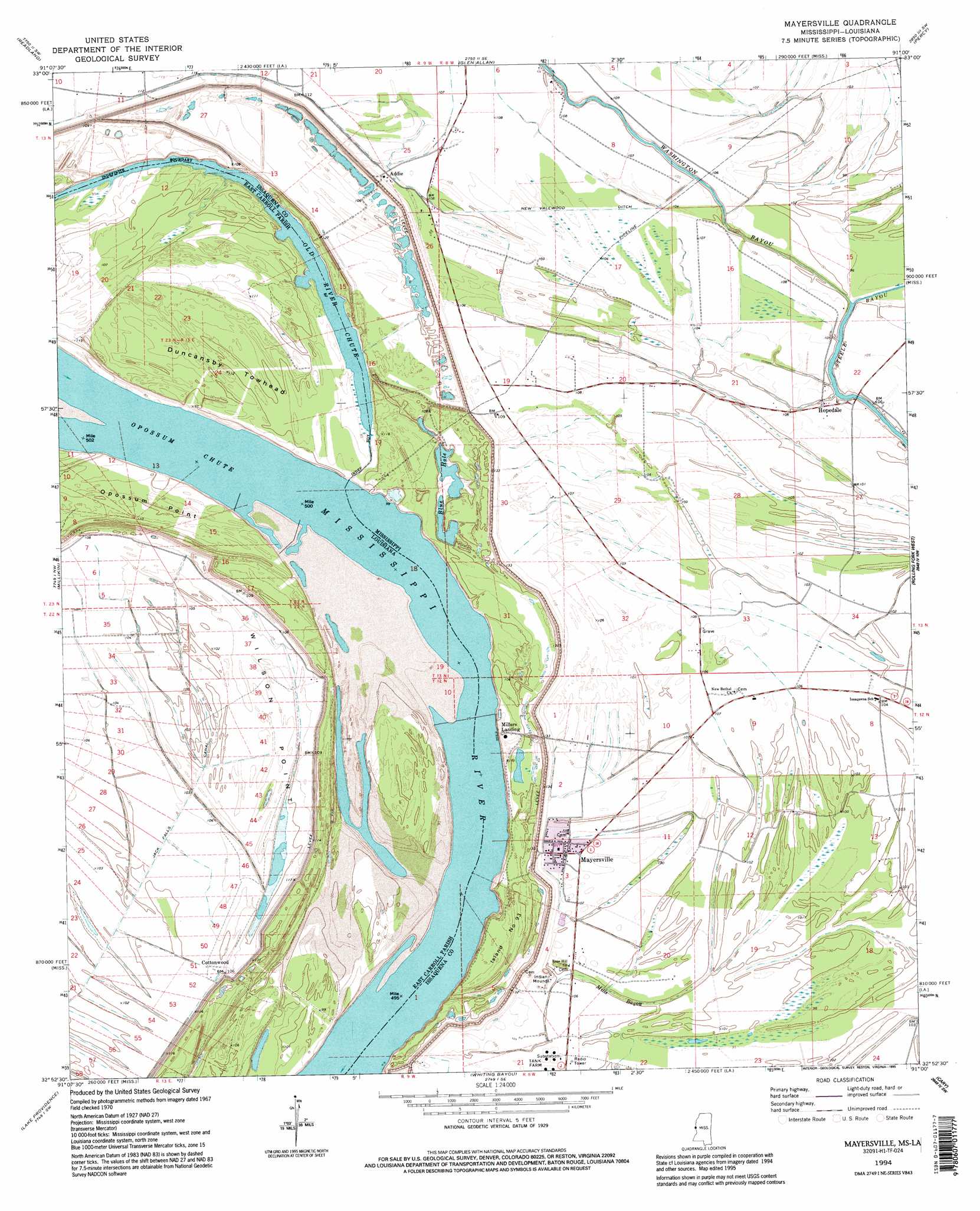
USGS Topo Quad 32091h1 - 1:24,000 scale
| Topo Map Name: | Mayersville |
| USGS Topo Quad ID: | 32091h1 |
| Print Size: | ca. 21 1/4" wide x 27" high |
| Southeast Coordinates: | 32.875° N latitude / 91° W longitude |
| Map Center Coordinates: | 32.9375° N latitude / 91.0625° W longitude |
| U.S. States: | MS, LA |
| Filename: | o32091h1.jpg |
| Download Map JPG Image: | Mayersville topo map 1:24,000 scale |
| Map Type: | Topographic |
| Topo Series: | 7.5´ |
| Map Scale: | 1:24,000 |
| Source of Map Images: | United States Geological Survey (USGS) |
| Alternate Map Versions: |
Wilsons Point MS 1909 Download PDF Buy paper map Wilson Point MS 1909, updated 1961 Download PDF Buy paper map Mayersville MS 1970, updated 1972 Download PDF Buy paper map Mayersville MS 1970, updated 1986 Download PDF Buy paper map Mayersville MS 1970, updated 1986 Download PDF Buy paper map Mayersville MS 1994, updated 1995 Download PDF Buy paper map Mayersville MS 2012 Download PDF Buy paper map Mayersville MS 2015 Download PDF Buy paper map |
1:24,000 Topo Quads surrounding Mayersville
Eudora North |
Eminence |
Avon |
Swan Lake Nw |
Hollandale |
Eudora South |
Readland |
Glen Allan |
Percy |
Delta City |
Kilbourne |
Millikin |
Mayersville |
Rolling Fork West |
Rolling Fork East |
Baxter Bayou |
Lake Providence |
Whiting Bayou |
Cary |
Red Rock |
Caraway Lake |
Transylvania |
Fitler |
Onward |
Valley Park |
> Back to 32091e1 at 1:100,000 scale
> Back to 32090a1 at 1:250,000 scale
> Back to U.S. Topo Maps home
Mayersville topo map: Gazetteer
Mayersville: Areas
Island Number Ninetythree elevation 35m 114′Mayersville: Canals
New Valewood Ditch elevation 30m 98′Mayersville: Capes
Wilson Point elevation 33m 108′Mayersville: Channels
Opossum Chute elevation 24m 78′Mayersville: Crossings
Lakeside Ferry (historical) elevation 28m 91′Mayersville: Guts
Mills Bayou elevation 29m 95′Old River Chute elevation 25m 82′
Mayersville: Islands
Duncansby Towhead elevation 33m 108′Mayersville: Lakes
Blue Hole elevation 26m 85′Old River Chute elevation 25m 82′
Wilson Point Lake (historical) elevation 30m 98′
Mayersville: Populated Places
Addie elevation 32m 104′Ashland elevation 31m 101′
Cottonwood elevation 32m 104′
Hopedale elevation 33m 108′
Mayersville elevation 32m 104′
Millers Landing elevation 32m 104′
Wilson Point (historical) elevation 34m 111′
Mayersville: Streams
Washington Bayou elevation 27m 88′Mayersville digital topo map on disk
Buy this Mayersville topo map showing relief, roads, GPS coordinates and other geographical features, as a high-resolution digital map file on DVD: