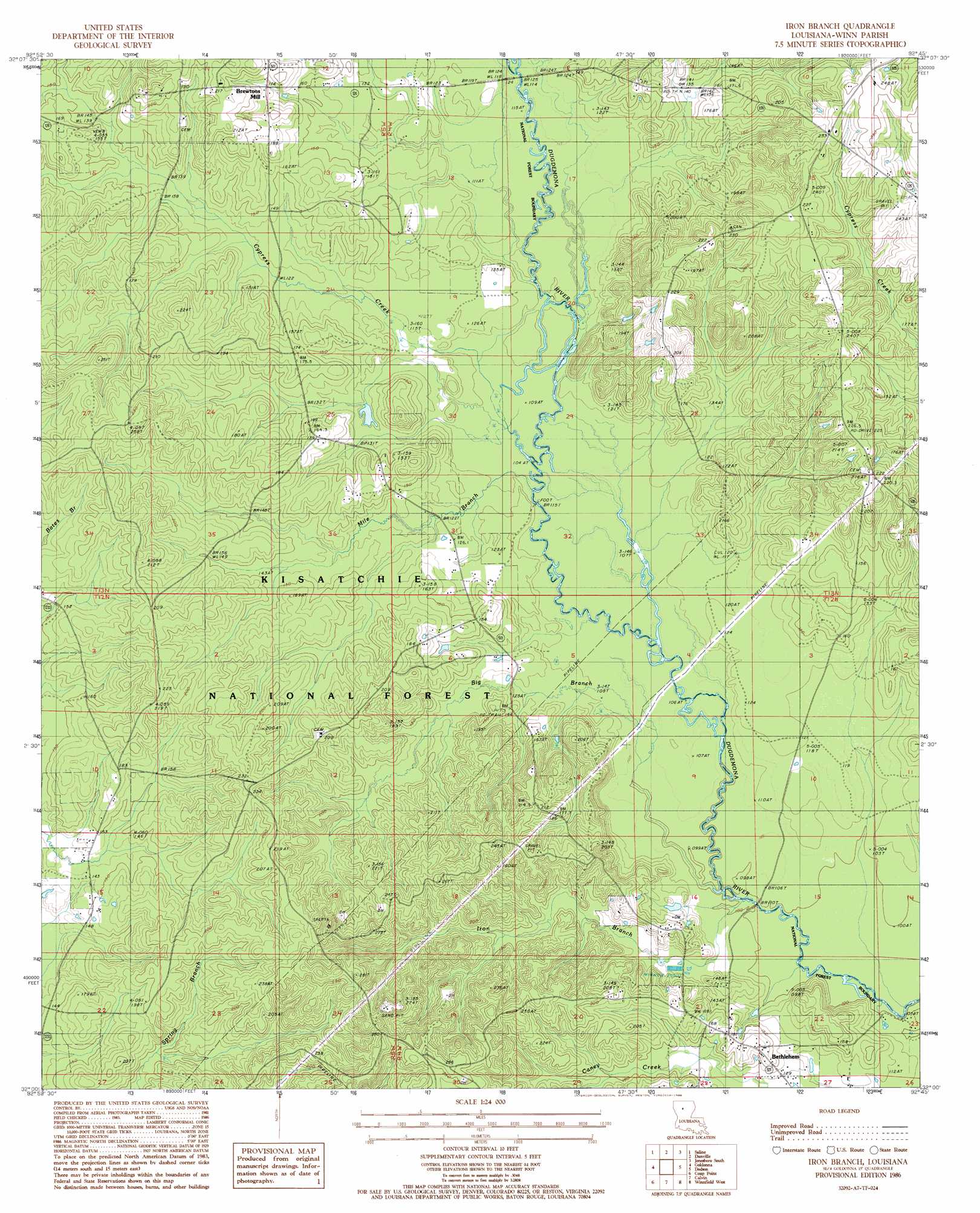
Iron Branch Topo Map Louisiana
To zoom in, hover over the map of Iron Branch
USGS Topo Quad 32092a7 - 1:24,000 scale
| Topo Map Name: | Iron Branch |
| USGS Topo Quad ID: | 32092a7 |
| Print Size: | ca. 21 1/4" wide x 27" high |
| Southeast Coordinates: | 32° N latitude / 92.75° W longitude |
| Map Center Coordinates: | 32.0625° N latitude / 92.8125° W longitude |
| U.S. State: | LA |
| Filename: | o32092a7.jpg |
| Download Map JPG Image: | Iron Branch topo map 1:24,000 scale |
| Map Type: | Topographic |
| Topo Series: | 7.5´ |
| Map Scale: | 1:24,000 |
| Source of Map Images: | United States Geological Survey (USGS) |
| Alternate Map Versions: |
Iron Branch LA 1986, updated 1986 Download PDF Buy paper map Iron Branch LA 2003, updated 2005 Download PDF Buy paper map Iron Branch LA 2012 Download PDF Buy paper map Iron Branch LA 2015 Download PDF Buy paper map |
| FStopo: | US Forest Service topo Iron Branch is available: Download FStopo PDF Download FStopo TIF |
1:24,000 Topo Quads surrounding Iron Branch
Sparta |
Bienville |
Mount Olive |
Jonesboro North |
Curr Creek |
Ashland |
Saline |
Danville |
Jonesboro South |
Weston |
Chestnut |
Goldonna |
Iron Branch |
Dodson |
Hudson |
Campti |
Coup Point |
Calvin |
Winnfield West |
Winnfield East |
Natchitoches North |
Saint Maurice |
Coochie Brake |
Atlanta |
Packton |
> Back to 32092a1 at 1:100,000 scale
> Back to 32092a1 at 1:250,000 scale
> Back to U.S. Topo Maps home
Iron Branch topo map: Gazetteer
Iron Branch: Oilfields
Calvin Gas Field elevation 40m 131′Iron Branch: Populated Places
Bethlehem elevation 53m 173′Brewtons Mill elevation 53m 173′
Crockett (historical) elevation 50m 164′
Mill elevation 54m 177′
Mulberry Hill (historical) elevation 61m 200′
Iron Branch: Streams
Big Branch elevation 30m 98′Cypress Creek elevation 32m 104′
Iron Branch elevation 30m 98′
Lick Creek elevation 34m 111′
Mile Branch elevation 32m 104′
Iron Branch digital topo map on disk
Buy this Iron Branch topo map showing relief, roads, GPS coordinates and other geographical features, as a high-resolution digital map file on DVD: