Chatham Topo Map Louisiana
To zoom in, hover over the map of Chatham
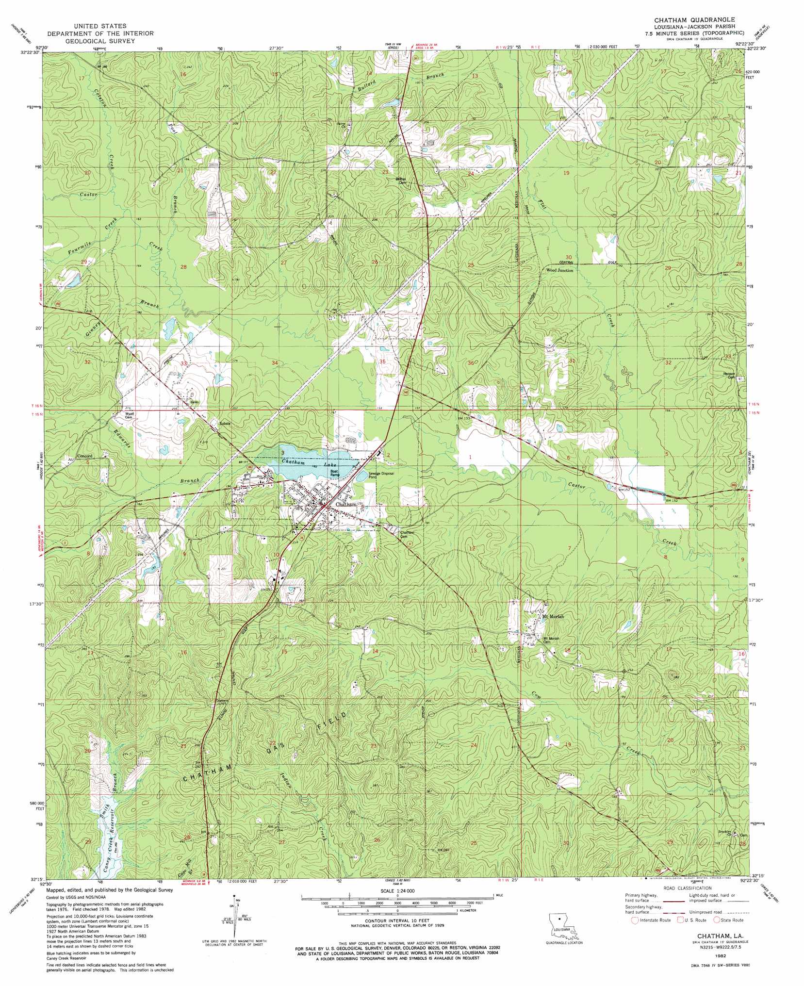
USGS Topo Quad 32092c4 - 1:24,000 scale
| Topo Map Name: | Chatham |
| USGS Topo Quad ID: | 32092c4 |
| Print Size: | ca. 21 1/4" wide x 27" high |
| Southeast Coordinates: | 32.25° N latitude / 92.375° W longitude |
| Map Center Coordinates: | 32.3125° N latitude / 92.4375° W longitude |
| U.S. State: | LA |
| Filename: | o32092c4.jpg |
| Download Map JPG Image: | Chatham topo map 1:24,000 scale |
| Map Type: | Topographic |
| Topo Series: | 7.5´ |
| Map Scale: | 1:24,000 |
| Source of Map Images: | United States Geological Survey (USGS) |
| Alternate Map Versions: |
Chatham LA 1982, updated 1982 Download PDF Buy paper map Chatham LA 2012 Download PDF Buy paper map Chatham LA 2015 Download PDF Buy paper map |
1:24,000 Topo Quads surrounding Chatham
Ruston West |
Ruston East |
Downsville South |
Calhoun |
West Monroe North |
Clay |
Vernon |
Eros |
Cadeville |
West Monroe South |
Jonesboro North |
Curr Creek |
Chatham |
Chatham Se |
Luna |
Jonesboro South |
Weston |
Womack |
Vixen |
Blankston |
Dodson |
Hudson |
Sikes |
Cotton Plant |
Clark |
> Back to 32092a1 at 1:100,000 scale
> Back to 32092a1 at 1:250,000 scale
> Back to U.S. Topo Maps home
Chatham topo map: Gazetteer
Chatham: Dams
Chatham Lake Dam elevation 49m 160′Chatham: Oilfields
Chatham Gas Field elevation 66m 216′Chatham: Populated Places
Brooklyn (historical) elevation 49m 160′Chatham elevation 55m 180′
Concord elevation 68m 223′
Dalley (historical) elevation 65m 213′
Mount Moriah elevation 70m 229′
Nash (historical) elevation 70m 229′
Wood Junction elevation 52m 170′
Chatham: Post Offices
Chatham Post Office elevation 55m 180′Chatham: Reservoirs
Chatham Lake elevation 49m 160′Chatham: Streams
Bullard Branch elevation 50m 164′Colston Creek elevation 51m 167′
Edwards Branch elevation 45m 147′
Flat Creek elevation 43m 141′
Fourmile Creek elevation 51m 167′
Ginney Branch elevation 49m 160′
Pool Branch elevation 49m 160′
Smith Branch elevation 60m 196′
Chatham digital topo map on disk
Buy this Chatham topo map showing relief, roads, GPS coordinates and other geographical features, as a high-resolution digital map file on DVD: