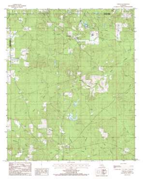
Vernon Topo Map Louisiana
To zoom in, hover over the map of Vernon
USGS Topo Quad 32092d5 - 1:24,000 scale
| Topo Map Name: | Vernon |
| USGS Topo Quad ID: | 32092d5 |
| Print Size: | ca. 21 1/4" wide x 27" high |
| Southeast Coordinates: | 32.375° N latitude / 92.5° W longitude |
| Map Center Coordinates: | 32.4375° N latitude / 92.5625° W longitude |
| U.S. State: | LA |
| Filename: | o32092d5.jpg |
| Download Map JPG Image: | Vernon topo map 1:24,000 scale |
| Map Type: | Topographic |
| Topo Series: | 7.5´ |
| Map Scale: | 1:24,000 |
| Source of Map Images: | United States Geological Survey (USGS) |
| Alternate Map Versions: |
Vernon LA 1985, updated 1986 Download PDF Buy paper map Vernon LA 2012 Download PDF Buy paper map Vernon LA 2015 Download PDF Buy paper map |
1:24,000 Topo Quads surrounding Vernon
> Back to 32092a1 at 1:100,000 scale
> Back to 32092a1 at 1:250,000 scale
> Back to U.S. Topo Maps home
Vernon topo map: Gazetteer
Vernon: Dams
Kelly Pond Dam elevation 73m 239′Vernon: Lakes
Lamkin Pond elevation 70m 229′Vernon: Oilfields
Kelleys Gas Field elevation 71m 232′Vernon Gas Field elevation 71m 232′
Vernon: Populated Places
Ebenzer elevation 90m 295′Kelleys elevation 65m 213′
Longstraw elevation 77m 252′
Mount Zion (historical) elevation 93m 305′
Oak Ridge elevation 75m 246′
Vernon elevation 79m 259′
Vernon: Streams
Chunk Creek elevation 50m 164′Colon Creek elevation 64m 209′
Guice Branch elevation 57m 187′
Kelleys Creek elevation 52m 170′
McDowell Branch elevation 61m 200′
Mill Creek elevation 50m 164′
Sandy Creek elevation 42m 137′
Shaw Creek elevation 44m 144′
Stud Horse Creek elevation 58m 190′
Washington Branch elevation 63m 206′
Vernon: Summits
Buckenham Hill elevation 82m 269′Vernon digital topo map on disk
Buy this Vernon topo map showing relief, roads, GPS coordinates and other geographical features, as a high-resolution digital map file on DVD:


