Cedarton Topo Map Louisiana
To zoom in, hover over the map of Cedarton
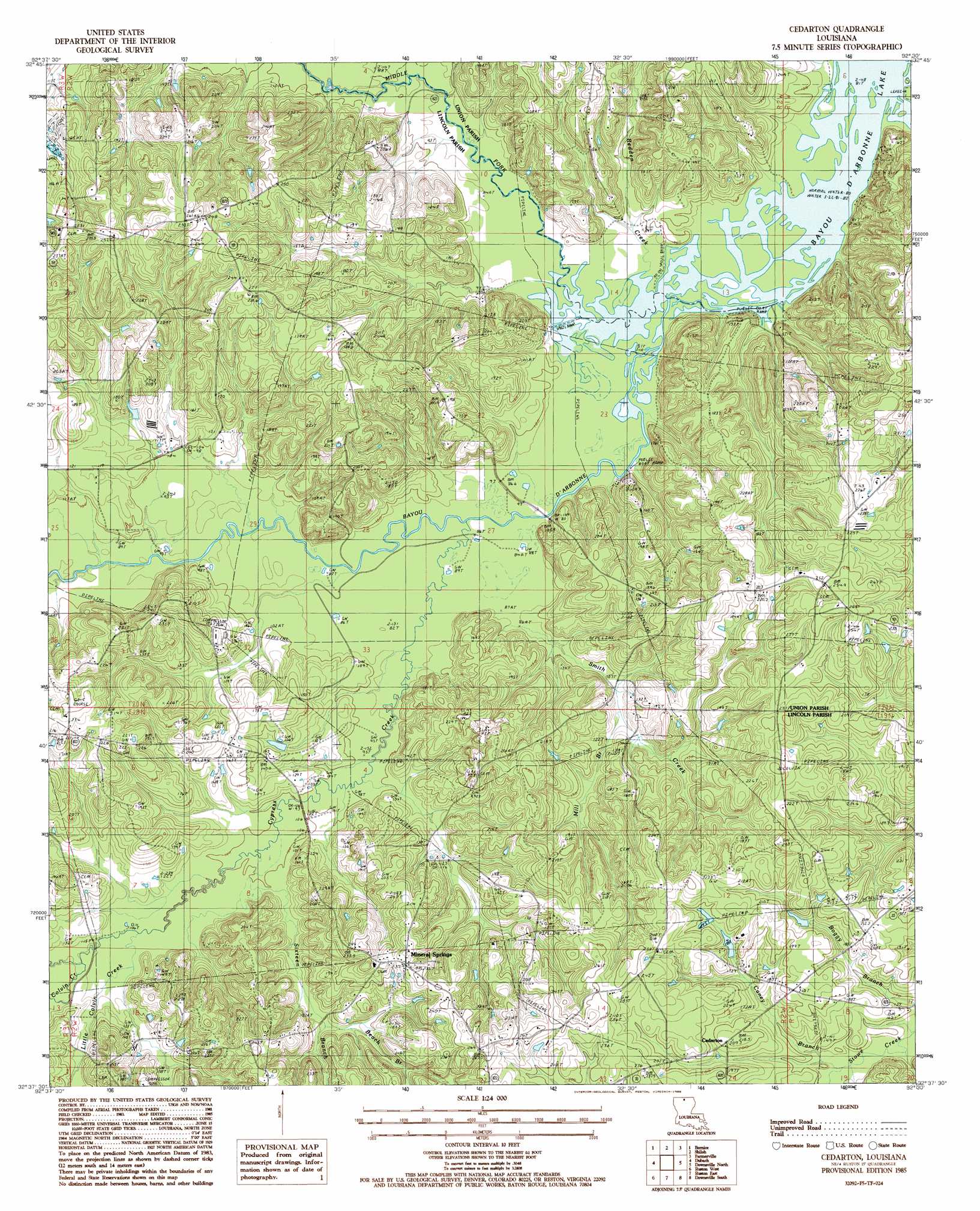
USGS Topo Quad 32092f5 - 1:24,000 scale
| Topo Map Name: | Cedarton |
| USGS Topo Quad ID: | 32092f5 |
| Print Size: | ca. 21 1/4" wide x 27" high |
| Southeast Coordinates: | 32.625° N latitude / 92.5° W longitude |
| Map Center Coordinates: | 32.6875° N latitude / 92.5625° W longitude |
| U.S. State: | LA |
| Filename: | o32092f5.jpg |
| Download Map JPG Image: | Cedarton topo map 1:24,000 scale |
| Map Type: | Topographic |
| Topo Series: | 7.5´ |
| Map Scale: | 1:24,000 |
| Source of Map Images: | United States Geological Survey (USGS) |
| Alternate Map Versions: |
Cedarton LA 1985, updated 1986 Download PDF Buy paper map Cedarton LA 2012 Download PDF Buy paper map Cedarton LA 2015 Download PDF Buy paper map |
1:24,000 Topo Quads surrounding Cedarton
Summerfield |
Lillie |
Spearsville |
Truxno |
Marion West |
Lisbon |
Bernice |
Shiloh |
Farmerville |
De Loutre |
Lake Foursome |
Dubach |
Cedarton |
Downsville North |
Point |
Simsboro |
Ruston West |
Ruston East |
Downsville South |
Calhoun |
Wilson Creek |
Clay |
Vernon |
Eros |
Cadeville |
> Back to 32092e1 at 1:100,000 scale
> Back to 32092a1 at 1:250,000 scale
> Back to U.S. Topo Maps home
Cedarton topo map: Gazetteer
Cedarton: Oilfields
Unionville Gas Field elevation 42m 137′Cedarton: Populated Places
Cedarton elevation 63m 206′Culbertson elevation 77m 252′
Gills Ferry elevation 28m 91′
Mineral Springs elevation 72m 236′
Rock Corner elevation 72m 236′
Cedarton: Streams
Andy Branch elevation 27m 88′Basin Branch elevation 24m 78′
Beach Branch elevation 40m 131′
Caney Branch elevation 41m 134′
Colvin Creek elevation 34m 111′
Cypress Creek elevation 25m 82′
Little Colvin Creek elevation 33m 108′
Middle Fork Bayou D'Arbonne elevation 24m 78′
Mill Branch elevation 33m 108′
Redden Creek elevation 24m 78′
Sixteen Branch elevation 30m 98′
Smith Creek elevation 25m 82′
Cedarton digital topo map on disk
Buy this Cedarton topo map showing relief, roads, GPS coordinates and other geographical features, as a high-resolution digital map file on DVD: