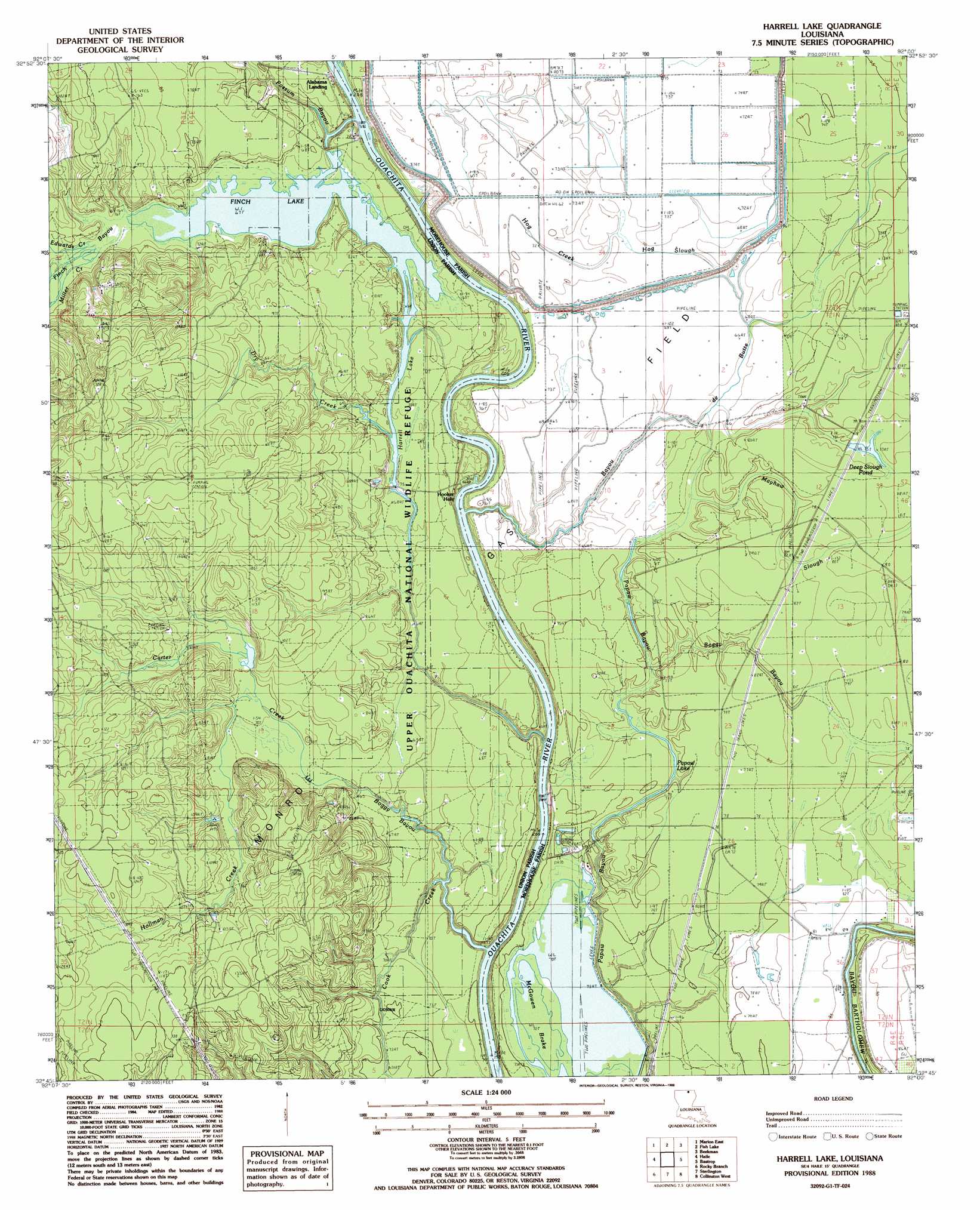
Harrell Lake Topo Map Louisiana
To zoom in, hover over the map of Harrell Lake
USGS Topo Quad 32092g1 - 1:24,000 scale
| Topo Map Name: | Harrell Lake |
| USGS Topo Quad ID: | 32092g1 |
| Print Size: | ca. 21 1/4" wide x 27" high |
| Southeast Coordinates: | 32.75° N latitude / 92° W longitude |
| Map Center Coordinates: | 32.8125° N latitude / 92.0625° W longitude |
| U.S. State: | LA |
| Filename: | o32092g1.jpg |
| Download Map JPG Image: | Harrell Lake topo map 1:24,000 scale |
| Map Type: | Topographic |
| Topo Series: | 7.5´ |
| Map Scale: | 1:24,000 |
| Source of Map Images: | United States Geological Survey (USGS) |
| Alternate Map Versions: |
Harrell Lake LA 1988, updated 1988 Download PDF Buy paper map Harrell Lake LA 2012 Download PDF Buy paper map Harrell Lake LA 2015 Download PDF Buy paper map |
1:24,000 Topo Quads surrounding Harrell Lake
Strong |
Huttig |
Felsenthal Dam |
Crossett South |
Berlin |
Marion West |
Marion East |
Fish Lake |
Beckman |
Twin Oaks |
De Loutre |
Haille |
Harrell Lake |
Bastrop |
Mer Rouge |
Point |
Rocky Branch |
Sterlington |
Collinston West |
Collinston East |
Calhoun |
West Monroe North |
Monroe North |
Swartz |
Irwin Lake |
> Back to 32092e1 at 1:100,000 scale
> Back to 32092a1 at 1:250,000 scale
> Back to U.S. Topo Maps home
Harrell Lake topo map: Gazetteer
Harrell Lake: Lakes
Finch Lake elevation 20m 65′Harrell Lake elevation 21m 68′
Papaw Lake elevation 21m 68′
Harrell Lake: Populated Places
Alabama Landing elevation 22m 72′Hooker Hole elevation 22m 72′
Harrell Lake: Reservoirs
Deep Slough Pond elevation 23m 75′Harrell Lake: Streams
Bayou de Butte elevation 17m 55′Boggy Bayou elevation 17m 55′
Boggy Bayou elevation 21m 68′
Carter Creek elevation 21m 68′
Cook Creek elevation 16m 52′
Dry Creek elevation 21m 68′
Edwards Creek elevation 21m 68′
Finch Bayou elevation 17m 55′
Haile Creek elevation 21m 68′
Hog Creek elevation 22m 72′
Hog Slough elevation 19m 62′
Hollman Creek elevation 20m 65′
Joe Edwards Creek elevation 28m 91′
Little Hog Slough elevation 19m 62′
Mayhaw Slough elevation 21m 68′
Miller Creek elevation 21m 68′
Possum Bayou elevation 17m 55′
Harrell Lake: Swamps
McGowen Brake elevation 21m 68′Harrell Lake digital topo map on disk
Buy this Harrell Lake topo map showing relief, roads, GPS coordinates and other geographical features, as a high-resolution digital map file on DVD: