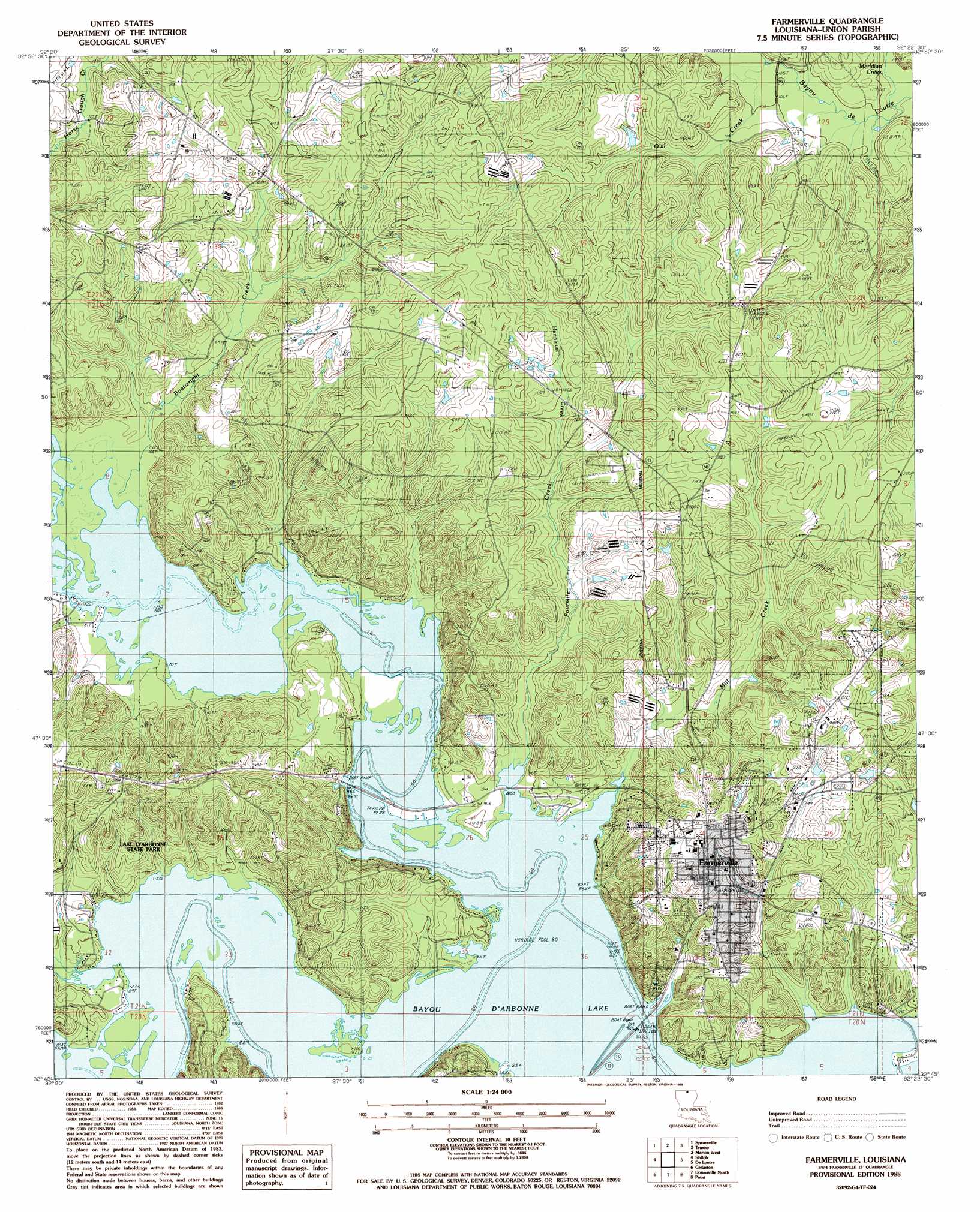
Farmerville Topo Map Louisiana
To zoom in, hover over the map of Farmerville
USGS Topo Quad 32092g4 - 1:24,000 scale
| Topo Map Name: | Farmerville |
| USGS Topo Quad ID: | 32092g4 |
| Print Size: | ca. 21 1/4" wide x 27" high |
| Southeast Coordinates: | 32.75° N latitude / 92.375° W longitude |
| Map Center Coordinates: | 32.8125° N latitude / 92.4375° W longitude |
| U.S. State: | LA |
| Filename: | o32092g4.jpg |
| Download Map JPG Image: | Farmerville topo map 1:24,000 scale |
| Map Type: | Topographic |
| Topo Series: | 7.5´ |
| Map Scale: | 1:24,000 |
| Source of Map Images: | United States Geological Survey (USGS) |
| Alternate Map Versions: |
Farmerville LA 1988, updated 1988 Download PDF Buy paper map Farmerville LA 2012 Download PDF Buy paper map Farmerville LA 2015 Download PDF Buy paper map |
1:24,000 Topo Quads surrounding Farmerville
Junction City |
Lockhart |
Gardner |
Strong |
Huttig |
Lillie |
Spearsville |
Truxno |
Marion West |
Marion East |
Bernice |
Shiloh |
Farmerville |
De Loutre |
Haille |
Dubach |
Cedarton |
Downsville North |
Point |
Rocky Branch |
Ruston West |
Ruston East |
Downsville South |
Calhoun |
West Monroe North |
> Back to 32092e1 at 1:100,000 scale
> Back to 32092a1 at 1:250,000 scale
> Back to U.S. Topo Maps home
Farmerville topo map: Gazetteer
Farmerville: Oilfields
Corney Bayou Oil Field elevation 61m 200′Ora Oil Field elevation 41m 134′
Farmerville: Parks
Lake D'Arbonne State Park elevation 31m 101′Farmerville: Populated Places
Farmerville elevation 52m 170′Farmerville: Post Offices
Farmerville Post Office elevation 50m 164′Farmerville: Streams
Boatwright Creek elevation 24m 78′Corney Bayou elevation 24m 78′
Cornie Bayou elevation 24m 78′
Edmonds Creek elevation 24m 78′
Fourmile Creek elevation 24m 78′
Hunnicutt Creek elevation 39m 127′
Meridian Creek elevation 29m 95′
Mill Creek elevation 24m 78′
Owl Creek elevation 29m 95′
Farmerville digital topo map on disk
Buy this Farmerville topo map showing relief, roads, GPS coordinates and other geographical features, as a high-resolution digital map file on DVD: