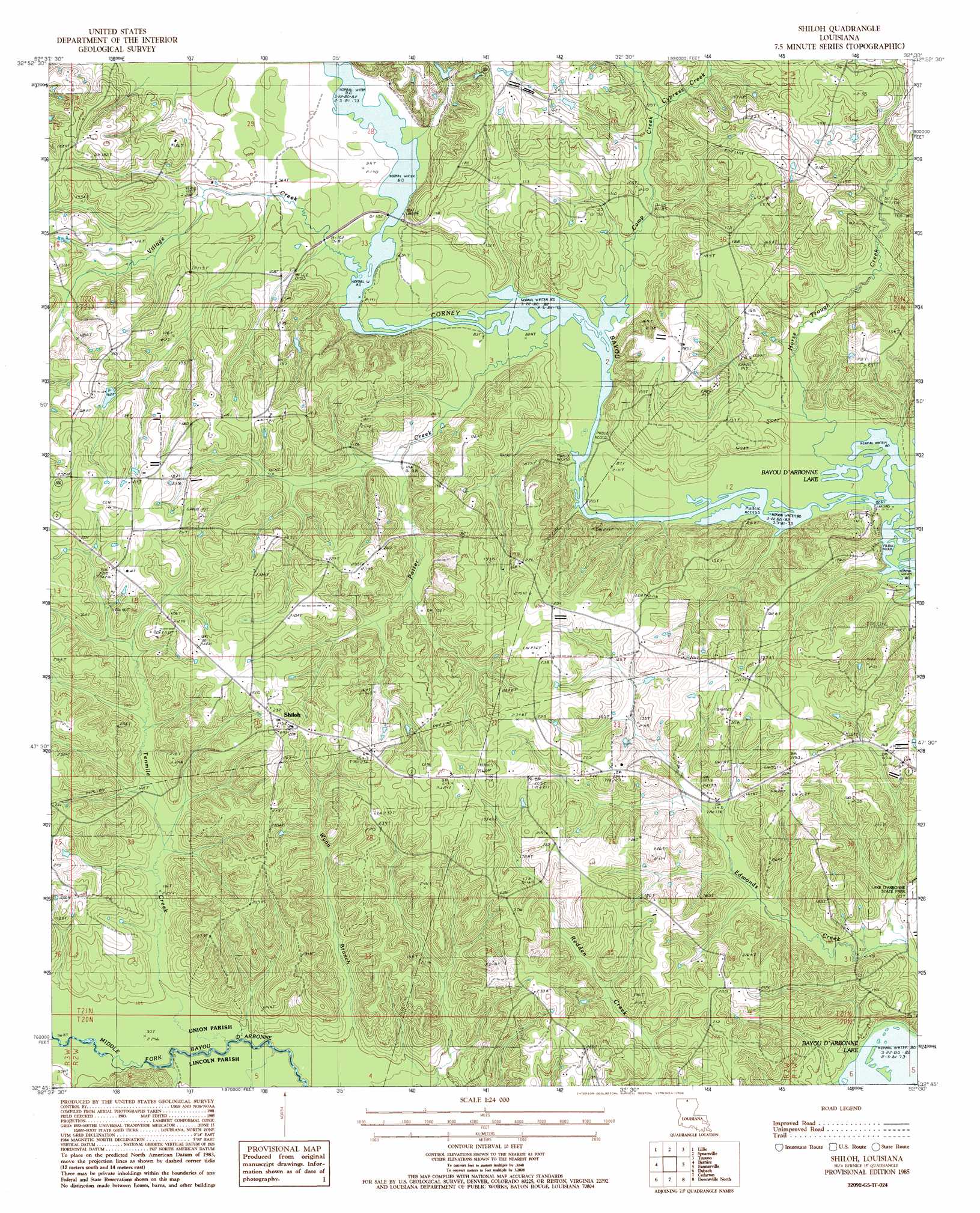
Shiloh Topo Map Louisiana
To zoom in, hover over the map of Shiloh
USGS Topo Quad 32092g5 - 1:24,000 scale
| Topo Map Name: | Shiloh |
| USGS Topo Quad ID: | 32092g5 |
| Print Size: | ca. 21 1/4" wide x 27" high |
| Southeast Coordinates: | 32.75° N latitude / 92.5° W longitude |
| Map Center Coordinates: | 32.8125° N latitude / 92.5625° W longitude |
| U.S. State: | LA |
| Filename: | o32092g5.jpg |
| Download Map JPG Image: | Shiloh topo map 1:24,000 scale |
| Map Type: | Topographic |
| Topo Series: | 7.5´ |
| Map Scale: | 1:24,000 |
| Source of Map Images: | United States Geological Survey (USGS) |
| Alternate Map Versions: |
Shiloh LA 1985, updated 1986 Download PDF Buy paper map Shiloh LA 2012 Download PDF Buy paper map Shiloh LA 2015 Download PDF Buy paper map |
1:24,000 Topo Quads surrounding Shiloh
Wesson |
Junction City |
Lockhart |
Gardner |
Strong |
Summerfield |
Lillie |
Spearsville |
Truxno |
Marion West |
Lisbon |
Bernice |
Shiloh |
Farmerville |
De Loutre |
Lake Foursome |
Dubach |
Cedarton |
Downsville North |
Point |
Simsboro |
Ruston West |
Ruston East |
Downsville South |
Calhoun |
> Back to 32092e1 at 1:100,000 scale
> Back to 32092a1 at 1:250,000 scale
> Back to U.S. Topo Maps home
Shiloh topo map: Gazetteer
Shiloh: Crossings
Lowrys Ferry (historical) elevation 25m 82′Shiloh: Oilfields
Bernice Oil and Gas Field elevation 62m 203′Shiloh Gas Field elevation 52m 170′
Shiloh: Populated Places
Clayton (historical) elevation 50m 164′Evergreen elevation 62m 203′
Shiloh elevation 73m 239′
Shiloh: Streams
Camp Creek elevation 25m 82′Cypress Creek elevation 30m 98′
Horse Trough Creek elevation 26m 85′
Potter Creek elevation 25m 82′
Tenmile Creek elevation 28m 91′
Village Creek elevation 24m 78′
Wynn Branch elevation 27m 88′
Shiloh digital topo map on disk
Buy this Shiloh topo map showing relief, roads, GPS coordinates and other geographical features, as a high-resolution digital map file on DVD: