Arizona Topo Map Louisiana
To zoom in, hover over the map of Arizona
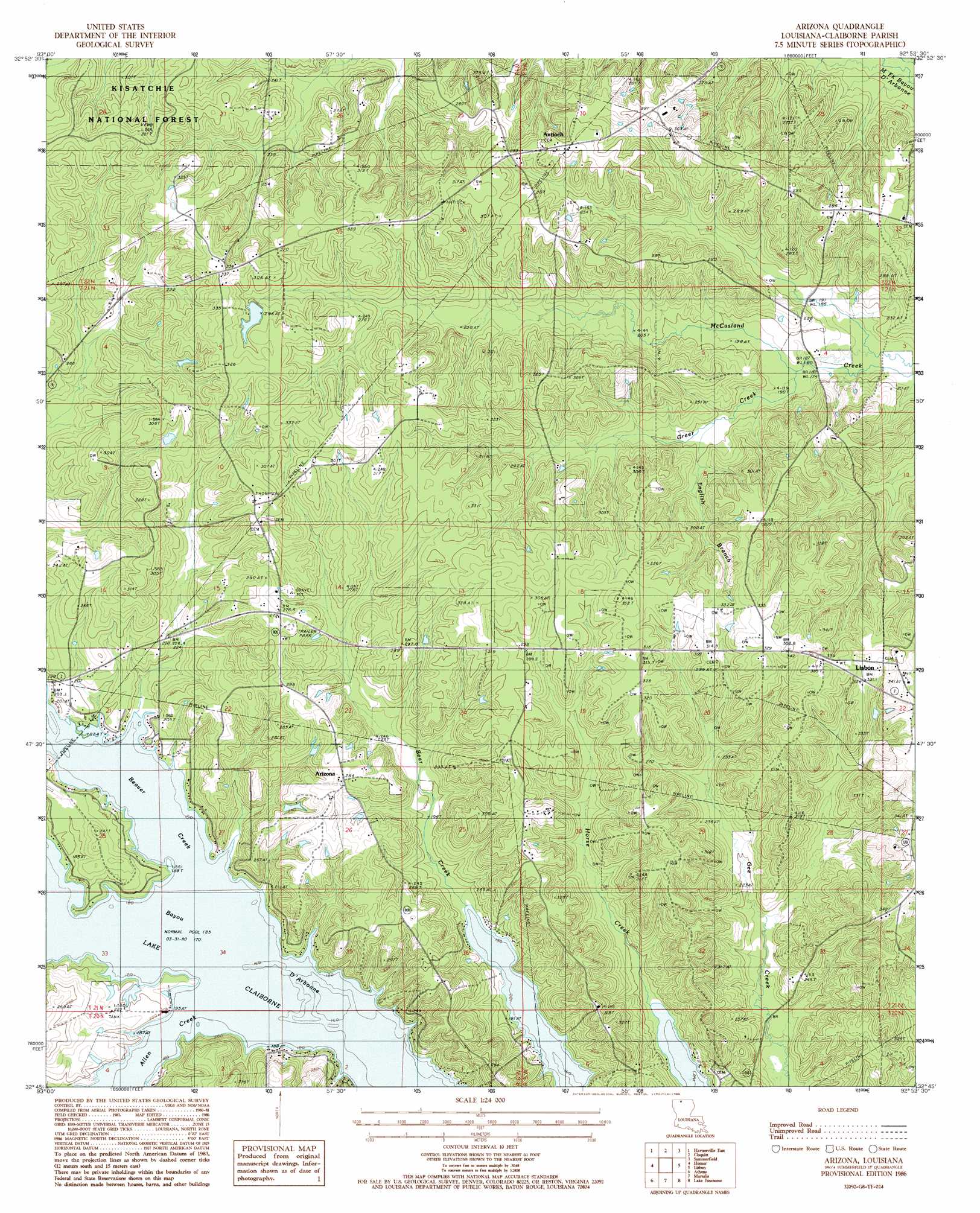
USGS Topo Quad 32092g8 - 1:24,000 scale
| Topo Map Name: | Arizona |
| USGS Topo Quad ID: | 32092g8 |
| Print Size: | ca. 21 1/4" wide x 27" high |
| Southeast Coordinates: | 32.75° N latitude / 92.875° W longitude |
| Map Center Coordinates: | 32.8125° N latitude / 92.9375° W longitude |
| U.S. State: | LA |
| Filename: | o32092g8.jpg |
| Download Map JPG Image: | Arizona topo map 1:24,000 scale |
| Map Type: | Topographic |
| Topo Series: | 7.5´ |
| Map Scale: | 1:24,000 |
| Source of Map Images: | United States Geological Survey (USGS) |
| Alternate Map Versions: |
Arizona LA 1986, updated 1986 Download PDF Buy paper map Arizona LA 2003, updated 2005 Download PDF Buy paper map Arizona LA 2012 Download PDF Buy paper map Arizona LA 2015 Download PDF Buy paper map |
| FStopo: | US Forest Service topo Arizona is available: Download FStopo PDF Download FStopo TIF |
1:24,000 Topo Quads surrounding Arizona
Emerson |
Emerson Se |
Wesson Sw |
Wesson |
Junction City |
Haynesville West |
Haynesville East |
Colquitt |
Summerfield |
Lillie |
Blackburn |
Homer |
Arizona |
Lisbon |
Bernice |
Langston |
Athens |
Marsalis |
Lake Foursome |
Dubach |
Ada |
Gibsland |
Arcadia |
Simsboro |
Ruston West |
> Back to 32092e1 at 1:100,000 scale
> Back to 32092a1 at 1:250,000 scale
> Back to U.S. Topo Maps home
Arizona topo map: Gazetteer
Arizona: Oilfields
Forest Grove School Gas Field elevation 86m 282′McCasland Creek Oil and Gas Field elevation 85m 278′
West Lisbon Oil and Gas Field elevation 96m 314′
Arizona: Populated Places
Antioch elevation 93m 305′Arizona elevation 85m 278′
Forest Grove elevation 94m 308′
Arizona: Post Offices
Antioch Post Office (historical) elevation 74m 242′Arizona: Streams
Beaver Creek elevation 56m 183′English Branch elevation 60m 196′
Green Creek elevation 56m 183′
Arizona digital topo map on disk
Buy this Arizona topo map showing relief, roads, GPS coordinates and other geographical features, as a high-resolution digital map file on DVD: