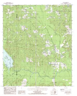
Lillie Topo Map Louisiana
To zoom in, hover over the map of Lillie
USGS Topo Quad 32092h6 - 1:24,000 scale
| Topo Map Name: | Lillie |
| USGS Topo Quad ID: | 32092h6 |
| Print Size: | ca. 21 1/4" wide x 27" high |
| Southeast Coordinates: | 32.875° N latitude / 92.625° W longitude |
| Map Center Coordinates: | 32.9375° N latitude / 92.6875° W longitude |
| U.S. State: | LA |
| Filename: | o32092h6.jpg |
| Download Map JPG Image: | Lillie topo map 1:24,000 scale |
| Map Type: | Topographic |
| Topo Series: | 7.5´ |
| Map Scale: | 1:24,000 |
| Source of Map Images: | United States Geological Survey (USGS) |
| Alternate Map Versions: |
Lillie LA 1985, updated 1986 Download PDF Buy paper map Lillie LA 2003, updated 2005 Download PDF Buy paper map Lillie LA 2012 Download PDF Buy paper map Lillie LA 2015 Download PDF Buy paper map |
| FStopo: | US Forest Service topo Lillie is available: Download FStopo PDF Download FStopo TIF |
1:24,000 Topo Quads surrounding Lillie
> Back to 32092e1 at 1:100,000 scale
> Back to 32092a1 at 1:250,000 scale
> Back to U.S. Topo Maps home
Lillie topo map: Gazetteer
Lillie: Lakes
Kidd Lake elevation 30m 98′Lillie: Populated Places
Bethel Springs elevation 64m 209′Copley elevation 33m 108′
Lillie elevation 37m 121′
Randolph elevation 39m 127′
Rum Center elevation 54m 177′
Wards Mill (historical) elevation 61m 200′
Lillie: Post Offices
Lillie Post Office elevation 36m 118′Lillie: Reservoirs
Corney Lake elevation 35m 114′Lillie: Streams
Bear Creek elevation 36m 118′Beaver Creek elevation 33m 108′
Big Branch elevation 29m 95′
Davis Creek elevation 37m 121′
Dry Creek elevation 27m 88′
Farrar Branch elevation 30m 98′
Field Branch elevation 30m 98′
Hammock Creek elevation 27m 88′
Jenks Branch elevation 31m 101′
Lee Creek elevation 31m 101′
Little Corney Bayou elevation 26m 85′
Little Cornie Bayou elevation 27m 88′
Lowery Creek elevation 26m 85′
Mill Creek elevation 36m 118′
Spring Branch elevation 27m 88′
Steep Bank Creek elevation 38m 124′
Thompson Branch elevation 28m 91′
Lillie digital topo map on disk
Buy this Lillie topo map showing relief, roads, GPS coordinates and other geographical features, as a high-resolution digital map file on DVD:


