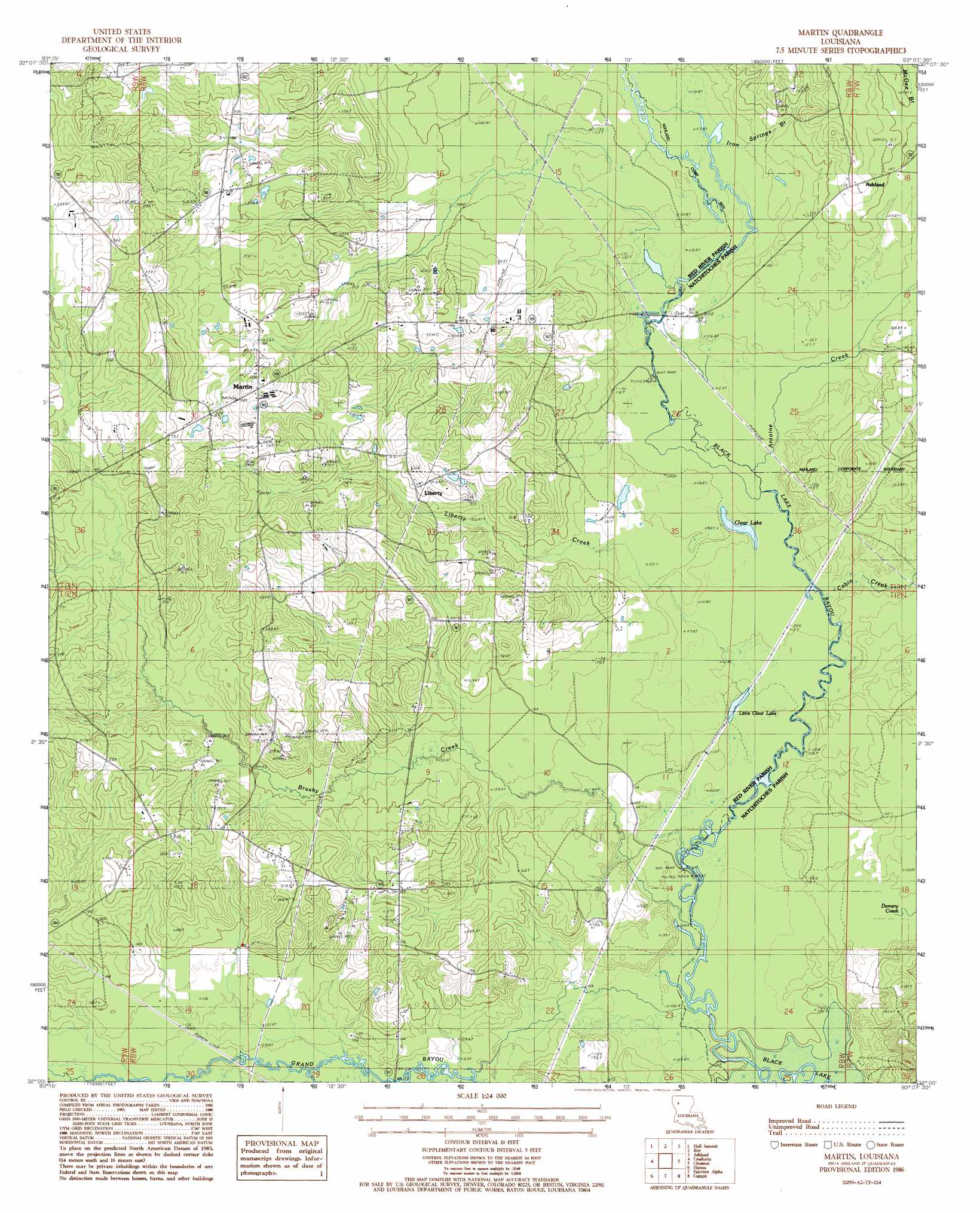
Martin Topo Map Louisiana
To zoom in, hover over the map of Martin
USGS Topo Quad 32093a2 - 1:24,000 scale
| Topo Map Name: | Martin |
| USGS Topo Quad ID: | 32093a2 |
| Print Size: | ca. 21 1/4" wide x 27" high |
| Southeast Coordinates: | 32° N latitude / 93.125° W longitude |
| Map Center Coordinates: | 32.0625° N latitude / 93.1875° W longitude |
| U.S. State: | LA |
| Filename: | o32093a2.jpg |
| Download Map JPG Image: | Martin topo map 1:24,000 scale |
| Map Type: | Topographic |
| Topo Series: | 7.5´ |
| Map Scale: | 1:24,000 |
| Source of Map Images: | United States Geological Survey (USGS) |
| Alternate Map Versions: |
Martin LA 1986, updated 1986 Download PDF Buy paper map Martin LA 2012 Download PDF Buy paper map Martin LA 2015 Download PDF Buy paper map |
1:24,000 Topo Quads surrounding Martin
Bossier Point |
Ringgold |
Jamestown |
Sparta |
Bienville |
East Point |
Hall Summit |
Troy |
Ashland |
Saline |
Harmon |
Coushatta |
Martin |
Chestnut |
Goldonna |
Evelyn |
Hanna |
Messick |
Campti |
Coup Point |
Hollis Creek |
Allen |
Powhatan |
Natchitoches North |
Saint Maurice |
> Back to 32093a1 at 1:100,000 scale
> Back to 32092a1 at 1:250,000 scale
> Back to U.S. Topo Maps home
Martin topo map: Gazetteer
Martin: Bridges
Coffeys Bridge (historical) elevation 34m 111′Lake Village Bridge elevation 34m 111′
Martin: Lakes
Clear Lake elevation 34m 111′Little Clear Lake elevation 34m 111′
Martin: Oilfields
Liberty Gas Field elevation 79m 259′Southwest Demery Creek Gas Field elevation 59m 193′
Martin: Populated Places
Liberty elevation 61m 200′Martin elevation 73m 239′
Martin: Streams
Antoine Creek elevation 34m 111′Brushy Creek elevation 32m 104′
Cabin Creek elevation 34m 111′
Demery Creek elevation 32m 104′
Grand Bayou elevation 31m 101′
Iron Springs Branch elevation 35m 114′
Liberty Creek elevation 34m 111′
Robertson Branch elevation 34m 111′
Martin digital topo map on disk
Buy this Martin topo map showing relief, roads, GPS coordinates and other geographical features, as a high-resolution digital map file on DVD: