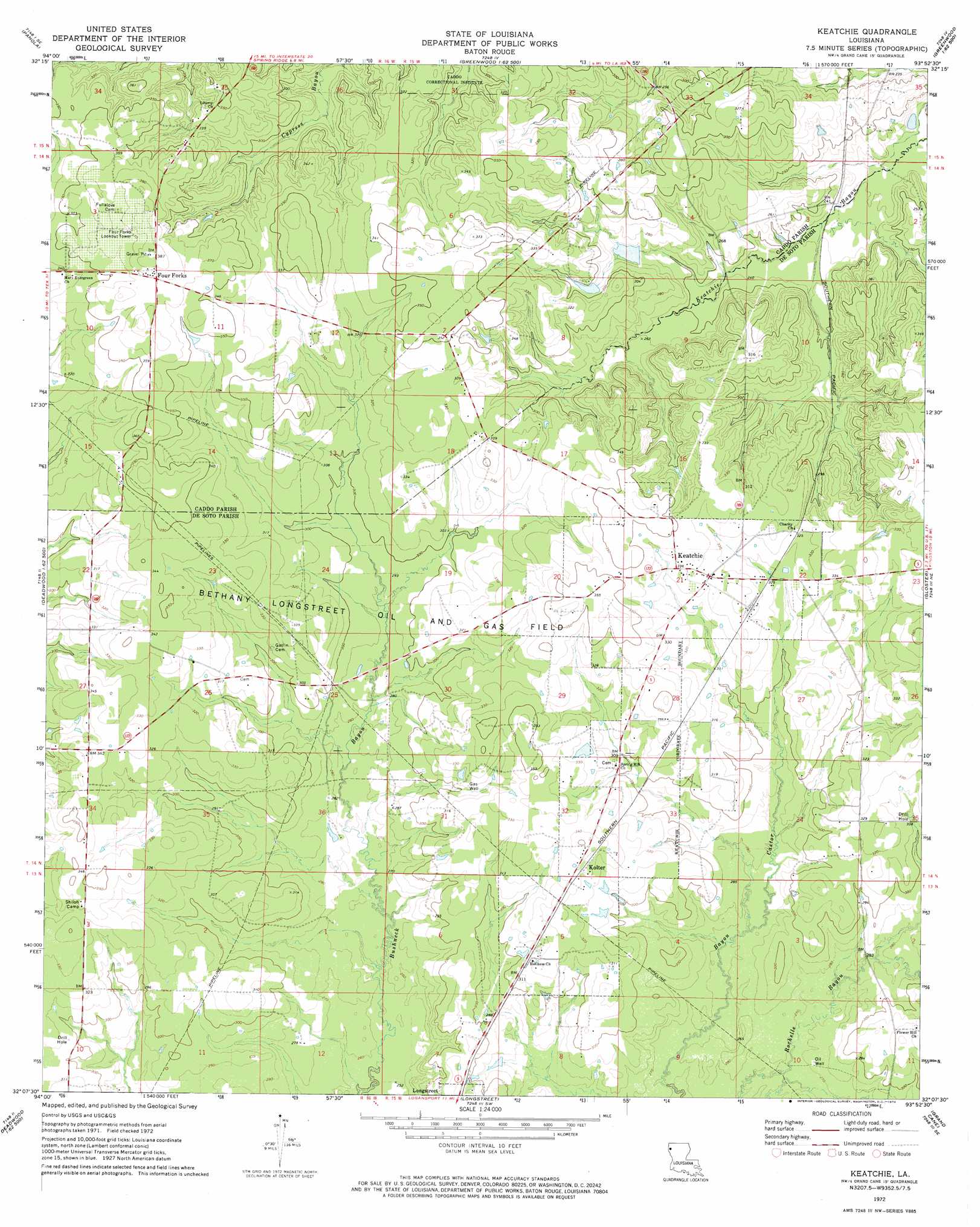
Keatchie Topo Map Louisiana
To zoom in, hover over the map of Keatchie
USGS Topo Quad 32093b8 - 1:24,000 scale
| Topo Map Name: | Keatchie |
| USGS Topo Quad ID: | 32093b8 |
| Print Size: | ca. 21 1/4" wide x 27" high |
| Southeast Coordinates: | 32.125° N latitude / 93.875° W longitude |
| Map Center Coordinates: | 32.1875° N latitude / 93.9375° W longitude |
| U.S. State: | LA |
| Filename: | o32093b8.jpg |
| Download Map JPG Image: | Keatchie topo map 1:24,000 scale |
| Map Type: | Topographic |
| Topo Series: | 7.5´ |
| Map Scale: | 1:24,000 |
| Source of Map Images: | United States Geological Survey (USGS) |
| Alternate Map Versions: |
Keatchie LA 1972, updated 1974 Download PDF Buy paper map Keatchie LA 2012 Download PDF Buy paper map Keatchie LA 2015 Download PDF Buy paper map |
1:24,000 Topo Quads surrounding Keatchie
Stricklin Springs |
Waskom |
Greenwood |
Shreveport West |
Shreveport East |
De Berry |
Panola |
Spring Ridge |
Stonewall |
Wallace Lake |
River Hill |
Old Panola |
Keatchie |
Gloster |
Holly |
Old Center |
Galloway |
Longstreet |
Grand Cane |
Mansfield |
Tenaha East |
Logansport West |
Logansport East |
Hunter |
Trenton |
> Back to 32093a1 at 1:100,000 scale
> Back to 32092a1 at 1:250,000 scale
> Back to U.S. Topo Maps home
Keatchie topo map: Gazetteer
Keatchie: Airports
Maeora Airport elevation 93m 305′Keatchie: Dams
Milton Crowe Lake Number One Dam elevation 86m 282′Milton Crowe Lake Number Two Dam elevation 95m 311′
Keatchie: Oilfields
Bethany Longstreet Oil and Gas Field elevation 87m 285′Keatchie: Populated Places
Four Forks elevation 112m 367′Keatchie elevation 101m 331′
Kolter elevation 102m 334′
Whitley (historical) elevation 103m 337′
Keatchie digital topo map on disk
Buy this Keatchie topo map showing relief, roads, GPS coordinates and other geographical features, as a high-resolution digital map file on DVD: