Langston Topo Map Louisiana
To zoom in, hover over the map of Langston
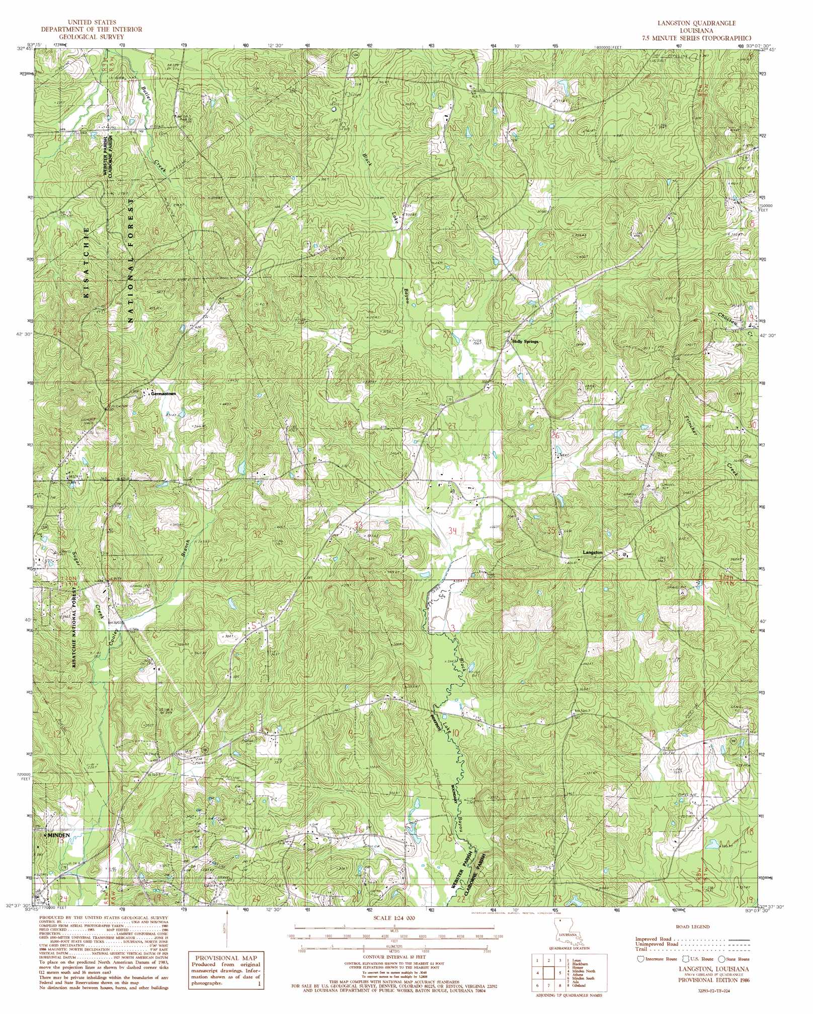
USGS Topo Quad 32093f2 - 1:24,000 scale
| Topo Map Name: | Langston |
| USGS Topo Quad ID: | 32093f2 |
| Print Size: | ca. 21 1/4" wide x 27" high |
| Southeast Coordinates: | 32.625° N latitude / 93.125° W longitude |
| Map Center Coordinates: | 32.6875° N latitude / 93.1875° W longitude |
| U.S. State: | LA |
| Filename: | o32093f2.jpg |
| Download Map JPG Image: | Langston topo map 1:24,000 scale |
| Map Type: | Topographic |
| Topo Series: | 7.5´ |
| Map Scale: | 1:24,000 |
| Source of Map Images: | United States Geological Survey (USGS) |
| Alternate Map Versions: |
Langston LA 1986, updated 1986 Download PDF Buy paper map Langston LA 2003, updated 2005 Download PDF Buy paper map Langston LA 2012 Download PDF Buy paper map Langston LA 2015 Download PDF Buy paper map |
| FStopo: | US Forest Service topo Langston is available: Download FStopo PDF Download FStopo TIF |
1:24,000 Topo Quads surrounding Langston
Cullen |
Shongaloo |
Haynesville West |
Haynesville East |
Colquitt |
Cotton Valley |
Leton |
Blackburn |
Homer |
Arizona |
Hortman |
Minden North |
Langston |
Athens |
Marsalis |
Doyline |
Minden South |
Ada |
Gibsland |
Arcadia |
Koran |
Heflin |
Fryeburg |
Sailes |
Bryceland |
> Back to 32093e1 at 1:100,000 scale
> Back to 32092a1 at 1:250,000 scale
> Back to U.S. Topo Maps home
Langston topo map: Gazetteer
Langston: Oilfields
Minden Oil and Gas Field elevation 102m 334′Langston: Populated Places
Germantown elevation 113m 370′Holly Springs elevation 99m 324′
Langston elevation 119m 390′
Langston: Streams
Sugar Creek elevation 76m 249′Langston digital topo map on disk
Buy this Langston topo map showing relief, roads, GPS coordinates and other geographical features, as a high-resolution digital map file on DVD: