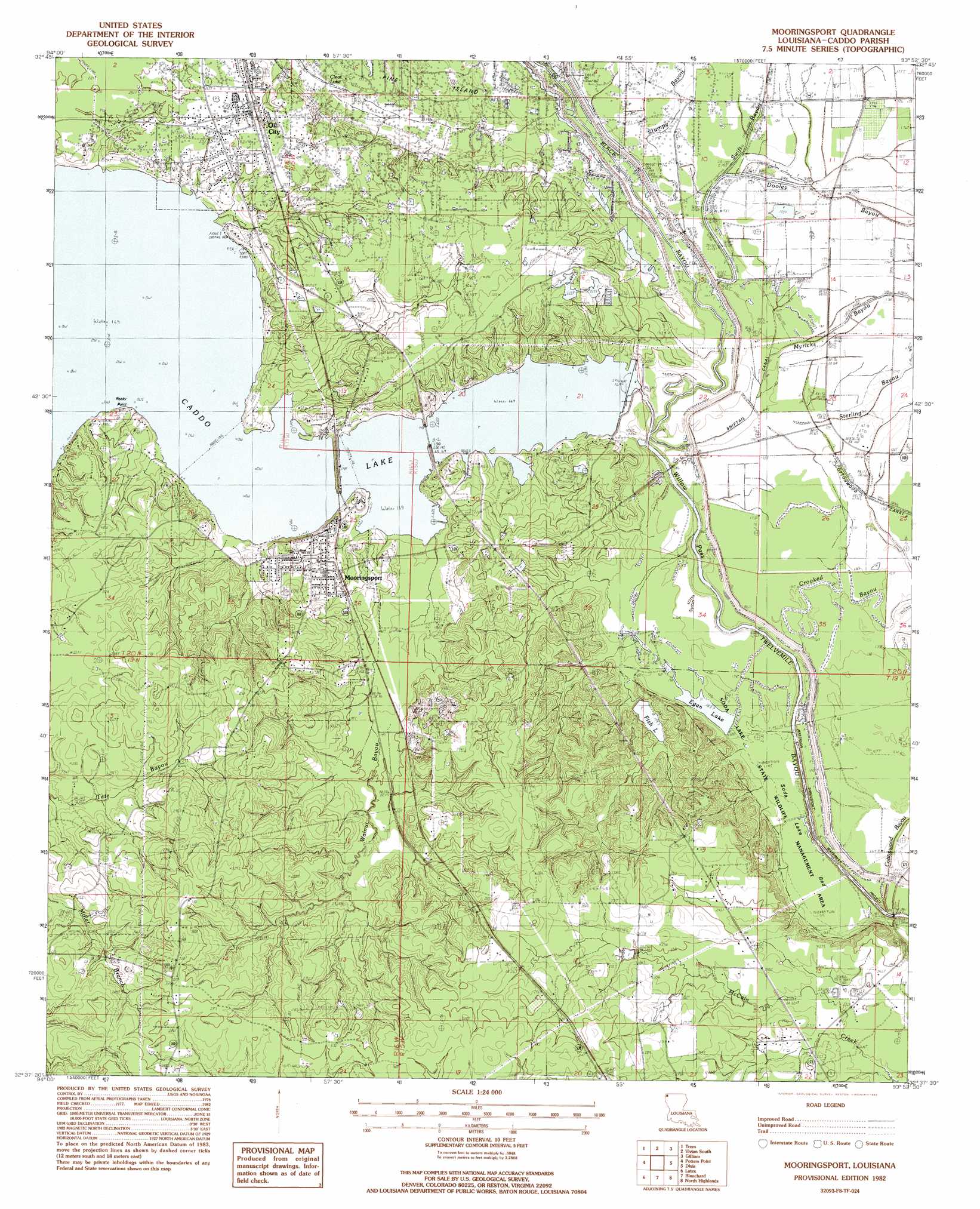
Mooringsport Topo Map Louisiana
To zoom in, hover over the map of Mooringsport
USGS Topo Quad 32093f8 - 1:24,000 scale
| Topo Map Name: | Mooringsport |
| USGS Topo Quad ID: | 32093f8 |
| Print Size: | ca. 21 1/4" wide x 27" high |
| Southeast Coordinates: | 32.625° N latitude / 93.875° W longitude |
| Map Center Coordinates: | 32.6875° N latitude / 93.9375° W longitude |
| U.S. State: | LA |
| Filename: | o32093f8.jpg |
| Download Map JPG Image: | Mooringsport topo map 1:24,000 scale |
| Map Type: | Topographic |
| Topo Series: | 7.5´ |
| Map Scale: | 1:24,000 |
| Source of Map Images: | United States Geological Survey (USGS) |
| Alternate Map Versions: |
Mooringsport LA 1982, updated 1982 Download PDF Buy paper map Mooringsport LA 1982, updated 1982 Download PDF Buy paper map Mooringsport LA 2012 Download PDF Buy paper map Mooringsport LA 2015 Download PDF Buy paper map |
1:24,000 Topo Quads surrounding Mooringsport
Kildare |
Mcleod |
Vivian North |
Wardview |
Plain Dealing |
Smithland |
Trees |
Vivian South |
Gilliam |
Hughes |
Karnack |
Potters Point |
Mooringsport |
Dixie |
Benton |
Scottsville |
Latex |
Blanchard |
North Highlands |
Bossier City |
Stricklin Springs |
Waskom |
Greenwood |
Shreveport West |
Shreveport East |
> Back to 32093e1 at 1:100,000 scale
> Back to 32092a1 at 1:250,000 scale
> Back to U.S. Topo Maps home
Mooringsport topo map: Gazetteer
Mooringsport: Bridges
Bridge 184 elevation 44m 144′Mooringsport: Canals
Shiftail Canal elevation 51m 167′Mooringsport: Capes
Canfiels Point elevation 59m 193′Rocky Point elevation 56m 183′
Stormy Point elevation 52m 170′
Mooringsport: Channels
Willow Pass elevation 51m 167′Mooringsport: Dams
Caddo Dam elevation 51m 167′Fish Lake Dam elevation 55m 180′
Mooringsport: Flats
Soda Lake Bed elevation 50m 164′Mooringsport: Guts
Sterling Bayou elevation 52m 170′Mooringsport: Lakes
Clear Lake elevation 51m 167′Egan Lake elevation 50m 164′
Shift-Tail Lake (historical) elevation 51m 167′
Mooringsport: Parks
Soda Lake State Wildlife Management Area elevation 50m 164′Mooringsport: Populated Places
Arlatex elevation 57m 187′Brian elevation 84m 275′
Mooringsport elevation 69m 226′
Oil City elevation 62m 203′
Mooringsport: Reservoirs
Caddo Lake elevation 51m 167′Caddo Lake elevation 51m 167′
Fish Lake elevation 55m 180′
Mooringsport: Streams
Black Bayou elevation 48m 157′Black Bayou elevation 45m 147′
Cottonwood Bayou elevation 44m 144′
Crooked Bayou elevation 48m 157′
Myricks Bayou elevation 51m 167′
Stumpy Bayou elevation 49m 160′
Swift Bayou elevation 49m 160′
Walnut Bayou elevation 51m 167′
Mooringsport digital topo map on disk
Buy this Mooringsport topo map showing relief, roads, GPS coordinates and other geographical features, as a high-resolution digital map file on DVD: