Blackburn Topo Map Louisiana
To zoom in, hover over the map of Blackburn
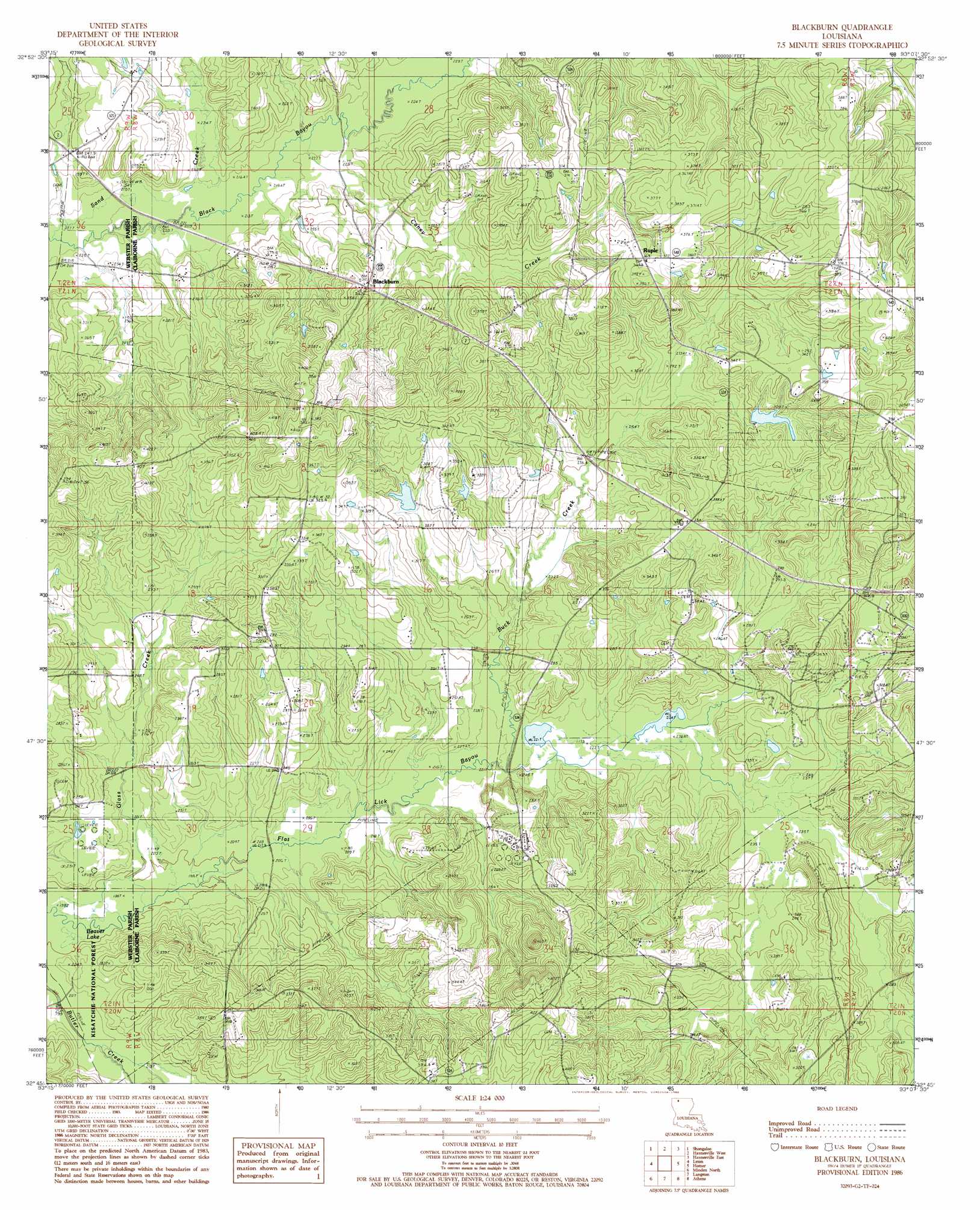
USGS Topo Quad 32093g2 - 1:24,000 scale
| Topo Map Name: | Blackburn |
| USGS Topo Quad ID: | 32093g2 |
| Print Size: | ca. 21 1/4" wide x 27" high |
| Southeast Coordinates: | 32.75° N latitude / 93.125° W longitude |
| Map Center Coordinates: | 32.8125° N latitude / 93.1875° W longitude |
| U.S. State: | LA |
| Filename: | o32093g2.jpg |
| Download Map JPG Image: | Blackburn topo map 1:24,000 scale |
| Map Type: | Topographic |
| Topo Series: | 7.5´ |
| Map Scale: | 1:24,000 |
| Source of Map Images: | United States Geological Survey (USGS) |
| Alternate Map Versions: |
Blackburn LA 1986, updated 1986 Download PDF Buy paper map Blackburn LA 2003, updated 2005 Download PDF Buy paper map Blackburn LA 2012 Download PDF Buy paper map Blackburn LA 2015 Download PDF Buy paper map |
| FStopo: | US Forest Service topo Blackburn is available: Download FStopo PDF Download FStopo TIF |
1:24,000 Topo Quads surrounding Blackburn
Taylor |
Walkerville |
Emerson |
Emerson Se |
Wesson Sw |
Cullen |
Shongaloo |
Haynesville West |
Haynesville East |
Colquitt |
Cotton Valley |
Leton |
Blackburn |
Homer |
Arizona |
Hortman |
Minden North |
Langston |
Athens |
Marsalis |
Doyline |
Minden South |
Ada |
Gibsland |
Arcadia |
> Back to 32093e1 at 1:100,000 scale
> Back to 32092a1 at 1:250,000 scale
> Back to U.S. Topo Maps home
Blackburn topo map: Gazetteer
Blackburn: Dams
Hollenshead Dam elevation 98m 321′Blackburn: Lakes
Beaver Lake elevation 60m 196′Blackburn: Oilfields
East Blackburn Gas Field elevation 102m 334′Homer Oil Field elevation 78m 255′
Blackburn: Populated Places
Blackburn elevation 93m 305′Ruple elevation 112m 367′
Blackburn: Streams
Buck Creek elevation 66m 216′Caney Creek elevation 67m 219′
Glass Creek elevation 61m 200′
Sand Creek elevation 64m 209′
Blackburn digital topo map on disk
Buy this Blackburn topo map showing relief, roads, GPS coordinates and other geographical features, as a high-resolution digital map file on DVD: