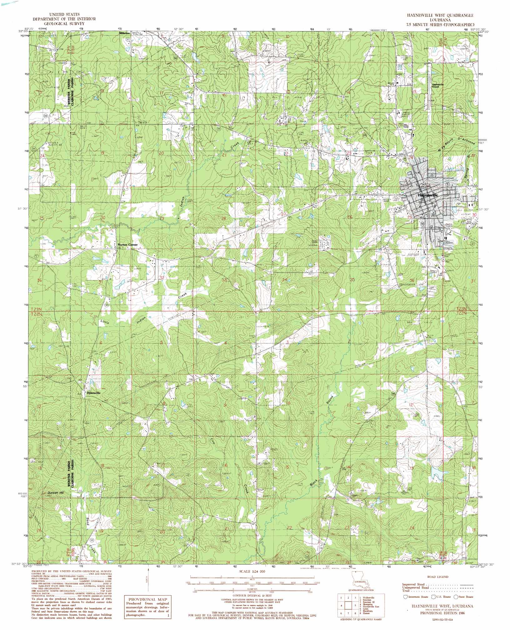
Haynesville West Topo Map Louisiana
To zoom in, hover over the map of Haynesville West
USGS Topo Quad 32093h2 - 1:24,000 scale
| Topo Map Name: | Haynesville West |
| USGS Topo Quad ID: | 32093h2 |
| Print Size: | ca. 21 1/4" wide x 27" high |
| Southeast Coordinates: | 32.875° N latitude / 93.125° W longitude |
| Map Center Coordinates: | 32.9375° N latitude / 93.1875° W longitude |
| U.S. State: | LA |
| Filename: | o32093h2.jpg |
| Download Map JPG Image: | Haynesville West topo map 1:24,000 scale |
| Map Type: | Topographic |
| Topo Series: | 7.5´ |
| Map Scale: | 1:24,000 |
| Source of Map Images: | United States Geological Survey (USGS) |
| Alternate Map Versions: |
Haynesville West LA 1986, updated 1986 Download PDF Buy paper map Haynesville West LA 2012 Download PDF Buy paper map Haynesville West LA 2015 Download PDF Buy paper map |
1:24,000 Topo Quads surrounding Haynesville West
Bussey |
Macedonia |
Calhoun |
Spotville |
Marysville |
Taylor |
Walkerville |
Emerson |
Emerson Se |
Wesson Sw |
Cullen |
Shongaloo |
Haynesville West |
Haynesville East |
Colquitt |
Cotton Valley |
Leton |
Blackburn |
Homer |
Arizona |
Hortman |
Minden North |
Langston |
Athens |
Marsalis |
> Back to 32093e1 at 1:100,000 scale
> Back to 32092a1 at 1:250,000 scale
> Back to U.S. Topo Maps home
Haynesville West topo map: Gazetteer
Haynesville West: Airports
Haynesville Airport elevation 105m 344′Haynesville West: Dams
Claiborne Mercantile Dam elevation 100m 328′Lake Miller Dam elevation 93m 305′
Haynesville West: Oilfields
Blackburn Gas Field elevation 72m 236′East Dykesville Gas Field elevation 102m 334′
Haynesville Oil and Gas Field elevation 93m 305′
Oaks Oil and Gas Field elevation 101m 331′
Haynesville West: Populated Places
Dykesville elevation 111m 364′Haynesville elevation 113m 370′
Norton Corner elevation 91m 298′
Haynesville West: Streams
Cow Creek elevation 69m 226′Spring Branch elevation 84m 275′
Haynesville West digital topo map on disk
Buy this Haynesville West topo map showing relief, roads, GPS coordinates and other geographical features, as a high-resolution digital map file on DVD: