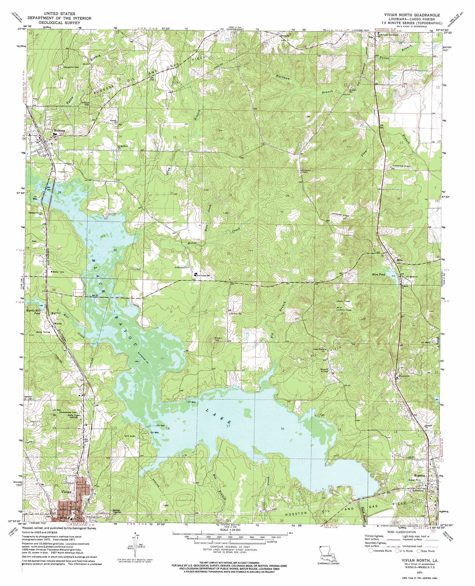
Vivian North Topo Map Louisiana
To zoom in, hover over the map of Vivian North
USGS Topo Quad 32093h8 - 1:24,000 scale
| Topo Map Name: | Vivian North |
| USGS Topo Quad ID: | 32093h8 |
| Print Size: | ca. 21 1/4" wide x 27" high |
| Southeast Coordinates: | 32.875° N latitude / 93.875° W longitude |
| Map Center Coordinates: | 32.9375° N latitude / 93.9375° W longitude |
| U.S. State: | LA |
| Filename: | o32093h8.jpg |
| Download Map JPG Image: | Vivian North topo map 1:24,000 scale |
| Map Type: | Topographic |
| Topo Series: | 7.5´ |
| Map Scale: | 1:24,000 |
| Source of Map Images: | United States Geological Survey (USGS) |
| Alternate Map Versions: |
Vivian North LA 1971, updated 1973 Download PDF Buy paper map Vivian North LA 2012 Download PDF Buy paper map Vivian North LA 2015 Download PDF Buy paper map |
1:24,000 Topo Quads surrounding Vivian North
Atlanta North |
Bloomburg |
Doddridge Nw |
Doddridge Ne |
Canfield |
Atlanta South |
Ravanna |
Doddridge |
Doddridge Se |
Bradley |
Kildare |
Mcleod |
Vivian North |
Wardview |
Plain Dealing |
Smithland |
Trees |
Vivian South |
Gilliam |
Hughes |
Karnack |
Potters Point |
Mooringsport |
Dixie |
Benton |
> Back to 32093e1 at 1:100,000 scale
> Back to 32092a1 at 1:250,000 scale
> Back to U.S. Topo Maps home
Vivian North topo map: Gazetteer
Vivian North: Dams
Black Bayou Dam elevation 53m 173′Mira Pond Dam elevation 64m 209′
Myrtis Mill Pond Dam elevation 61m 200′
Vivian North: Flats
Old Bed Horseshoe Lake elevation 58m 190′Vivian North: Oilfields
Caddo Pine Island Oil Field elevation 61m 200′Hosston Oil and Gas Field elevation 54m 177′
Mira Oil Field elevation 84m 275′
Rodessa Oil and Gas Field elevation 72m 236′
Vivian North: Populated Places
Frog Level (historical) elevation 79m 259′Hosston elevation 66m 216′
Mira elevation 69m 226′
Myrtis elevation 64m 209′
Rodessa elevation 70m 229′
Vivian North: Post Offices
Rodessa Post Office elevation 70m 229′Vivian North: Reservoirs
Black Bayou Lake elevation 55m 180′Mira Pond elevation 62m 203′
Myrtis Mill Pond elevation 58m 190′
Vivian North: Streams
Bee Branch elevation 55m 180′Big Branch elevation 55m 180′
Gray Branch elevation 55m 180′
Hartman Branch elevation 59m 193′
Horse Creek elevation 55m 180′
Hoss Creek elevation 61m 200′
Lowe Creek elevation 55m 180′
Myrtis Mill Creek elevation 55m 180′
Vivian North digital topo map on disk
Buy this Vivian North topo map showing relief, roads, GPS coordinates and other geographical features, as a high-resolution digital map file on DVD: