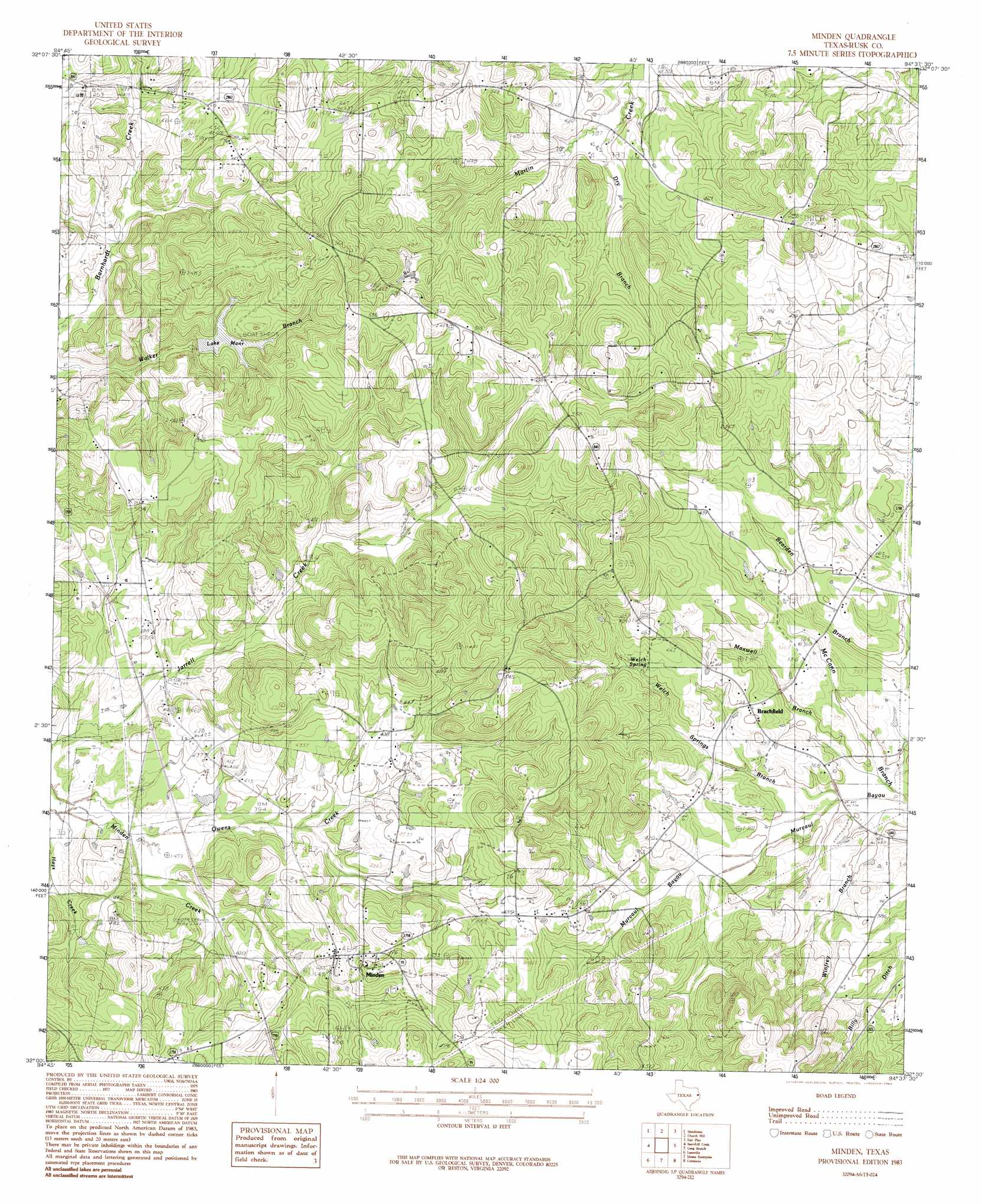
Minden Topo Map Texas
To zoom in, hover over the map of Minden
USGS Topo Quad 32094a6 - 1:24,000 scale
| Topo Map Name: | Minden |
| USGS Topo Quad ID: | 32094a6 |
| Print Size: | ca. 21 1/4" wide x 27" high |
| Southeast Coordinates: | 32° N latitude / 94.625° W longitude |
| Map Center Coordinates: | 32.0625° N latitude / 94.6875° W longitude |
| U.S. State: | TX |
| Filename: | o32094a6.jpg |
| Download Map JPG Image: | Minden topo map 1:24,000 scale |
| Map Type: | Topographic |
| Topo Series: | 7.5´ |
| Map Scale: | 1:24,000 |
| Source of Map Images: | United States Geological Survey (USGS) |
| Alternate Map Versions: |
Minden TX 1983, updated 1983 Download PDF Buy paper map Minden TX 2010 Download PDF Buy paper map Minden TX 2013 Download PDF Buy paper map Minden TX 2016 Download PDF Buy paper map |
1:24,000 Topo Quads surrounding Minden
Kilgore Sw |
Kilgore Se |
Elderville |
Tatum |
Harris Chapel |
Price |
Henderson |
Church Hill |
Fair Play |
Beckville |
Gum Springs |
Berryhill Creek |
Minden |
Long Branch |
Lake Murvaul |
New Salem |
Laneville |
Mount Enterprise |
Caledonia |
Timpson |
Reklaw |
Cushing |
Trawick |
Garrison West |
Garrison East |
> Back to 32094a1 at 1:100,000 scale
> Back to 32094a1 at 1:250,000 scale
> Back to U.S. Topo Maps home
Minden topo map: Gazetteer
Minden: Dams
Lake Manr Dam elevation 126m 413′Minden: Populated Places
Brachfield elevation 122m 400′Minden elevation 143m 469′
Minden: Reservoirs
Lake Manr elevation 126m 413′Minden: Streams
Dry Branch elevation 116m 380′Maxwell Branch elevation 102m 334′
McCann Branch elevation 101m 331′
Owens Creek elevation 110m 360′
Welch Springs Branch elevation 101m 331′
Winfrey Branch elevation 101m 331′
Minden digital topo map on disk
Buy this Minden topo map showing relief, roads, GPS coordinates and other geographical features, as a high-resolution digital map file on DVD: