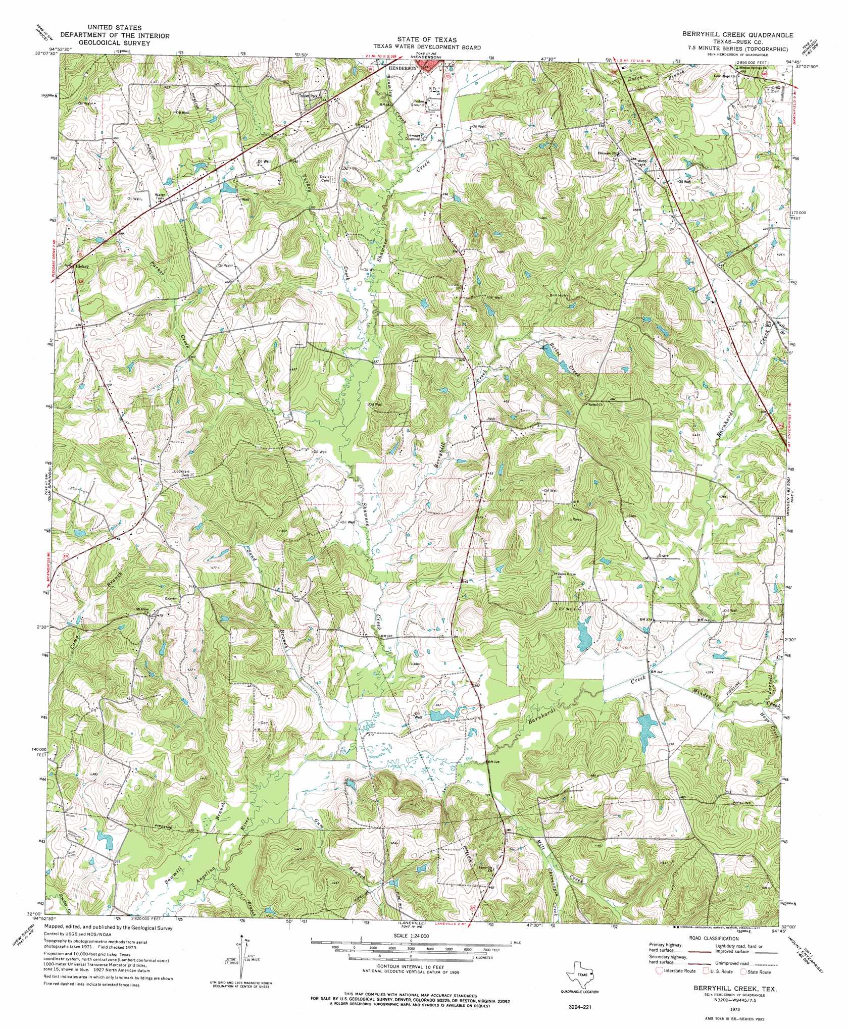
Berryhill Creek Topo Map Texas
To zoom in, hover over the map of Berryhill Creek
USGS Topo Quad 32094a7 - 1:24,000 scale
| Topo Map Name: | Berryhill Creek |
| USGS Topo Quad ID: | 32094a7 |
| Print Size: | ca. 21 1/4" wide x 27" high |
| Southeast Coordinates: | 32° N latitude / 94.75° W longitude |
| Map Center Coordinates: | 32.0625° N latitude / 94.8125° W longitude |
| U.S. State: | TX |
| Filename: | o32094a7.jpg |
| Download Map JPG Image: | Berryhill Creek topo map 1:24,000 scale |
| Map Type: | Topographic |
| Topo Series: | 7.5´ |
| Map Scale: | 1:24,000 |
| Source of Map Images: | United States Geological Survey (USGS) |
| Alternate Map Versions: |
Berryhill Creek TX 1973, updated 1977 Download PDF Buy paper map Berryhill Creek TX 2010 Download PDF Buy paper map Berryhill Creek TX 2013 Download PDF Buy paper map Berryhill Creek TX 2016 Download PDF Buy paper map |
1:24,000 Topo Quads surrounding Berryhill Creek
Hope Pond |
Kilgore Sw |
Kilgore Se |
Elderville |
Tatum |
Troup East |
Price |
Henderson |
Church Hill |
Fair Play |
Griffin |
Gum Springs |
Berryhill Creek |
Minden |
Long Branch |
New Summerfield |
New Salem |
Laneville |
Mount Enterprise |
Caledonia |
Atoy |
Reklaw |
Cushing |
Trawick |
Garrison West |
> Back to 32094a1 at 1:100,000 scale
> Back to 32094a1 at 1:250,000 scale
> Back to U.S. Topo Maps home
Berryhill Creek topo map: Gazetteer
Berryhill Creek: Dams
Eaton Lake Dam elevation 102m 334′J A Morris Dam elevation 103m 337′
Morris Lake Dam elevation 103m 337′
Shelton Lake Dam elevation 103m 337′
Youngblood Dam elevation 121m 396′
Berryhill Creek: Populated Places
Hickey elevation 137m 449′Berryhill Creek: Reservoirs
Eaton Lake elevation 102m 334′Morris Lake elevation 103m 337′
Shelton Lake elevation 103m 337′
Berryhill Creek: Streams
Barnhardt Creek elevation 94m 308′Berryhill Creek elevation 100m 328′
Bethel Creek elevation 116m 380′
Bromley Creek elevation 109m 357′
Chinquapin Creek elevation 102m 334′
Gum Branch elevation 92m 301′
Hays Creek elevation 105m 344′
Jarrell Creek elevation 106m 347′
Mill Creek elevation 98m 321′
Minden Creek elevation 102m 334′
Parker Creek elevation 101m 331′
Prairie Branch elevation 91m 298′
Sand Branch elevation 95m 311′
Shawnee Creek elevation 94m 308′
Turkey Creek elevation 102m 334′
Walker Branch elevation 115m 377′
Berryhill Creek digital topo map on disk
Buy this Berryhill Creek topo map showing relief, roads, GPS coordinates and other geographical features, as a high-resolution digital map file on DVD: