Colliers Creek Topo Map Texas
To zoom in, hover over the map of Colliers Creek
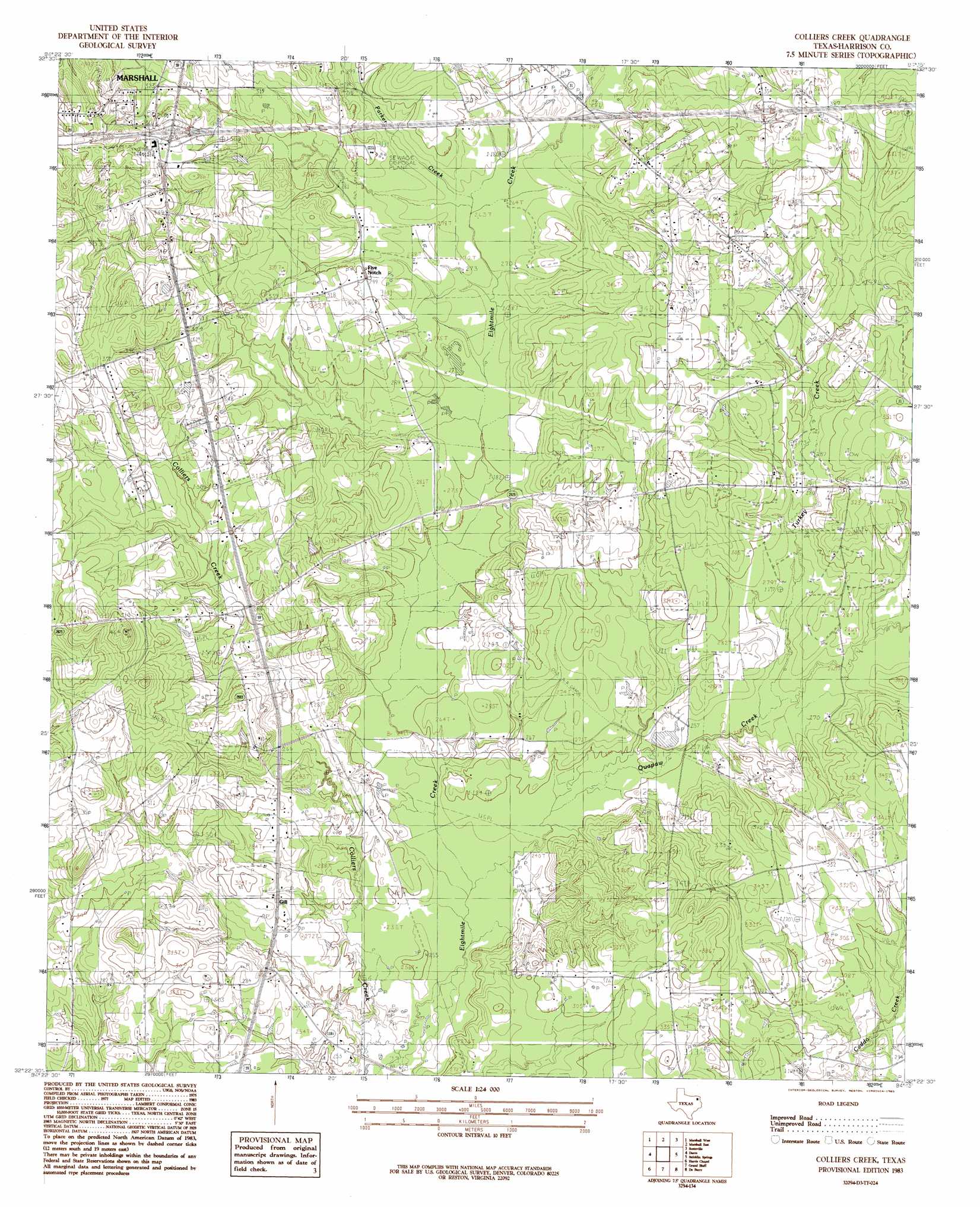
USGS Topo Quad 32094d3 - 1:24,000 scale
| Topo Map Name: | Colliers Creek |
| USGS Topo Quad ID: | 32094d3 |
| Print Size: | ca. 21 1/4" wide x 27" high |
| Southeast Coordinates: | 32.375° N latitude / 94.25° W longitude |
| Map Center Coordinates: | 32.4375° N latitude / 94.3125° W longitude |
| U.S. State: | TX |
| Filename: | o32094d3.jpg |
| Download Map JPG Image: | Colliers Creek topo map 1:24,000 scale |
| Map Type: | Topographic |
| Topo Series: | 7.5´ |
| Map Scale: | 1:24,000 |
| Source of Map Images: | United States Geological Survey (USGS) |
| Alternate Map Versions: |
Colliers Creek TX 1983, updated 1985 Download PDF Buy paper map Colliers Creek TX 2010 Download PDF Buy paper map Colliers Creek TX 2013 Download PDF Buy paper map Colliers Creek TX 2016 Download PDF Buy paper map |
1:24,000 Topo Quads surrounding Colliers Creek
Harleton |
Marshall Nw |
Woodlawn |
Karnack |
Potters Point |
Hallsville |
Marshall West |
Marshall East |
Scottsville |
Latex |
Easton |
Darco |
Colliers Creek |
Stricklin Springs |
Waskom |
Tatum |
Harris Chapel |
Grand Bluff |
De Berry |
Panola |
Fair Play |
Beckville |
Carthage |
River Hill |
Old Panola |
> Back to 32094a1 at 1:100,000 scale
> Back to 32094a1 at 1:250,000 scale
> Back to U.S. Topo Maps home
Colliers Creek topo map: Gazetteer
Colliers Creek: Dams
C Ranch Lake Dam elevation 80m 262′Colliers Creek: Parks
Marshall Soccer Complex elevation 105m 344′Colliers Creek: Populated Places
Gill elevation 82m 269′Colliers Creek: Reservoirs
C Ranch Lake elevation 80m 262′Colliers Creek: Streams
Colliers Creek elevation 70m 229′Parker Creek elevation 80m 262′
Quapaw Creek elevation 72m 236′
Turkey Creek elevation 78m 255′
Colliers Creek digital topo map on disk
Buy this Colliers Creek topo map showing relief, roads, GPS coordinates and other geographical features, as a high-resolution digital map file on DVD: