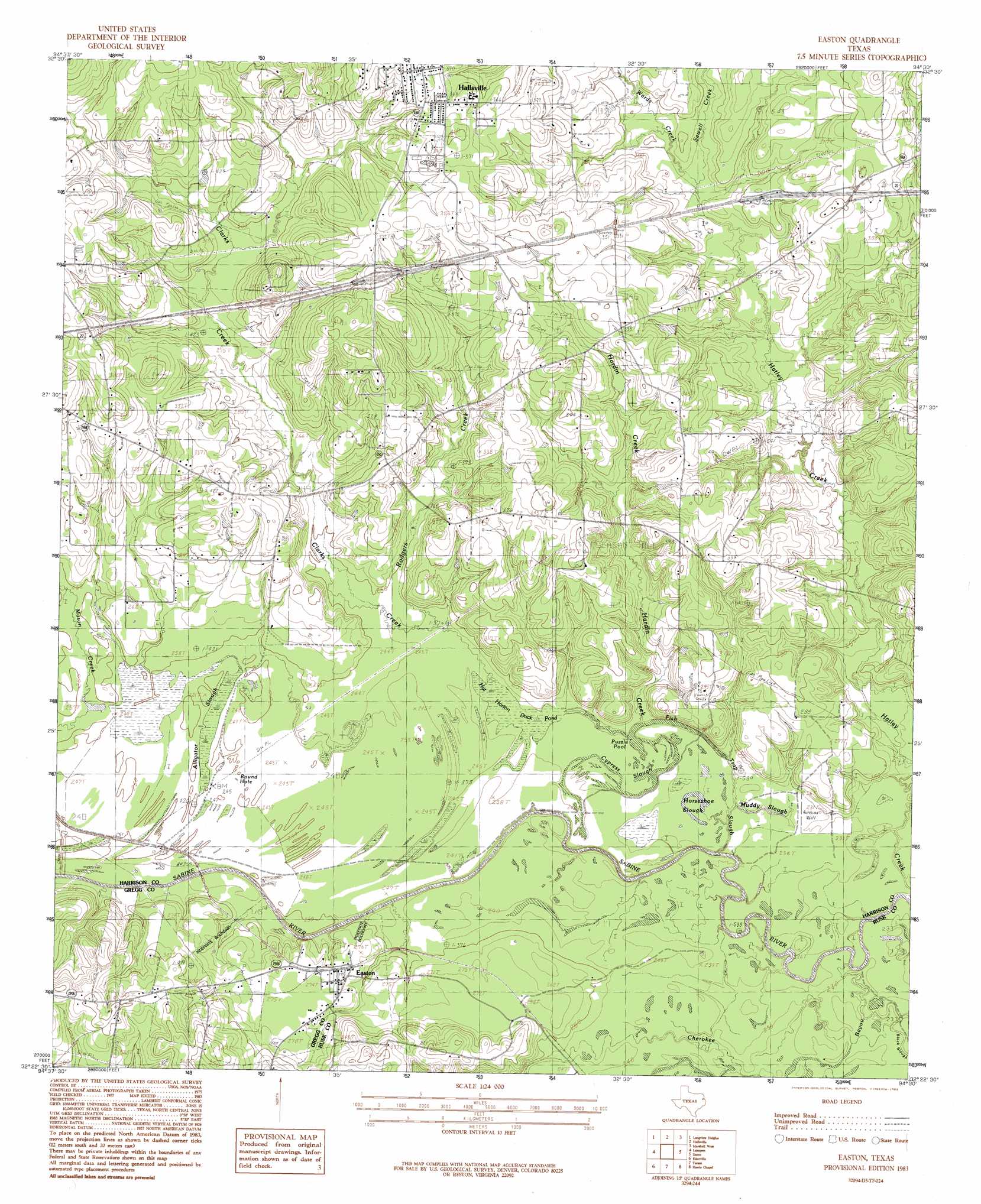
Easton Topo Map Texas
To zoom in, hover over the map of Easton
USGS Topo Quad 32094d5 - 1:24,000 scale
| Topo Map Name: | Easton |
| USGS Topo Quad ID: | 32094d5 |
| Print Size: | ca. 21 1/4" wide x 27" high |
| Southeast Coordinates: | 32.375° N latitude / 94.5° W longitude |
| Map Center Coordinates: | 32.4375° N latitude / 94.5625° W longitude |
| U.S. State: | TX |
| Filename: | o32094d5.jpg |
| Download Map JPG Image: | Easton topo map 1:24,000 scale |
| Map Type: | Topographic |
| Topo Series: | 7.5´ |
| Map Scale: | 1:24,000 |
| Source of Map Images: | United States Geological Survey (USGS) |
| Alternate Map Versions: |
Easton TX 1983, updated 1983 Download PDF Buy paper map Easton TX 2010 Download PDF Buy paper map Easton TX 2013 Download PDF Buy paper map Easton TX 2016 Download PDF Buy paper map |
1:24,000 Topo Quads surrounding Easton
Glenwood |
Ashland |
Harleton |
Marshall Nw |
Woodlawn |
White Oak |
Longview Heights |
Hallsville |
Marshall West |
Marshall East |
Kilgore Ne |
Lakeport |
Easton |
Darco |
Colliers Creek |
Kilgore Se |
Elderville |
Tatum |
Harris Chapel |
Grand Bluff |
Henderson |
Church Hill |
Fair Play |
Beckville |
Carthage |
> Back to 32094a1 at 1:100,000 scale
> Back to 32094a1 at 1:250,000 scale
> Back to U.S. Topo Maps home
Easton topo map: Gazetteer
Easton: Parks
Bobcat Stadium elevation 114m 374′Easton: Populated Places
Easton elevation 83m 272′Easton: Streams
Black Slough elevation 67m 219′Cherokee Bayou elevation 67m 219′
Clarks Creek elevation 68m 223′
Hardin Creek elevation 70m 229′
Rodgers Creek elevation 73m 239′
Sewell Creek elevation 85m 278′
Sewell Creek elevation 84m 275′
Wards Creek elevation 84m 275′
Easton digital topo map on disk
Buy this Easton topo map showing relief, roads, GPS coordinates and other geographical features, as a high-resolution digital map file on DVD: