Latex Topo Map Texas
To zoom in, hover over the map of Latex
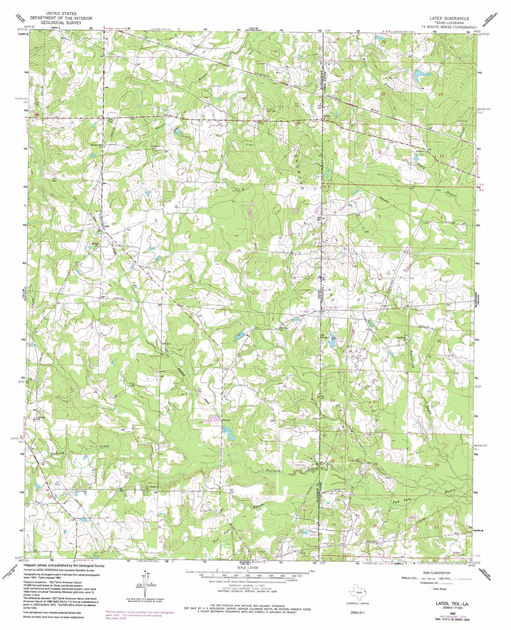
USGS Topo Quad 32094e1 - 1:24,000 scale
| Topo Map Name: | Latex |
| USGS Topo Quad ID: | 32094e1 |
| Print Size: | ca. 21 1/4" wide x 27" high |
| Southeast Coordinates: | 32.5° N latitude / 94° W longitude |
| Map Center Coordinates: | 32.5625° N latitude / 94.0625° W longitude |
| U.S. States: | TX, LA |
| Filename: | o32094e1.jpg |
| Download Map JPG Image: | Latex topo map 1:24,000 scale |
| Map Type: | Topographic |
| Topo Series: | 7.5´ |
| Map Scale: | 1:24,000 |
| Source of Map Images: | United States Geological Survey (USGS) |
| Alternate Map Versions: |
Latex TX 1962, updated 1964 Download PDF Buy paper map Latex TX 1962, updated 1978 Download PDF Buy paper map Latex TX 1962, updated 1991 Download PDF Buy paper map Latex TX 2010 Download PDF Buy paper map Latex TX 2013 Download PDF Buy paper map Latex TX 2016 Download PDF Buy paper map |
1:24,000 Topo Quads surrounding Latex
Jefferson |
Smithland |
Trees |
Vivian South |
Gilliam |
Woodlawn |
Karnack |
Potters Point |
Mooringsport |
Dixie |
Marshall East |
Scottsville |
Latex |
Blanchard |
North Highlands |
Colliers Creek |
Stricklin Springs |
Waskom |
Greenwood |
Shreveport West |
Grand Bluff |
De Berry |
Panola |
Spring Ridge |
Stonewall |
> Back to 32094e1 at 1:100,000 scale
> Back to 32094a1 at 1:250,000 scale
> Back to U.S. Topo Maps home
Latex topo map: Gazetteer
Latex: Oilfields
Longwood Oil and Gas Field elevation 88m 288′Longwood Oil and Gas Field elevation 81m 265′
Latex: Populated Places
Latex elevation 88m 288′Latex elevation 88m 288′
Lotta elevation 94m 308′
Latex: Springs
Coushatta Spring elevation 88m 288′Latex: Streams
Bullard Creek elevation 60m 196′Bullard Creek elevation 60m 196′
Latex digital topo map on disk
Buy this Latex topo map showing relief, roads, GPS coordinates and other geographical features, as a high-resolution digital map file on DVD: