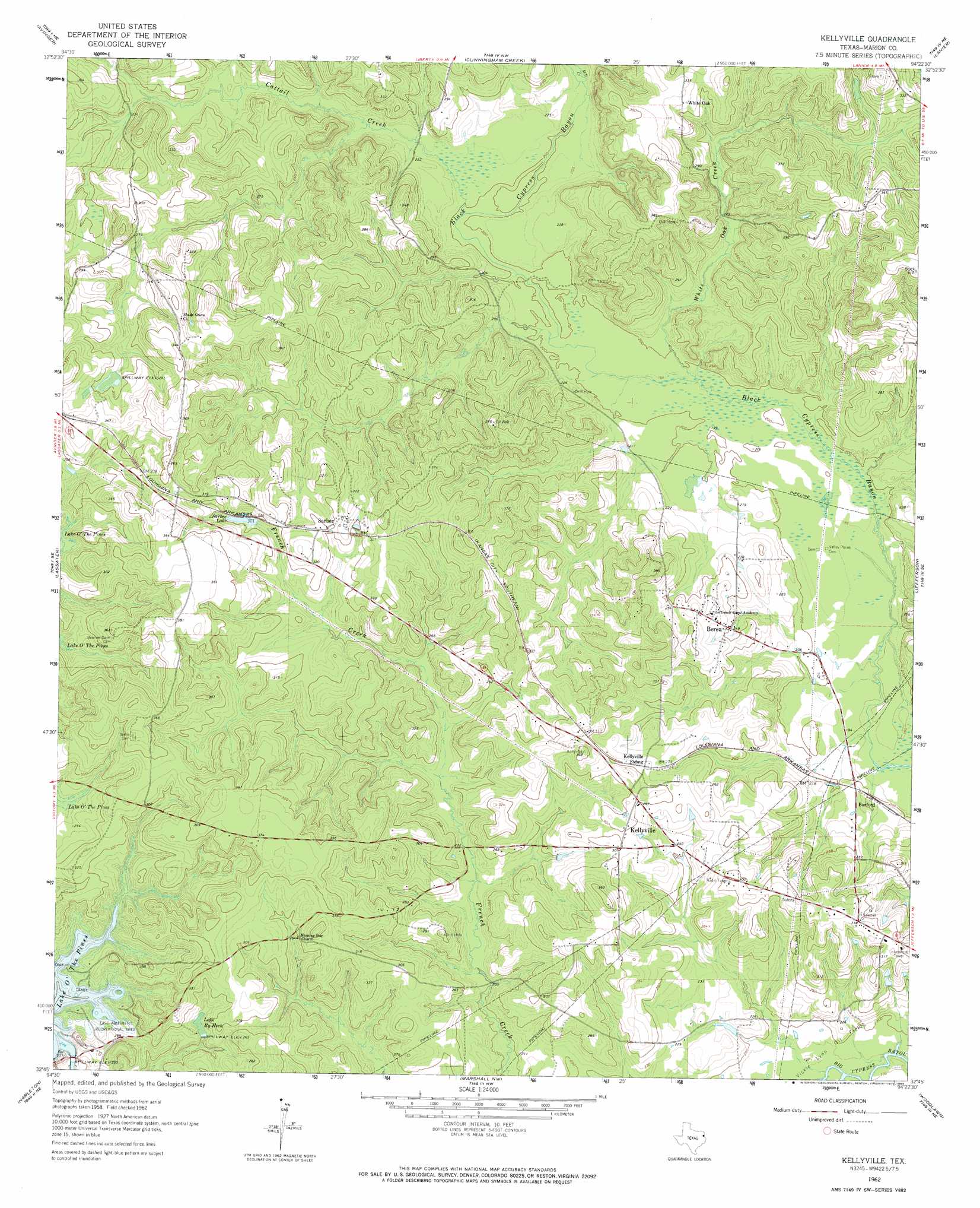
Kellyville Topo Map Texas
To zoom in, hover over the map of Kellyville
USGS Topo Quad 32094g4 - 1:24,000 scale
| Topo Map Name: | Kellyville |
| USGS Topo Quad ID: | 32094g4 |
| Print Size: | ca. 21 1/4" wide x 27" high |
| Southeast Coordinates: | 32.75° N latitude / 94.375° W longitude |
| Map Center Coordinates: | 32.8125° N latitude / 94.4375° W longitude |
| U.S. State: | TX |
| Filename: | o32094g4.jpg |
| Download Map JPG Image: | Kellyville topo map 1:24,000 scale |
| Map Type: | Topographic |
| Topo Series: | 7.5´ |
| Map Scale: | 1:24,000 |
| Source of Map Images: | United States Geological Survey (USGS) |
| Alternate Map Versions: |
Kellyville TX 1962, updated 1963 Download PDF Buy paper map Kellyville TX 1962, updated 1974 Download PDF Buy paper map Kellyville TX 1962, updated 1983 Download PDF Buy paper map Kellyville TX 2010 Download PDF Buy paper map Kellyville TX 2013 Download PDF Buy paper map Kellyville TX 2016 Download PDF Buy paper map |
1:24,000 Topo Quads surrounding Kellyville
Daingerfield |
Sardis |
Carterville |
Linden |
Atlanta South |
Lone Star |
Avinger |
Cunningham Creek |
Lanier |
Kildare |
Ore City |
Lassater |
Kellyville |
Jefferson |
Smithland |
Ashland |
Harleton |
Marshall Nw |
Woodlawn |
Karnack |
Longview Heights |
Hallsville |
Marshall West |
Marshall East |
Scottsville |
> Back to 32094e1 at 1:100,000 scale
> Back to 32094a1 at 1:250,000 scale
> Back to U.S. Topo Maps home
Kellyville topo map: Gazetteer
Kellyville: Parks
Buckhorn Creek Park elevation 75m 246′Kellyville: Populated Places
Berea elevation 78m 255′Burford elevation 64m 209′
Kellyville elevation 79m 259′
Sarber elevation 95m 311′
White Oak elevation 98m 321′
Kellyville: Reservoirs
Lake By-Heck elevation 78m 255′Lake O' the Pines elevation 69m 226′
Sarber Lake elevation 92m 301′
Kellyville: Streams
Cattail Creek elevation 61m 200′Mill Creek elevation 62m 203′
White Oak Creek elevation 59m 193′
Kellyville digital topo map on disk
Buy this Kellyville topo map showing relief, roads, GPS coordinates and other geographical features, as a high-resolution digital map file on DVD: