Cunningham Creek Topo Map Texas
To zoom in, hover over the map of Cunningham Creek
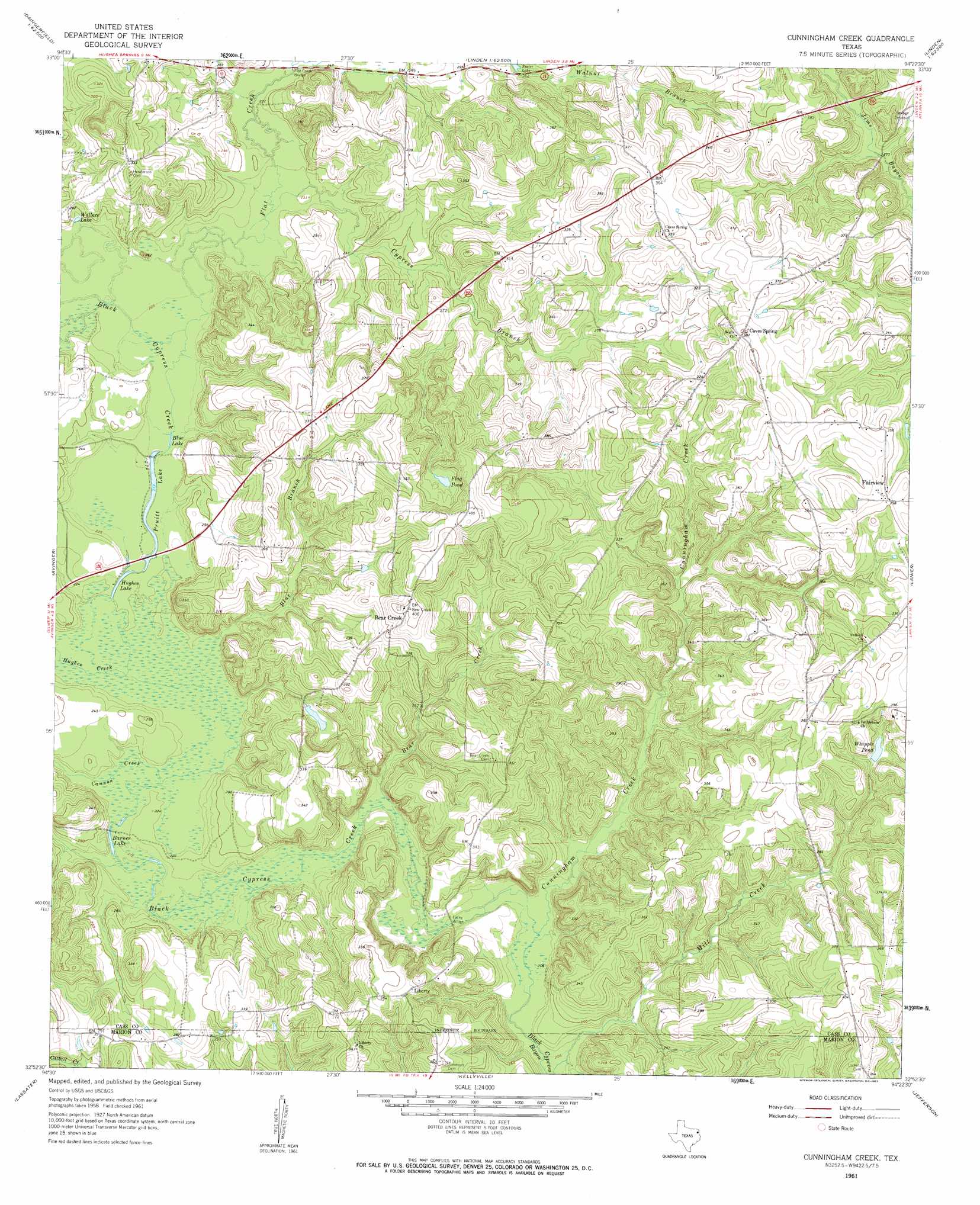
USGS Topo Quad 32094h4 - 1:24,000 scale
| Topo Map Name: | Cunningham Creek |
| USGS Topo Quad ID: | 32094h4 |
| Print Size: | ca. 21 1/4" wide x 27" high |
| Southeast Coordinates: | 32.875° N latitude / 94.375° W longitude |
| Map Center Coordinates: | 32.9375° N latitude / 94.4375° W longitude |
| U.S. State: | TX |
| Filename: | o32094h4.jpg |
| Download Map JPG Image: | Cunningham Creek topo map 1:24,000 scale |
| Map Type: | Topographic |
| Topo Series: | 7.5´ |
| Map Scale: | 1:24,000 |
| Source of Map Images: | United States Geological Survey (USGS) |
| Alternate Map Versions: |
Cunningham Creek TX 1961, updated 1963 Download PDF Buy paper map Cunningham Creek TX 2010 Download PDF Buy paper map Cunningham Creek TX 2013 Download PDF Buy paper map Cunningham Creek TX 2016 Download PDF Buy paper map |
1:24,000 Topo Quads surrounding Cunningham Creek
Naples |
Marietta |
Bryans Mill |
Douglassville |
Atlanta North |
Daingerfield |
Sardis |
Carterville |
Linden |
Atlanta South |
Lone Star |
Avinger |
Cunningham Creek |
Lanier |
Kildare |
Ore City |
Lassater |
Kellyville |
Jefferson |
Smithland |
Ashland |
Harleton |
Marshall Nw |
Woodlawn |
Karnack |
> Back to 32094e1 at 1:100,000 scale
> Back to 32094a1 at 1:250,000 scale
> Back to U.S. Topo Maps home
Cunningham Creek topo map: Gazetteer
Cunningham Creek: Bridges
Flat Creek Bridge elevation 70m 229′Lacey Bridge elevation 63m 206′
Cunningham Creek: Lakes
Barnes Lake elevation 65m 213′Blue Lake elevation 68m 223′
Hughes Lake elevation 67m 219′
Pruitt Lake elevation 67m 219′
Wallace Lake elevation 72m 236′
Cunningham Creek: Populated Places
Bear Creek elevation 112m 367′Caves Spring elevation 119m 390′
Fairview elevation 108m 354′
Liberty elevation 101m 331′
Cunningham Creek: Reservoirs
Flag Pond elevation 98m 321′Whipple Pond elevation 99m 324′
Cunningham Creek: Streams
Bear Creek elevation 65m 213′Black Cypress Creek elevation 63m 206′
Blue Branch elevation 66m 216′
Cane Creek elevation 99m 324′
Cannon Creek elevation 66m 216′
Cunningham Creek elevation 63m 206′
Cypress Branch elevation 69m 226′
Flat Creek elevation 68m 223′
Hughes Creek elevation 65m 213′
Cunningham Creek digital topo map on disk
Buy this Cunningham Creek topo map showing relief, roads, GPS coordinates and other geographical features, as a high-resolution digital map file on DVD: