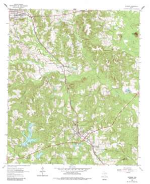
Avinger Topo Map Texas
To zoom in, hover over the map of Avinger
USGS Topo Quad 32094h5 - 1:24,000 scale
| Topo Map Name: | Avinger |
| USGS Topo Quad ID: | 32094h5 |
| Print Size: | ca. 21 1/4" wide x 27" high |
| Southeast Coordinates: | 32.875° N latitude / 94.5° W longitude |
| Map Center Coordinates: | 32.9375° N latitude / 94.5625° W longitude |
| U.S. State: | TX |
| Filename: | o32094h5.jpg |
| Download Map JPG Image: | Avinger topo map 1:24,000 scale |
| Map Type: | Topographic |
| Topo Series: | 7.5´ |
| Map Scale: | 1:24,000 |
| Source of Map Images: | United States Geological Survey (USGS) |
| Alternate Map Versions: |
Avinger TX 1962, updated 1964 Download PDF Buy paper map Avinger TX 1962, updated 1982 Download PDF Buy paper map Avinger TX 2010 Download PDF Buy paper map Avinger TX 2013 Download PDF Buy paper map Avinger TX 2016 Download PDF Buy paper map |
1:24,000 Topo Quads surrounding Avinger
> Back to 32094e1 at 1:100,000 scale
> Back to 32094a1 at 1:250,000 scale
> Back to U.S. Topo Maps home
Avinger topo map: Gazetteer
Avinger: Airports
Eagle Landing Airport elevation 109m 357′Avinger: Dams
Avis Dam elevation 113m 370′Birdie Dam elevation 105m 344′
Rhyne Dam elevation 92m 301′
Simpson Lake Dam elevation 93m 305′
Avinger: Populated Places
Avinger elevation 120m 393′Love elevation 105m 344′
Patman elevation 88m 288′
Pruitt Lake elevation 84m 275′
Avinger: Reservoirs
Avis Lake elevation 113m 370′Birdie Lake elevation 105m 344′
Rhyne Lake elevation 92m 301′
Simpson Lake elevation 94m 308′
Avinger: Streams
Bogg Branch elevation 84m 275′Cawhorn Creek elevation 79m 259′
Cloninger Creek elevation 98m 321′
Flag Pond Creek elevation 78m 255′
Goodson Branch elevation 70m 229′
King Branch elevation 90m 295′
Peacock Creek elevation 75m 246′
Regan Creek elevation 75m 246′
Sturdivant Branch elevation 70m 229′
Turkey Creek elevation 72m 236′
Whites Branch elevation 75m 246′
Avinger: Summits
Donaldson Mountain elevation 123m 403′Avinger: Swamps
Minnow Ponds elevation 108m 354′Avinger digital topo map on disk
Buy this Avinger topo map showing relief, roads, GPS coordinates and other geographical features, as a high-resolution digital map file on DVD:


